Download
1 / 22
230 likes | 244 Views
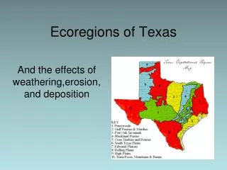
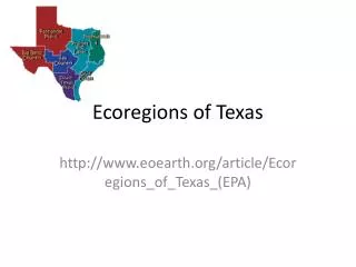
Texas Ecoregions. Effects of Weathering, Erosion and Deposition. Factors Affecting Our Ecoregions. Weathering – chemical and physical break down of rocks into sediment Erosion – the movement of sediment from one place to another

E N D
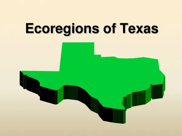
Texas Ecoregions Effects of Weathering, Erosion and Deposition
Factors Affecting Our Ecoregions Weathering– chemical and physical break down of rocks into sediment Erosion – the movement of sediment from one place to another Deposition – the placement of sediment after being carried from place of origin
i. Piney Woods • This ecoregion is found in Southeast Texas. • It is the wettest region of the state. This allows for a high rate of decompositionto occur resulting in healthy, nutrient-rich soils. • The topography is gently rolling to near flat through out the region. • Pine trees, woody vines, and hardwood trees dominate the vegetation. • It is a fire climax system. Fire is necessary in order for pines to maintain dominance in the area. • Unless an area has been clear-cut of vegetation for construction, the amount of trees and plants can prevent erosion.
ii. Gulf Coastal Plain • Coastal region; soil in the region is primarily sand-based. • If there is not enough vegetation to keep the soil in place, rainfall received can cause severe erosion. • Catastrophic events such as hurricanes can increase wave erosion and deposition.
iii. Blackland Prairie • Precipitation 35 to 45 inches • Topography Ranges from gently rolling hills to level land. • Soils Upper Cretaceous marine chalks, limestone, and shale give rise to the development of the characteristic black,heavy clay soils. • Vegetation Description Perennialand annualgrasses. Live oaks are the trees that dominate a large part of this eco-region. • Impacts of Fire For the most part fires in this eco-region no longer greatly impact vegetation.
iv. Edwards Plateau • This region is located between dry western plains and moist prairies and woods. • Unfortunately, erosion has left most of the very shallow soils (leregion with ss than 10 inches) lined with limestone rock layers. • High amounts of rain in a short amount of time can cause flash flooding.
v. Rolling Plains • This region is part of the Great Plains of the central United States. • Soils in this area are most fertile and sought after for crop production. • Periods of drought and then sudden increase in rainfall causes large amounts of erosion and deplete the soil of nutrients.
vi. Crosstimbers and Prairies • This is a small, thin region running North to South on either side of the prairies and plains. • The soil is not as prone to flooding because it allows water to infiltrate very easily. • The region is described as rough, hilly terrain.
vii. High Plains • “Texas Panhandle” • Largest and most completely flat areas of it size in the world! • The region extends to the Palo Duro Canyon-the nation’s 2nd largest canyon. • Palo Duro Canyon was formed by water erosion from the Prairie Dog Town Fork of the Red River. • The water deepens the canyon by moving sediment downstream. • Wind and water erosion gradually widen the canyon.
vii. South Texas Plains • The area is known as “Brush Country” due to the shorter trees and many shrubs. • Overgrazing of the land has allowed nutrient-rich topsoil to erode way. • Rocky, dry soil cannot support grasses, trees can thrive because of their deeper root system.
ix. Post Oak Savannah • Precipitation 35 to 45 inches • Topography Forested areas in the western region of the Post Oak Savannah are generally restricted to bottomlandareas associated with water. • Soils Soils range from a clay to sandy soil. • Vegetation Description Dominated by native bunch grasses and scattered post oaks. • Impacts of Fire Fire has been completely removed from the management of this eco-region to support the raising of cattle.
x. Mountain and Basins/Trans Pecos • Home of the tallest mountain in Texas, Guadalupe Peak. Elevation is 8,749 feet. • Pines and Oaks dominate the tree species. • Soils are shallow and rocky. Weathering continues to play a role in developing soil and will for thousands of years to come. • Soils in the canyon bottoms and valleys are deeper as a result of deposition.