Download
1 / 15
150 likes | 155 Views
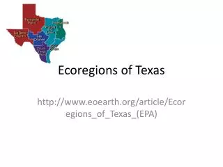
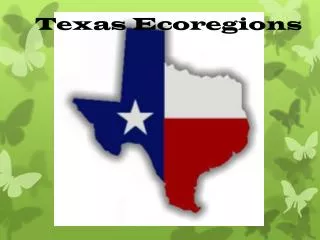
Texas Ecoregions. Effects of Weathering, Erosion and Deposition. What is an Ecoregion?. an area defined by its environmental conditions, esp. climate, landforms, and soil characteristics. Factors Affecting Our Ecoregions . Weathering – chemical and physical break down of rocks into sediment

E N D
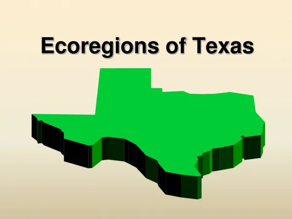
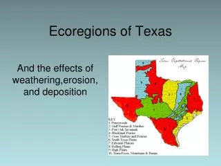
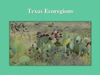
Texas Ecoregions Effects of Weathering, Erosion and Deposition
What is an Ecoregion? • an area defined by its environmental conditions, esp. climate, landforms, and soil characteristics.
Factors Affecting Our Ecoregions Weathering– chemical and physical break down of rocks into sediment Erosion – the movement of sediment from one place to another Deposition – the placement of sediment after being carried from place of origin
Piney Woods • It is the wettest region of the state. • This allows for a high rate of decompositionto occur resulting in healthy, nutrient-rich soils. • The topography is gently rolling to near flat through out the region. • Pine trees, woody vines, and hardwood trees dominate the vegetation. • Unless an area has been clear-cut of vegetation for construction, the amount of trees and plants can prevent erosion. • Very little erosion takes place in these areas. http://www.youtube.com/watch?v=9o8lKGhJ5KI&list=PL6353227E5419A80D
Oak Wood Prairies • These areas have nutrient-rich soils and receive good amounts of rainfall through the year. • If the land is clear-cut of natural vegetation for construction nutrients can easily be eroded by wind and water.
Blackland Prairies • Large herds of bison grazed on the grasses at one time. • Blackland prairies in Texas, which are mostly composed of clays, are eroded primarily by water. Secondary causes include wind, and the action of burrowing animals (bio erosion). http://www.youtube.com/watch?v=lBl-FruPos0&list=PL6353227E5419A80D
Gulf Coast Prairies and Marshes • A narrow band about 60 miles wide along the Texas coast from the Louisiana border to Brownsville roughly outlines the Gulf Coast Prairies and Marshes • Near the gulf waters you can see marshes, barrier islands, estuaries (where salty sea water and fresh river water meet), and bays. • Catastrophic events such as hurricanes can increase wave erosion. http://www.youtube.com/watch?v=mZdsyKaIAYE&list=PL6353227E5419A80D
Llano Uplift • A basin; in some places, it is 1000 feet below the level of the surrounding limestone escarpment. • It gets its name from the granitic mass that is exposed in the basin, granite that has been dated at one billion years old. • Upland soils are shallow, reddish brown, stony, sandy loams over granite, gneiss, and schist with deeper sandy loams in the valleys.
South Texas Brush Country • The area is known as “Brush Country” due to the shorter trees and many shrubs. • Overgrazing of the land has allowed nutrient-rich topsoil to erode way by wind and water. • Rocky, dry soil cannot support grasses, trees can thrive because of their deeper root system. http://www.youtube.com/watch?v=XyluCiAOdso&list=PL6353227E5419A80D
Coastal Sand Plains • Soil in the region is primarily sand-based. • If there isn’t enough vegetation to keep the soil in place, rainfall received can cause severe erosion. • Catastrophic events such as hurricanes can increase wave erosion.
Edwards Plateau • This region is located between dry western plains and moist prairies and woods. • Unfortunately, water erosion has left most of the region with very shallow soils (less than 10 inches) lined with limestone rock layers. • High amounts of rain in a short amount of time can. cause flash flooding http://www.youtube.com/watch?v=DY7ueukM1QQ&list=PL6353227E5419A80D
Rolling Plains • This region is part of the Great Plains of the central United States. • Soils in this area are most fertile and sought after for crop production. • Periods of drought and then sudden increase in rainfall causes large amounts of erosion and deplete the soil of nutrients. http://www.youtube.com/watch?v=0UlDeYfJ1XU&list=PL6353227E5419A80D
High Plains • “Texas Panhandle” • Largest and most completely flat areas of it size in the world! • The High Plains ecoregion is one of the windiest regions in the United States. • The climate is generally dry, and areas without vegetation experience wind erosion. • The Palo Duro Canyon was formed by water erosion by a fork of the Red River. The canyon continues to become deeper as the water moves sediment downstream. Wind and water erosion gradually widen the canyon.
Trans-Pecos • “Desert portion” of Texas. • The weathered bedrock in this area has high amounts of calcium. • The Guadalupe Mountains and the Davis Mountains are located in this ecoregion, making it the most mountainous area of Texas. • * In general, soil in this region is eroded due to the decline of grasslands. • Flash-flooding and rapid runoff are causes of erosion in the park. • Erosion of the limestone cliffs takes place because of acid rain. • http://www.youtube.com/watch?v=b1FErNrxVZo&list=PL6353227E5419A80D
Marine Environment • This ecoregion has seagrasses, oyster reefs, barrier islands, muddy estaurine bottoms, reefs and open water. • These areas provide plants and animals with their basic needs and support hundreds of species. • Global warming has one of the most negative impacts in marine ecosystems.