Download
1 / 23
230 likes | 366 Views
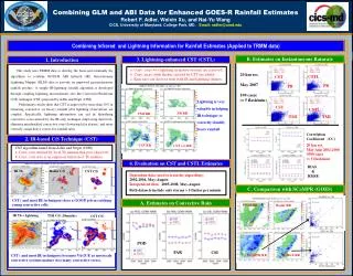
Combining GLM and ABI Data for Enhanced GOES-R Rainfall Estimates Robert Adler, Weixin Xu and Nai-Yu Wang CICS/University of Maryland.

E N D
Combining GLM and ABI Data for Enhanced GOES-R Rainfall Estimates Robert Adler, Weixin Xu and Nai-Yu Wang CICS/University of Maryland A combination of existing project under Wang dealing with microwave/lightning relations and new proposal by Adler on IR/lightning rain estimation, both focused on improving GOES-R Baseline rain algorithm (Kuligkowski). 2 journal papers recently submitted Xu, W., R. F. Adler, and N.-Y. Wang, 2012: Improving Geostationary Satellite Rainfall Estimates Using Lightning Observations, I: Underlying Lightning-Rainfall Relationships. J. Appl. Meteor. Climatol., (submitted). Wang, N-Y, K. Gopalan, and R. Albrecht, 2012: Lightning, radar reflectivity and passive microwave observations over land from TRMM: Characteristics and application in rainfall retrievals, J. Geophysical Research (submitted).
Issues and Motivation Limitations of infrared-based rain estimates: -- Only “see” the top of precipitating cloud; (though cloud growth or structure can be considered) -- May treat cold cirrus clouds as intense convection; -- May misrepresent convective rain: location, area and rain intensity; (especially under relatively uniform cold cloud shields in mature MCSs) (but geostationary rain estimation still very important because of temporal resolution and rapid access) How would lightning information help? -- Provide information associated with convection location and intensity (~ rainfall rate)
Objectives • Design a lightning-enhanced geostationary IR technique to • Remove false IR-defined intense convection • Identify convective cores and conv. rain area below cloud shields • Define correct rain intensity (on pixel scale) • Improve microwave-based calibration of IR technique • Recent Work/Approach • Examine lightning-cloud-rain relations with TRMM observations (papers submitted) • Develop a rain estimation technique to take advantage of lightning information potential—apply to TRMM data • Compare to Baseline algorithm
Relationships between Lightning and Convective Rainfall
Precipitation Features (radar raining clusters) From University of Utah TRMM Precipitation Feature (PF) Database Radar IR Precip. Features Lightning + PMW 85 GHz Convective (Red) Stratiform (Blue)
Storm discrimination by lightning Intense echo top Echo top Cloud top temp. Ice scattering
Improvement of Passive Microwave Retrievals (Used as Calibrator for IR Baseline Algorithm) An Example: Lightning Impact on Rain Rate Retrievals radar microwave microwave + lightning P(C) rain rate Overall impact of of lightning on rainrate is 5-10%, but focused on highest rainrates
IR (and IR + Lightning) Rain Estimation Applied to TRMM Data • Initial IR technique is variation of Convective Stratiform Technique (CST, Adler and Negri, 1988) • Defines convective core/areas by IR Tb minima (with some tests) and stratiform rain area by Tb threshold (usually cold ~215K). Rain rates in convective and stratiform areas derived separately and empirically • Lightning information will be used to define convective cores “unseen” by IR and eliminate IR cloud top minimaincorrectly identified as “convective”
IR-based C/S Technique (CST) STEPS: (Adler and Negri, 1988) 1. Local Tb minima; 2. Slope test; IR Lightning + Radar (Conv/Strat) CST ( and most IR techniques) does a GOOD job in catching young convective cells. CST (from IR) Conv. Area by PR
IR-based C/S Technique (CST) IR Lightning + Radar (Conv/Strat) CST becomes VAGUE as convective systems develop (too many convective cores) CST (from IR)
IR-based C/S Technique (CST) IR Lightning + Radar (Conv/Strat) CST (and all IR techniques) does a relatively POOR job for mature convective systems. CST (from IR)
IR-Lighting-Combined C/S Technique (CSTL) • Conv. cores w/o lightning in mature systems are removed • Conv. areas (with flash) missed by CST are added; IR Radar (Conv/Strat) Lightning + CST (from IR+L) CST (from IR)
Identification of Convective Cores by Adding Lightning * Estimates of Convective ID evaluated by PR; * CST and CSTL run in an area (600x600 km2); * 2000 cases (> 20 lightning flashes) are selected; • Lightning improves the convective detection (POD) • 2. Lightning lowers the false alarm (FAR)
“Full” Version of CSTL with Rainfall Rate
Flash Rate Density/ Rain Rate Relationships • Used to guide assignment of rain rate based on flash density • (fl/min/100km2) • At 20 km resolution: • FD dBZ RR(mm/h) • 4 40 15 • 45 22 • 35 55 45
Assigning Rainfall Rate • Stratiform: 2.5 mm/hr; 2: Convective:12.5 mm/hr; • CSTL is assigned discretely with flashes in 20 km; PMW RR Radar RR IR + L RR IR RR Conv. Area by PR
Assigning Rainfall Rate (20 km resolution) PMW RR Radar RR IR RR IR + L RR Potential of GOES-R GLM/ABI Rain Product
Evaluation by PR 2A25 (5 cases) 5 cases of mature MCSs are selected for statistics
Comparison with SCaMPR/Baseline • VIRS and GOES Channels are slightly different • Time difference is a few minutes apart TRMM GOES East
Comparison with SCaMPR PMW Radar IR+L SCaMPER Potential of GOES-R GLM/ABI Rain Product
Comparison with SCaMPR Vs. PR Vs. TMI
Summary/Next Steps • Lightning/cloud/rain relations have been established for use in developing GLM/ABI combined rain estimation (papers submitted) • Initial work completed in developing framework for testing IR (and IR + lightning) rain estimation with TRMM data and for comparing results with GOES-R baseline algorithm • Preliminary results indicate obvious value of lightning information to establish location of convective cores “unseen” by IR and eliminate incorrect core identification by IR. Preliminary statistics indicate significant improvement in rain estimation with use of lightning data • Next steps include: • - full analysis of TRMM IR and IR+L rain estimation to carefully quantify lightning impact and its potential and limitations in comparison/ combination with Baseline algorithm • - use of CHUVA and other data sets to evaluate IR+L with Baseline and test with time resolution/evolution • - continue analysis of lightning impact on microwave rain retrievals using TRMM data