Download
1 / 8
90 likes | 167 Views
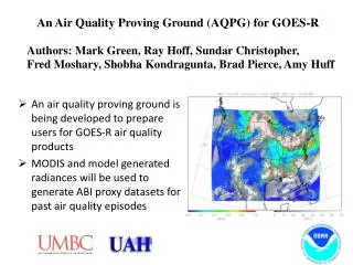
Dissemination of ABI Air Quality Data from GOES-R. Ray Hoff. Proving Ground Goals.

E N D
Proving Ground Goals • The Proving Ground brings together NOAA and its partners to bridge the gap between research and operations and provide a rich source of information contributing to user education and training on GOES-R applications through: • Utilizing current systems (satellite, terrestrial, or model/synthetic) to emulate various aspects of future GOES-R capabilities • Infusing GOES-R products and techniques into the NWS operational environment, with emphasis on the Advanced Weather Information Processing System (AWIPS) and transitioning from AWIPS-I ("AWIPS Legacy") to AWIPS-II ("AWIPS Migration") • Engaging in a two-way dialogue to provide feedback to the developers from the users
GOES-R Data Dissemination • All Level 2 products including air quality products: • Aerosol Optical Depth • Suspended Matter • Aerosol type (urban, generic, dust, smoke) • Aerosol detection (smoke/dust mask) • Fires and emissions • Burned area • cloud mask • Operational product users with a capability to use AWIPS-II (e.g., WFOs) AWIPS GOES-R Ground System (closed non-IP) • Environmental Protection Agency • United States Forest Service • National Weather Prediction (NWP) centers OSDPD Data Distribution Server (open IP access)
Visualization/Data Dissemination System for Air Quality Forecasters – McIDAS-V CALIPSO slice in vertical MODIS 2D layer McIDAS-V: Interactive Analysis, 4D Visualization and integration of Geophysical Data. Time: 2006-07-07, 18Z
Air Quality Data Dissemination Air quality forecasters • Air quality products: • Aerosol Optical Depth • Suspended Matter • Aerosol type (urban, generic, dust, smoke) • Aerosol detection (smoke/dust mask) • Fires and emissions • Burned area • cloud mask • Product Tailoring: • compositing • zooming capabilities • time series • remapped to a pre-defined grid • overpass data for specific stations • overlays of different but related products (e.g., wind vectors over AOD) • geotiff, KML, etc. GOES-R Ground System Visualization System AQPG is building this over the next year and will deliver this to OSDPD for Implementation before launch
An Example of a Web-Based Visualization/Data Dissemination System for Air Quality Forecasters (http://star.nesdis.noaa.gov/smcd/spb/aq/)
We will build a web portal at OSDPD but what should be there? • Imagery (like RGB, not RGB but close) • AOD Product? • Aerosol type product? • Nowcasting – motion? • PM estimation? • Verification panels? • Ability to manipulate? Zoom? Slice? • HMS? • Meteorology? • Active links to other GOES-R products? • What else?