Download
1 / 22
240 likes | 388 Views
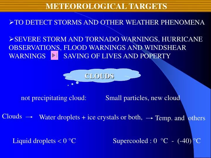
METEOROLOGICAL TARGETS. not precipitating cloud:. Small particles, new cloud . Clouds . Water droplets + ice crystals or both, . Temp. and others. Liquid droplets 0 °C. Supercooled : 0 °C - (-40) °C. TO DETECT STORMS AND OTHER WEATHER PHENOMENA

E N D
METEOROLOGICAL TARGETS not precipitating cloud: Small particles, new cloud Clouds Water droplets + ice crystals or both, Temp. and others Liquid droplets 0 °C Supercooled : 0 °C - (-40) °C • TO DETECT STORMS AND OTHER WEATHER PHENOMENA • SEVERE STORM AND TORNADO WARNINGS, HURRICANE OBSERVATIONS, FLOOD WARNINGS AND WINDSHEAR WARNINGS SAVING OF LIVES AND POPERTY CLOUDS
Kind Size distribution age height Geographic location The farther from cloud base The larger the droplets are As a cloud gets older Droplets get larger Maritime clouds Continental clouds Droplets sizes : 5 – 100 m
The mean droplet size distributions for various cloud types. St As Cu (Fletcher, 1966)
z : generally quite weak Total: 1.80.10-2=-17.4 dBz
Rainrate (mm/h) One technique Raindrop camera Liquid water content (g/m3) Radar reflectivity (mm6/m3) RAIN From these distributions Raindrop size dist. 30-40 years Easly detectable
Marshall and Palmer drop-size distributions compared with the results of Laws and Parsons.
ND : approximate size distribution (number of drops) No : 8000/m3mm D : droplet diameter (mm) : wavelength The Marshall-Palmer relationsihip is given by R : rainrate in mm/h Using these,,,,, obtain : the number of drops per unit volume
Z-R RELEATIONSHIP rainrate Correlate statisticallay By plotting Z-R rel. reflectivity R : rainrate in mm/h Z : rad. ref. Factor (mm6/m3) A, b : emprical constants Emprical relationship: Battan (1973) : 60 experiments for Z-R Most commonly used Z-R : (Marshall and Palmer)
From 20 dBZ (100 mm6/m3) to 50 dBZ (100 000 mm6/m3) Z for rain : Z for storms : 75 dBZ Z for hail : 55 dBZ NWS’s results for rainrate and reflectivitiy :
SNOW at warm temp. more water vapor at cold temp. Easily detectable Snow and Rain differences 1.Precipitation rate for snow is usually mucc less than it is for rain. “water equivalent” precipitation rate MOISTURE --- TEMPERATURE : heaviest snows : above the melting temp. of ice, 33 ° to 36 °F
2.DECice DECwater DEC : the dielectric constant 0.93 for water term in the radar equation : 0.197 for ice • The primary reason snow is not detectable by radar is the shallow • height of typical snow storms. • Snow storms are usually much lower than most rain storms. • Snow storms are often very widespread in area, but they may only extend a few thousand meters above the surface. • SNOW IS LESS EASILY DETECTABLE THAN RAIN..
HAIL thunderstorms Lightning and thunder HAIL : A precipitation in the form of ice. Diameter : 5 mm (at least) 85 % of thunderstorms contain hail (at least during part of their lives) Diameter : ranges from 5 mm to 10 cm Coeffeville, Kansas, World’s record hailstone 14 September 1972 14 cm (longest dimension)
Hailstone diameter Shape of the hail Density of the air Terminal Velocity of Hail Measurements and calculations for Vt : D : hailstone diameter (usually in cm) Vt : terminal velocity (in m/s) A : an emprical constant. Measurements for A ; 11.45 (Matson and Huggins, 1979)
Z from hail depends upon wether the outside surface is WET or DRY. Dry hail has a lower reflectivity than wet hail of the same size. HAILSTONES MIE REGION For =3 cm and 5 cm radars MIE REGION For =10 cm radars RAYLEIGH REGION
DISCUSSIONS • Besides those already discussed ; there are certainly other • targets of meteorological interest. Among those are: • TORNADOES, HURRICANES, MCC’s and various WIND PHENOMENA Tornadoes : prevalent within USA, to detect ---- WSR-88D radars NEXRAD algorithms are being used specifically for the detection of mesocyclones and tornedoes themselves. Hurricanes generally form hundreds or thousands of kilometers away from land. Ground-based radars have detectable ranges on the order of 400 km or so. Consequently, hurricanes are not detected until they have moved close enough to land to already be a problem. But Doppler radars have been used in stduying H.
MCC’s are complexes of numerous storms. As such, the various components are just as detectable as they would be if they occured individually. MCC’s are sometimes so large, however, that a single radar does not have the ability to cover the entire event; they are just too extensive. DATA from more than one radar are rouitnely combined, fortunately, so that entire events can be monitored by ground- based radar networks. The NEXRAD network will add velocity measurements to the reflectivity measurements already available and should provide even more useful information to study this events.
Both technological comfort and scientific researches can be presented for people using by radars in developed countries especially. Some natural disasters (meteorologically) such as avalanche, flood, tornado have occured in many regions of the world and they have caused to the death of huming beings and bringing greate ecenomic losses. Therefore, radars have a great importance in determining of the natural disasters and its early warning systems.
Clear-Air Return Doppler, NEXRAD and TDWR radars Advanced uses of Meteorological Radars Radar Maps and Interpretations SELECTED TOPICS FOR NEXT SEMINAR ARE:
R E F E R E N C E S (selected) Atlas, D., 1990: Radar in Meteorology, Boston, Amer. Meteor. Soc., 806 pp. Battan, L. J., 1973: Radar Observation of the Atmosphere, Chicago, University of Chicago Press, 324 pp., [Reprinted by: TechBooks, 2600 Seskey Glen Court, Herndon, VA 22071]. Buderi, R., 1996: The Invention That Changed the World, Simon & Schuster, New York, 575 pp. Doviak, R. J. and D. S. Zrnic, , 1993: Doppler Radar and WeatherObservations, Second Edition, San Diego, AcademicPress, Inc., 562 pp. Marshall, J. S. and W. McK. Palmer, 1948: The Distribution ofRaindrops with Size, J. Meteor., 5, 165-166. Matson, R. and A. W. Huggins, 1979: Field Observations of the Kinematics of Hailstorms, NCAR/CSD, Boulder, NCAR /TN-139+STR, 68 pp. Rinehart, R. E., 2001: Radar for Meteorologists, RinehartPublicatipns, Columbia, MO, 427 pp.