Download
1 / 28
280 likes | 397 Views
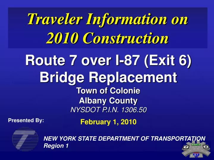
Traveler Information on 2010 Construction. Route 7 over I-87 (Exit 6) Bridge Replacement Town of Colonie Albany County NYSDOT P.I.N. 1306.50. Presented By:. February 1, 2010. NEW YORK STATE DEPARTMENT OF TRANSPORTATION Region 1. Construction is resuming March 2010.

E N D
Traveler Information on 2010 Construction Route 7 over I-87 (Exit 6) Bridge Replacement Town of Colonie Albany County NYSDOT P.I.N. 1306.50 Presented By: February 1, 2010 NEW YORK STATE DEPARTMENT OF TRANSPORTATION Region 1
Construction is resuming March 2010 • Beginning in March 2010, construction will resume at the Exit 6 interchange. • This year’s traffic impacts due to construction are anticipated to be more extensive than the previous years’ impacts. • The predicted impacts are expected to begin in March of 2010 and last through mid-fall.
What will happen beginning March 2010 • Construction impact will begin with a weekend interchange closure. All ramps will be closed to traffic and one lane in each direction will be available on the bridge. Signed detours will be in effect for the weekend. • This weekend interchange closure will mark the beginning of the long term traffic pattern changes at the interchange for the 2010 construction season. • After weekend closure, lanes will be closed on the bridge for approximately seven (7) months.
What roadways will be affected? • The primary impacts from construction during 2010 will be to travel on Route 7 and Route 2, the ramps at the Exit 6 interchange, and on the roadways surrounding the Exit 6 traffic due to travelers diverting away from the interchange and using those roadways. • I-87 travel northbound and southbound should not be significantly affected with the exception of the on and off ramps at Exit 6.
Traffic Impacts to be expected ANTICIPATED TRAFFIC IMPACT LEVEL PLANNED CONSTRUCTION WORK YEAR Route 7/2 Ramps I-87 2008 Wetland construction LOW LOW LOW 2010 predicted traffic impacts Minor Route 7/2 work LOW LOW LOW MEDIUM I-87 auxiliary lanes LOW MEDIUM 2009 Bridge foundations and walls construction LOW LOW MEDIUM MEDIUM Route 7 construction west of interchange MEDIUM LOW Sparrowbush Road improvements LOW LOW LOW MEDIUM LOW 2010 Bridge superstructure HIGH Route 7/2 construction at interchange HIGH MEDIUM LOW MEDIUM LOW Ramp construction HIGH 2011 Miscellaneous Paving LOW LOW LOW Landscaping LOW LOW LOW Cleanup LOW LOW LOW
Why are lanes being closed on the bridge? • Lanes are being closed on the bridge because the new bridge occupies the same location as the old bridge. In order to build the new bridge, some of the old bridge needs to be removed. In order to remove some of the old bridge, some of the lanes need to be closed. • The following diagram shows the existing lane configuration on the existing bridge and what to expect during the 2010 construction season.
Bridge lane configuration for 2010 Westbound Route 2 thru to Route 7 Westbound Route 2 left to I-87 South Eastbound Route 7 left to I-87 North Eastbound Route 7 thru to Route 2 Existing Configuration (7 Lanes) Westbound Route 2 left to I-87 South Eastbound Route 7 left to I-87 North Eastbound Route 7 thru to Route 2 Westbound Route 2 thru to Route 7 Configuration March-June 2010 (4 Lanes) Westbound Route 2 left to I-87 South Eastbound Route 7 left to I-87 North Eastbound Route 7 thru to Route 2 Westbound Route 2 thru to Route 7 Configuration July-October 2010 (4 Lanes)
What NYSDOT did to plan for the this year’s expected traffic impacts NYSDOT understands the planned traffic conditions may significantly impact traffic. Before making the decision to close lanes on the bridge the Department: • Completed comprehensive traffic analyses on alternate routes around the project to see if those routes could handle the additional traffic. • Identified problem areas on those alternate routes and formulation of solutions for those areas. • Completed Public outreach at Public Information meetings and Public Hearing to get the public’s feedback.
Were there other options available rather than closing lanes on the bridge? Yes, but the other options: • Were longer in duration. Approximately four months longer. • Made construction much more difficult and costly. • Increased the effects, due to the longer duration, to adjacent businesses and the traveling public.
Why did NYSDOT choose to close Lanes on the bridge? • Closing lanes reduced the construction schedule by approximately four months. • Seasonal limitations in the Northeast make it difficult and costly to construct during the winter months. • Public feedback was in favor of greater traffic impacts from construction for a shorter period of time rather than moderate sustained impacts for a longer period of time.
What is NYSDOT doing to try and help traffic flow during 2010? • As a result of the traffic studies, NYSDOT recognized a plan was needed to help traffic flow in and around the interchange during 2010. • NYSDOT developed a Travel Demand Management Plan (TDM) plan for the project. • NYSDOT identified information and educating the traveling public of the project and the TDM plan was essential. • NYSDOT is implementing the plan to help and reduce the potential impacts to residents, businesses, and the traveling public.
Preferred Alternative Existing Traffic Patterns Primarily retail business in and around Exit 6 interchange General PM major traffic patterns. West to east/north via Rte. 7 east to Alt. 7/ Rte. 2/ I-87 Primarily commercial Business in and around Albany International Airport General AM major traffic pattern. South and east to west via Alt. 7/ I-87/ Rte. 2 to Rte. 7 east Project needs to minimize diversions from this area Greatest diversion of traffic will be realized by targeting commuters to and from this Area
Preferred Alternative Travel Demand Management (TDM) Plan TDM Plan Key elements • Public outreach through multiple media formats. • Prior comprehensive outreach to businesses. • “Real Time” traffic monitoring and information via the web and other technologies. • Traffic diversions via alternate routes targeting commuters. • Provide improvements to alternate routes to help traffic flow.
Why alternate routes were used rather than detours • Detours require traffic to use the directed route at all times while alternate routes can be utilized as needed. • Since NYSDOT anticipates the greatest delays will be during the morning and evening peak traffic periods, detours would be unnecessary during off-peak travel periods when traffic volumes are less. • During these off peak hours travel hours, detours would be confusing and unnecessary.
VMS VMS VMS VMS VMS VMS Proposed Signed Alternate Routes Temporary additional lane east & permanent signal modifications Wade Road Extension & Sparrowbush Road (Town Roads) Rte. 9 & Rte. 155 (State Roads) Wade Road & Old Niskayuna Rd. (Town Roads) LEGEND Variable electronic Message Signs Static Signed Alternate Routes Albany Shaker Rd. (County Road) VMS Roundabout constructed in 2009 at Old Niskayuna Road/Rte. 155
How the alternate routes will work • The alternate routes will contain static signs directing travelers. • Cameras installed at key locations around the interchange will be monitored. When backups and delays at or around the interchange are identified, strategically placed Variable Electronic Message Signs (VMS) will be posted with information on the use of alternate routes. • When congestion does not warrant the use of the alternate routes, the variable electronic message signs (VMS) will be turned off and traffic will not be directed to use the alternate Routes.
VMS EXIT 6 DELAYS VMS ALT. ROUTE TO RTE. 2 VMS VMS VMS NEXT RIGHT VMS ALT. ROUTE TO RTE. 7 NEXT LEFT EXIT 6 DELAYS NYSDOT recognizes congestion at or around the interchange ALT. ROUTE TO I-87 NEXT RIGHT The messages shown on this slide may not be exactly what are posted during construction Traffic Successfully diverted away from interchange easing congestion Typical Evening Rush Hour with “Real Time” TDM
Project and traffic information available to the public • There are two locations where the public can get information on the project. These two locations are the project’s website, WWW.EXIT6.ORG and the Department’s travel information gateway, WWW.511NY.ORG • Both contain information on the project but each source contains slightly different information.
WWW.EXIT6.ORG • WWW.EXIT6.ORG can only be updated periodically so it contains weekly construction updates, weekly general construction information, information on upcoming major events, and ways to contact the department. • It has information and directions for alternate routes. • Has a direct link to WWW.511NY.ORG for “real time” traffic updates. This link is specific to the project and zooms into the project site and turns on all available information layers.
WWW.EXIT6.ORG Direct Link to 511ny.org website for “real time” traffic information Travel Advisories Construction Information Weekly lane closures Upcoming Events Contact Information
WWW.511NY.ORG • WWW.511NY.ORG contains “real time” construction information including lane closures and congestion information for Route 7 and the interchange. • Has links to traffic cameras installed for this project around the interchange so the public and the Department can monitor traffic conditions. The Department will use the information from the cameras to update the WWW.511NY.ORG web site with traffic conditions in “real time.” • Contains upcoming construction events impacting travel conditions at the project site.
WWW.511NY.ORG “Real Time” Travel Advisories “Real Time” Construction Information on roadwork and delays “Real Time” Cameras Upcoming Events
WWW.511NY.ORG Click on the camera icons For “Real Time” camera shots of the roadways surrounding the interchange There are many cameras positioned on various roadways and at locations surrounding the interchange
WWW.511NY.ORG Lane Closures, Construction Information, and Upcoming Events for the Exit 6 interchange are typically marked by a construction cone icon. Click on the cone for additional information. Delays will be typically designated by a red mark on the roadway where the delay is occurring
WWW.511NY.ORG You can also receive the www.511ny.org traffic information via: Visit www.511ny.org for additional information and to sign up. TEXT MESSAGES TO YOUR CELL PHONE EMAILS TO YOUR COMPUTER OR SMARTPHONE DIALING THE DEPARTMENT’S SYSTEM
WWW.511NY.ORG • Travelers who use vehicle GPS units should be aware the real time traffic and construction information posted to the WWW.511NY.ORG website may not appear on the GPS unit. Although the Department makes the “real time” information available to GPS service providers, unless your GPS unit receives constant information updates and your service provider downloads the information from the Department, the construction information will not show up on your GPS unit.
“Plan your way and avoid Exit 6 roadwork delay” • Educate yourself to alternate routes around the construction and be prepared to use those alternate routes. • Leave extra time for travel when traveling on Route 7 and Route 2 and the roadways around the Exit 6 interchange. • For employers and employees, investigate such things as work from home, alternate work hours, carpooling, and the use of mass transit. • Use the information and tools available such as the project’s website, real time traffic information, and media reports to plan your travels around the Exit 6 interchange.
Preferred Alternative Where to get more information Project’s Information Office 4 Avis Drive, Suite 110, Latham, NY 12110 Entrance is at the rear of the building Phone: (518) 220-9519 Email: exit6@dot.state.ny.us Web: WWW.EXIT6.ORG