Download
1 / 11
110 likes | 207 Views
GIS and Water Data Services. David R. Maidment Center for Research in Water Resources The University of Texas at Austin. Morning Schedule. Session 1 (8:30-10AM): Basic Principles David Maidment: Introduction Clint Brown: ESRI’s “Hydro Vision”

E N D
GIS and Water Data Services David R. Maidment Center for Research in Water Resources The University of Texas at Austin
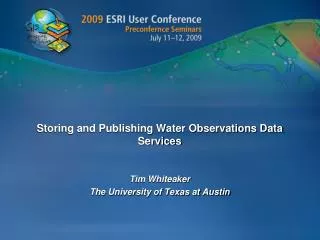
Morning Schedule • Session 1 (8:30-10AM): Basic Principles • David Maidment: Introduction • Clint Brown: ESRI’s “Hydro Vision” • Christine Eggers: What is a Services-Oriented Architecture? • Morning Break: 10-10:30 • Session 2 (10:30-12 noon): Building Texas HIS • David Maidment: Introduction to CUAHSI Water web services and Texas HIS • Tim Whiteaker: Storing and Publishing Water Observations Data Services • Dean Djokic and Christine Eggers: Portal Toolkit for HIS Node • Dean Djokic: Using Arc Hydro and CUAHSI Services
Afternoon Schedule • Session 3 (1:30-3PM): Consuming Web Services • Darren Baird: Chesapeake Bay Watershed Assessment • PravinRana and Charles Kovatch: Web services for NHD • Nawajish Noman: Using NEXRAD • Dean Djokic and Nefi Garza: San Antonio Flood Viewer • Afternoon Break: 3-3:30 • Session 4 (3:30-5PM): Enterprise Level Water and GIS Data Systems • Richard Baldwin: Use of Geoportal Toolkit and WaterML at the National Climatic Data Center • Tony Boston: Australian GeoFabric for water resources management and ingestion of water observations data to construct a set of national water accounts • Klaus Kisters: Open standardization for KISTERS time-series management software
Services-Oriented Architecture A services‐oriented architecture is a concept that applies to large, distributed information systems that have many owners, are complex and heterogeneous, and have considerable legacies from the way their various components have developed in the past (Josuttis, 2007).
Water Observations Data Water quantity Soil water Rainfall Water quality Groundwater Meteorology
HTML as a Web Language HyperText Markup Language Text and Pictures in Web Browser <head> <meta http-equiv="content-type" content="text/html; charset=utf-8" /> <title>Vermont EPSCoR</title> <link rel="stylesheet" href="epscor.css" type="text/css" media="all" /> <!-- <script type='text/javascript' language='javascript‘ src='Presets.inc.php'>--> </head>
WaterML as a Web Language Discharge of the San Marcos River at Luling, TX June 28 - July 18, 2002 Streamflow data in WaterML language
Linking GIS and Water Resources Water Resources GIS
Arc Hydro An ArcGIS data model for water resources Arc Hydro toolset for implementation Framework for linking hydrologic simulation models Arc Hydro: GIS for Water Resources Published in 2002, now in revision for Arc Hydro II The Arc Hydro data model and application tools are in the public domain
WFS and WaterML Observations Metadata in Space in GML as a Web Feature Service Observations Data in Timein WaterML