Download
1 / 11
110 likes | 215 Views
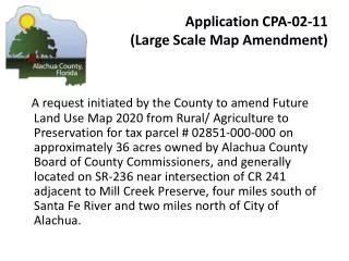
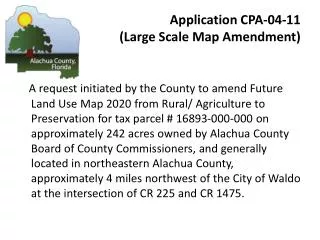
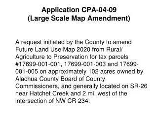
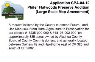
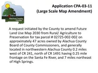
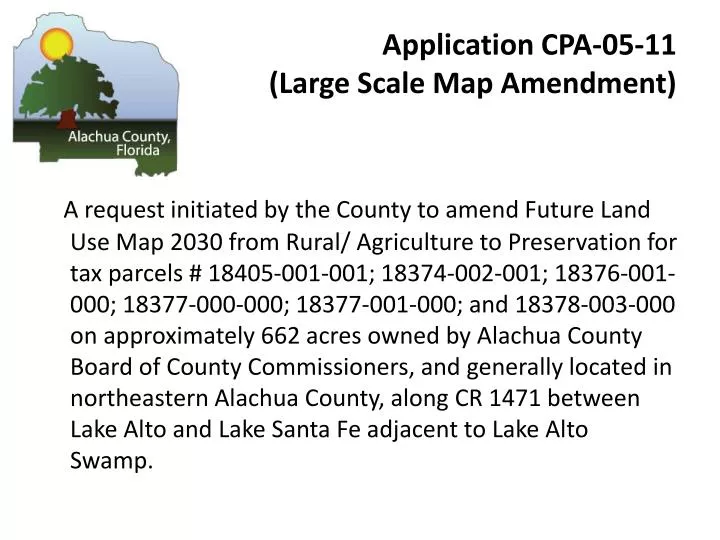
Application CPA-05-11 (Large Scale Map Amendment).

E N D
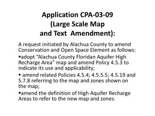
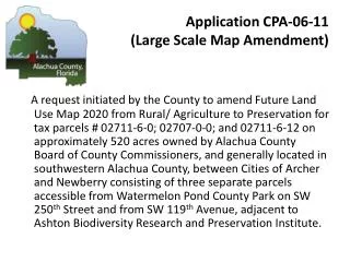
Application CPA-05-11 (Large Scale Map Amendment) A request initiated by the County toamend Future Land Use Map 2030 from Rural/ Agriculture to Preservation for tax parcels # 18405-001-001; 18374-002-001; 18376-001-000; 18377-000-000; 18377-001-000; and 18378-003-000 on approximately 662 acres owned by Alachua County Board of County Commissioners, and generally located in northeastern Alachua County, along CR 1471 between Lake Alto and Lake Santa Fe adjacent to Lake Alto Swamp.
Application CPA-05-11 Process • LPA Hearing Date: April 20, 2011 • BoCC Transmittal Hearing Date: May 10, 2011 The reviewing agencies identified in Section 163.3184(1)(c), F.S. reviewed the proposed comprehensive plan amendment pursuant to Sections 163.3184(3)(b)2, 3, and 4, F.S., and letters were received by the County from the State Land Planning Agency, the Department of Agriculture and Consumer Services, and the Florida Department of Education by June 15, 2011, which had no comments on amendment CPA 06-11; and, pursuant to Section 163.3184(3)(b)(c), the County is required to hold a public hearing on whether to adopt the comprehensive plan amendment within 180 days after receipt of agency comments.
CPA-05-11 Location Map LAKE ALTO PRESERVE Request initiated by the County to amend Future Land Use Map 2030 from Rural/Agriculture to Preservation
CPA-05-11 Zoning Lake Alto Preserve
Area to be changed to Preservation CPA-05-11 Existing Future Land Use Lake Alto Preserve
Area to be changed to Preservation CPA-05-11 Proposed Future Land Use Lake Alto Preserve
CPA 05-11 Lake Alto Preserve View looking south along CR 1471 and Lake Alto canal which forms southern boundary of TP# 18405-1-1 well off to the left (east).
CPA 05-11 Lake Alto Preserve View from Lake Alto Estates looking west
CPA 05-11 Lake Alto Preserve View of TP# 18405-001-001 looking west from CR 1471
CPA 05-11 Lake Alto Preserve View of TP# 18405-1-1 looking west toward CR 1471
Application CPA-05-11 (Large Scale Map Amendment) STAFF RECOMMENDATION: Adopt CPA-05-11 to designate publicly owned parcels # 18405-001-001; 18374-002-001; 18376-001-000; 18377-000-000; 18377-001-000; and 18378-003-000 as Preservation on the Future Land Use Map 2030. Bases: a. The designation of this publicly owned parcel, acquired for use as a natural resource and managed conservation land, would be consistent with COSE Objective 3.2 and related policies and the definition of Preservation Area/Land, i.e. ”intended for use as natural reserves or managed conservation lands for the preservation of natural resources.”