Download
1 / 10
100 likes | 208 Views
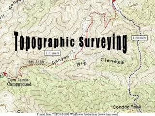
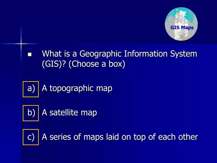
GIS Maps. GIS Maps. What is a Geographic Information System (GIS)? (Choose a box) a) A topographic map b) A satellite map c) A series of maps laid on top of each other. GIS Maps. GIS Maps. What is a Geographic Information System (GIS)? A topographic map Try again.

E N D
GIS Maps GISMaps • What is a Geographic Information System (GIS)? (Choose a box) a) A topographic map b) A satellite map c) A series of maps laid on top of each other
GIS Maps GISMaps • What is a Geographic Information System (GIS)? • A topographic map Try again. A topographic map is usually part of a GIS.
GIS Maps GISMaps • What is a Geographic Information System (GIS)? • A satellite map Try again. A satellite map is usually part of a GIS.
GIS Maps GISMaps • What is a Geographic Information System (GIS)? (Choose a box) c) A series of maps laid on top of each other. Yes. A GIS is way of overlaying different types of spatial information such as maps. The most modern form of GIS that we use today is through software like Google Earth, Google Maps that shows you any point on the Earth. These tools not only use topographic map information but also use satellite images of the Earth.
GIS Maps GISMaps Here is a simple GIS. Visit: http://www.ntlis.nt.gov.au/imfPublic/imf.jsp?site=nt_atlas Using the computer mouse, draw a square around the word, Jabiru. The following screen (or similar) will appear on your computer.
1. Can you see any familiar place names? 2. Can you find the grid square for Gunbalanya? (Hint: (remember your topographic maps!) 3. Use your computer mouse to draw a line around Gunbalanya’s topographic map square. (Hint: it’s 5573-3)
Does your screen look similar to this one? • If no, go back to previous slide. • If yes, what do you think this area (outlined in red) is? • 2. Draw another box around this area.
Does your screen look similar to this one? • If no, go back to previous slide. • If yes, let’s explore a layer of the Geographic Information System (GIS). • Click on this box: Land Use/Management (the tick should disappear) • Click on Refresh Map. • Does your screen look like the next slide?
Does your screen look similar to this one? If no, go back to previous slide. If yes, what do you think this layer shows? • Can you see Gunbalanya Community Education Centre (CEC)? • If you roll (and stop) your mouse over the Gunbalanya CEC, look at the bottom of the screen. It will show you your school’s location in longitude and latitude. • This reading below is known as its Global Positioning System (GPS) reading. This is like you locating points on a topographic map (but it’s from a satellite).
GIS Maps Now that you can find a GPS (Global Positioning System) reading using a Geographic Information System (GIS), your task is: Find the GPS reading of your favourite place (from My Place in Space) using the GIS at: http://www.ntlis.nt.gov.au/imfPublic/imf.jsp?site=nt_atlas Follow similar steps as before, but this time, you will need to change some layers (see layers below). Why do you think you will need to show the topographic map layer? (Don’t forget to Refresh the Map) GISMaps