Download

1 / 81
840 likes | 1.15k Views
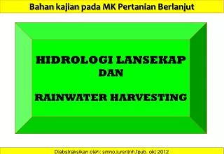
Bahan kajian pada MK Pertanian Berlanjut. HIDROLOGI LANSEKAP DAN RAINWATER HARVESTING. Diabstraksikan oleh : smno.jursntnh.fpub . okt 2012. HIDROLOGI…. “HIDROLOGI”

E N D
Bahankajianpada MK PertanianBerlanjut HIDROLOGI LANSEKAP DAN RAINWATER HARVESTING Diabstraksikanoleh: smno.jursntnh.fpub. okt2012
HIDROLOGI…. “HIDROLOGI” …. Kajianilmiahtentangsifat-sifat, distribusidanefek-efek air dipermukaanbumi, didalamtubuhtanah, didalambatuanbawahtanah, serta air diatmosfir. ….. SiklusHidrologi DiunduhdariSumber: http://www.tiimes.ucar.edu/highlights/fy06/images/hydrological%20cycle.jpg….. 17/10/2012
PENTINGNYA VEGETASI POHON DALAM SIKLUS HIDROLOGI…. Aliran air dalamsiklushidrologi: Evaporasi air daripermukaan; Transpirasiolehtumbuhan; Transport air diatmosfir; Presipitasi (Hujan); Limpasanpermukaan (runoff) danaliranbawahpermukaan. DiunduhdariSumber: http://www.coexploration.org/howsthewater/html/body_earth.html….. 17/10/2012
NERACA AIR DAN NERACA ENERGI …. POHON…. Precipitation (P) is any and all forms of water that fall from clouds and reach the ground. Runoff (R) is the water from precipitation that is not absorbed into the soil, but flows and reaches a stream or another body of water. Evapotranspiration (E) is water evaporating from wet surfaces and the soil plus the water release of plants. DiunduhdariSumber: http://ldas.gsfc.nasa.gov/resources/theory.php….. 17/10/2012
PENTINGNYA HUTAN DALAM SIKLUS HIDROLOGI…. Air hujan yang jatuhdarilangit : Menguapkembalikeatmosfir, mengalirdipermukaanlahan (runoff), meresapkedalamtanah (infiltration). Proses-prosesdiatasdikendalikanolehintensitashujan, karakteristiktanahdanlahan, kemiringanlahandanvegetasi. DiunduhdariSumber: http://www.eoearth.org/article/Hydrologic_cycle….. 17/10/2012
DAERAH ALIRAN SUNGAI (DAS) …. WATERSHED DAS meliputisemualahan yang menyalurkan air hujanmemasukisuatusistemsungaitertentu. DAS menangkapdanmenyimpan air hujan, melepaskan air tersebutsecarabertahapmemasukialursungai. Perubahandalamsuatu DAS, secaraalamiahataubuatanmanusia, akanmempengaruhikualitas air, kecepatan runoff, nilai habitat danerosi , yang padaakhirnyaakanberdampakpadakeseluruhan DAS. DiunduhdariSumber: http://www.pedrocreek.org/watershed.html….. 17/10/2012
…NERACA AIR DI BENTANG LAHAN. Annual water balance for the Walnut Gulch Experimental Watershed. The Walnut Gulch Experimental Watershed is located primarily in a high foothill alluvial fan portion of the San Pedro River watershed. Cenozoic alluvium is very deep and is composed of coarse-grained fragmentary material, the origin of which is readily traceable to present-day mountain flanks on the watershed. DiunduhdariSumber: http://www.tucson.ars.ag.gov/dap/field_sites.htm….. 17/10/2012
RAIN-WATER HARVESTING Panen air hujanmerupakansuatumetodememanfaatkan air hujanuntukkeperluandomestikdanpertanian, carainitelahbanyakdiaplikasikandiberbagaipenjurudunia. DELAPAN PRINSIP KEBERHASILAN PANEN AIR HUJAN: Mulaidariobservasilapangandenganhati-hatidankontinyu. Mulaidarititiktertinggidraibentang-lahanataupetakanlahandanbekerjamenurunikemiringanlahan. Mulaidarikerjakecildansederhana. Memperlambat, menyalurkandanmenginfiltrasikan air hujan. Merencanakansaluranpelimpasdanmemanfaatkan air limpasansebagaisumberdaya. Memaksimumkankomponenorganik /vegetatifdaritutupanlahan. Memaksimumkanfungsidanrelasi-relasi yang baikdneganjalan “stacking functions.” Memonitorhasilkerjadanmemperbaikinyaterusmenerus. DiunduhdariSumber: smnofpun… 17/10/2012
Rain Garden. “A rain garden” adalahsekungandipermukaanlahan yang ditanami (tumbuhan) yang memungkinkan air hujan yang mengalirdarilahandisekitarnyaditampungdandiresapkankedalamtanah. Hal inidapatmengurangi runoff air hujandanmemungkinkan air hujanmeresapkedalamtanah , sehinggadapatmengurangiancamanerosi, pencemaran air, banjirdankurangnyapasokan air kedalam groundwater. “Rain garden’ inidapatmengurangipencemaranperairandansungaihinggasebesar 30%. DiunduhdariSumber: ….. 17/10/2012
CONTOH RAIN GARDEN…. DiunduhdariSumber: www.gardenforglobalwarming.co.uk/2008.html ….. 17/10/2012
…EMBUNG PERTANIAN. Embungatautandon air merupakanwadukberukuranmikrodilahanpertanian ( small farm reservoir) yang dibangununtukmenampungkelebihan air hujandimusimhujan. Air yang ditampungtersebutselanjutnyadigunakansebagaisumberirigasisuplementeruntukbudidayakomoditaspertanianbernilaiekonomitinggidimusimkemarauataudisaatcurahhujanmakinjarang. Embungmerupakansalahsatuteknikpemanenan air HUJAN yang sangatsesuaidisegalajenisagroekosistem. • Pembuatanembunguntukpertanianbertujuanantara lain untuk : • Menampung air hujandanaliranpermukaan ( run off) padawilayahsekitarnyasertasumber air lainnya yang memungkinkansepertimata air, parit, sungai-sungaikecildansebagainya. • Menyediakansumber air sebagaisuplesiirigasidimusimkemarauuntuktanamanpalawija, hortikulturasemusim, tanamanperkebunansemusimdanpeternakan. DiunduhdariSumber: ….. 17/10/2012
. PERSYARATAN LOKASI EMBUNG…. • Daerah pertanianlahankering/perkebunan/ peternakan yang memerlukanpasokan air dariembungsebagaisuplesi air irigasi. • Air tanahnyasangatdalam. • Bukanlahanberpasir. • Terdapatsumber air yang dapatditampungbaikberupa air hujan, aliranpermukaandanmata air atauparitatausungaikecil. • Wilayah sebelahatasnyamempunyaidaerahtangkapan air atauwilayah yang mempunyaisumber air untukdimasukkankeembung, sepertimata air, sungaikecilatauparitdan lain sebagainya. Konstruksipembangunanembungdapatdilakukanolehkelompoktanisecarapadatkaryadanbertahap. DiunduhdariSumber: bebasbanjir2025.wordpress.com/.../embung/….. 17/10/2012
INFILTRASI Some of the precipitation that falls on land seeps into the ground where it is stored in aquifers and is transported to streams and lakes by subsurface flow. The amount of infiltration is influenced by the permeability and moisture content of the soil, the presence of vegetation and the volume and intensity of precipitation. The amount of water in an aquifer is indicated by the height of the water table (the upper boundary of aquifer). DiunduhdariSumber: http://techalive.mtu.edu/meec/module01/Infiltration.htm….. 17/10/2012
INFILTRASI • Infiltration is the downward movement of water from the land surface into the soil profile. • Infiltration. The downward entry of water into the immediate surface of soil or other materials. • Infiltration capacity. The maximum rate at which water can infiltrate into a soil under a given set of conditions. • Infiltration rate. The rate at which water penetrates the surface of the soil, expressed in cm/hr, mm/hr, or inches/hr. The rate of infiltration is limited by the capacity of the soil and the rate at which water is applied to the surface. This is a volume flux of water flowing into the profile per unit of soil surface area (expressed as velocity). • Percolation. Vertical and lateral movement of water through the soil by gravity. DiunduhdariSumber: http://iowacedarbasin.org/runoff/showMan.php?c1=2E-1 ….. 17/10/2012
INFILTRASI Figure : Zones of the infiltration process for the water content profile under ponded conditions The distribution of water during the infiltration process under ponded conditions is illustrated in Figure. In this idealized profile for soil-water distribution for a homogeneous soil, five zones are illustrated for the infiltration process. Transmission zone. This zone is characterized by a small change in water content with depth. In general, the transmission zone is a lengthening unsaturated zone with uniform water content. Gravity forces primarily drive hydraulic gradient in this zone. DiunduhdariSumber: http://iowacedarbasin.org/runoff/showMan.php?c1=2E-1 ….. 17/10/2012
INFILTRASI Soil-water infiltration is controlled by the rate and duration of water application, soil physical properties, slope, vegetation, and surface roughness. Generally, soil-water infiltration has a high rate in the beginning, decreases rapidly, and then slowly decreases until it approaches a constant rate. As shown in Figure , the infiltration rate will eventually become steady and approach the value of the saturated hydraulic conductivity. Source: Hillel, 1982 whenever water is ponded over the soil surface, the rate of infiltration exceeds the soil infiltration capacity. DiunduhdariSumber: http://iowacedarbasin.org/runoff/showMan.php?c1=2E-1 ….. 17/10/2012
SISTEM INFILTRASI Surface infiltration can be achieved through the use of grass buffer strips, vegetated swales, and porous pavement systems. Infiltration systems such as infiltration trenches, infiltration basins, and bioretention areas (including rain gardens) are designed specifically to capture a defined volume of storm runoff and transfer it directly to the soil profile. Several integrated practices, such as soil quality restoration and native landscaping, can be used in conjunction with these practices to improve the infiltration capacity of compacted urban soils. An infiltration BMP is designed to capture a volume of stormwater runoff, retain it, and infiltrate all or part of that volume into the ground. DiunduhdariSumber: http://iowacedarbasin.org/runoff/showMan.php?c1=2E-1 ….. 17/10/2012
Infiltration hydraulics and process…. . A fundamental principle for describing the flow of water in a homogeneous, porous media is given by Darcy’s Law (Chow, Maidment, and Mays, 1988; McCuen, 1989): Q = KA h/L where: Q = flow (cfsec); K = saturated hydraulic conductivity; characteristic of a specific porous medium when effectively saturated with water (fps); A = cross-sectional area through the porous medium perpendicular to the flow (ft2); h/L = hydraulic gradient, the difference in hydraulic head,h, per unit distance in the direction of flow, L ft/ft The velocity of flow through the porous medium can be determined from Equation 1 by substituting the continuity equation Q = qA to obtain: q = K (h/L) where: q = velocity of water through a unit cross section of the porous medium (fps) The velocity of water through the pores of the medium is described by: V = q/s where: V = fluid velocity (in/hr); s = water content of the medium (in3/in3) equal to the medium’s porosity less the volume of trapped air in the pore spaces. DiunduhdariSumber: http://iowacedarbasin.org/runoff/showMan.php?c1=2E-1 ….. 17/10/2012
Soils and infiltration…. • Factors that control infiltration rate and capacity: • Vegetative cover, root development, and organic content • Moisture content • Soil structure and texture • Porosity and permeability • Soil bulk density and compaction • Slope, landscape position, and topography Hydrologic soil group (HSG). The HSG refers to the soil characteristics that tend to decrease or increase the amount of runoff produced from a precipitation event. The HSG is used in the determination of the runoff curve number (CN) developed by the Natural Resource Conservation Service (NRCS). Group A. Sand, loamy sand, or sandy loam soil types. Low runoff potential and high infiltration rates, even when thoroughly wetted. Includes deep and well- to excessively-drained sands and gravels. High rate of water transmission (hydraulic conductivity). Group B. Silt loam or loam. Moderate infiltration rate when thoroughly wetted. Includes moderately deep to deep, moderately well- to well-drained soils. Moderately fine to moderately coarse textures. DiunduhdariSumber: http://iowacedarbasin.org/runoff/showMan.php?c1=2E-1 ….. 17/10/2012
Soils and infiltration…. Group C. Sandy clay loam. Low infiltration rates when thoroughly wetted. Consists primarily of soils with a layer that impedes downward movement of water. Moderately fine to fine structure. Perched water table at 40-60 inches; root-limiting at 20-40 inches. • Soil texture. • The hydrologic design methods presented are based on the use of two hydrologic soil properties; the effective water capacity (Cw) and the minimum infiltration rate (f) of the specific soil textural groups. • Effective water capacity. • The fraction of the void spaces available for water storage (in/in). • Minimum infiltration rate. • The final rate that water passes through the soil profile during saturated conditions (in/hr). Group D. Clay loam, silty clay loam, sandy clay, silty clay, and clay. Very low infiltration rates when thoroughly wetted. Consists chiefly of clay soils with high swelling potential, soils with a permanent high water table, soils with a claypan or clay layer at or near the surface, and shouldow soils over nearly impervious material. DiunduhdariSumber: http://iowacedarbasin.org/runoff/showMan.php?c1=2E-1 ….. 17/10/2012
Hydrologic soil properties classified by soil texture DiunduhdariSumber: http://iowacedarbasin.org/runoff/showMan.php?c1=2E-1 ….. 17/10/2012
Screening criteria for infiltration practices …. Evaluation of the viability of a particular site includes: Determine soil type from mapping and soil survey to review other parameters such as the amount of silt and clay, presence of a restrictive layer or seasonal high water table, and estimated permeability. The soil should not have more than 30 percent clay or more than 40 percent clay and silt combined. Eliminate sites that are clearly unsuitable for infiltration. If the surface and underlying soils are Group D or the saturated infiltration rate is less than 0.52 in/hr, the site should not be used for infiltration. Groundwater separation should be at least 4 feet from the basin invert to the measured groundwater elevation. Seasonal high groundwater should be a minimum of 4 feet below the infiltration surface.Bedrock or impervious soils should be a minimum of 4 feet from the infiltrating surface (i.e. bottom of trench). Location should be the following distances away from structures: 1). Buildings, slopes, and highway pavement: greater than 25 feet 2). Wells and bridge structures: greater than 100 feet. Infiltration practices should not be placed in locations that cause water problems to downgrade properties. Infiltration facilities should be set back 25 feet (10 feet for dry wells) down-gradient from structures. DiunduhdariSumber: http://iowacedarbasin.org/runoff/showMan.php?c1=2E-1 ….. 17/10/2012
Point system for the evaluation of potential infiltration sites DiunduhdariSumber: http://iowacedarbasin.org/runoff/showMan.php?c1=2E-1 ….. 17/10/2012
Point system for the evaluation of potential infiltration sites Source: Adapted from Urbonas and Stahre, 1993 DiunduhdariSumber: http://iowacedarbasin.org/runoff/showMan.php?c1=2E-1 ….. 17/10/2012
… Types of infiltration practices. • Design methodologies are presented for three infiltration practices and two integrated (complementary) practices below: • Infiltration trenches • Infiltration basins • Bioretention area (and rain gardens) • Soil quality restoration • Native landscaping. • Infiltration trench and infiltration basin systems rely directly on the site soil conditions to infiltrate the design capture volume of stormwater. Infiltration trenches and basins can be used on single/multi-family residential sites of up to 10 acres and up to 5 acres for commercial sites. DiunduhdariSumber: http://iowacedarbasin.org/runoff/showMan.php?c1=2E-1 ….. 17/10/2012
Slow the Flow: Manage and Reuse Storm Water On-Site…. Store and reuse stormwater beneficially: Soil amendment and infiltration is the most cost-effective way to store rainfall for landscape use Stormwater detention vaults/cisterns, if required, may be designed to feed filtration and reuse for toilet flushing or vehicle washing, or to store late spring storms for summer landscape irrigation. DiunduhdariSumber: http://toxipedia.org/display/toxipedia/Natural+Landscaping….. 17/10/2012
LAJU INFILTRASI…. Infiltration is the process by which water on the ground surface enters the soil. Infiltration rate in soil science is a measure of the rate at which soil is able to absorb rainfall or irrigation. It is measured in inches per hour or millimeters per hour. The rate at which water infiltrates into a ground is called the infiltration capacity. DiunduhdariSumber: http://civil-online2010.blogspot.com/2012/09/estimation-of-infiltration.html ….. 17/10/2012
LAJU INFILTRASI…. When a soil is dry, the infiltration rate is usually high compared to when the soil is moist. For an initially dry soil subjected to rain, the infiltration capacity curve shows an exponentially decaying trend . The observed trend is due to the fact that when the soil is initially dry, the rate of infiltration is high but soon decreases, as most of the soil gets moist. The rate of infiltration reaches a uniform rate after some time. DiunduhdariSumber: http://civil-online2010.blogspot.com/2012/09/estimation-of-infiltration.html ….. 17/10/2012
INDEKS INFILTRASI…. The average infiltration rate is called the Infiltration Index and the two types of indices commonly used are explained in the next section. Infiltration indicesThe two commonly used infiltration indices are : φ – index and W – index The φ - index : the rate of infiltration above which the rainfall volume equals runoff volume. The W – indexThis is the average infiltration rate during the time when the rainfall intensity exceeds the infiltration rate. Thus, W may be mathematically calculated by dividing the total infiltration (expressed as a depth of water) divided by the time during which the rainfall intensity exceeds the infiltration rate. Total infiltration may be fund out as under: Total infiltration = Total precipitation – Surface runoff – Effective storm retention The W – index can be derived from the observed rainfall and runoff data. It differs from the - index in that it excludes surface storage and retention. The index does not have any real physical significance when computed for a multiple complex watershed. Like the phi-index the - index, too is usually used for large watersheds. DiunduhdariSumber: http://civil-online2010.blogspot.com/2012/09/estimation-of-infiltration.html ….. 17/10/2012
Sumber: PertanianBerlanjut: LansekapPertaniandanHidrologi. Widianto 2012
Lansekap Pertanian • Tekanan sosial dan ekonomi mengakibatkan fragmentasi dan fraksionasi lahan; ukuran individu persil semakin kecil, keaneka-ragaman dalam lansekap semakin besar Sumber: PertanianBerlanjut: LansekapPertaniandanHidrologi. Widianto 2012
Lansekaphutantanamanindustridatarantinggidi DAS Konto Sumber: SMNO.hutanpinus.pujon.nop2012
Peta Tutupan/Penggunaan Lahan DAS Sumber Brantas (2005) No data Sumber : Sudarto(2009) Sumber: PertanianBerlanjut: LansekapPertaniandanHidrologi. Widianto 2012
Land resources planning: Communities Need Analysis Scenarios Feasibility Analysis Land Suitability Analysis Consumer Analysis &Participation Analysis Public Review Demand Analysis Land Resources Allocation Decision Land Capability Analysis Priority Demand Implementation, Monitoring, Evaluation, & Revision
Tutupan Lahan & Penggunaan Lahan di DAS Sumber Brantas Perhatikan hal-hal berikut dalam setiap macam tutupan lahan dan penggunaan lahan yang anda lihat di DAS Brantas Hulu : • Kanopi dan manajemen kanopi • Pengolahan tanah (guludan, parit, dsb) • Penutupan tanah (terbuka/tertutup) • Pemupukan • Pemberantasan Hama, Penyakit, Gulma • Irigasi dan/atau Drainasi • Pembuangan limbah/sampah Sumber: PertanianBerlanjut: LansekapPertaniandanHidrologi. Widianto 2012
Sumber: PertanianBerlanjut: LansekapPertaniandanHidrologi. Widianto 2012
KEBERLANJUTAN USAHA PENANGANAN LAHAN KRITIS Ekspor / Luardaerah HASIL Usaha Domestik Eksternal input SIAPA YG berusaha (Masyarakat) APA yang digarap ? (Lahan usaha) KEBERDAYAAN
Siklus Air dalam Plot PRESIPITASI EVAPO-TRANSPIRASI INTERSEPSI LATERAL LOLOS TAJUK PLOT INFILTRASI LIMPASAN PERMUKAAN PERKOLASI DRAINASI Sumber: PertanianBerlanjut: LansekapPertaniandanHidrologi. Widianto 2012
Siklus Air dalam Plot ? Sumber: PertanianBerlanjut: LansekapPertaniandanHidrologi. Widianto 2012
Siklus Air dalam Plot • Komponen Siklus Air (yang relevan) : • Presipitasi (Hujan) • Intersepsi (oleh tajuk tanaman) • Lolos Tajuk • Infiltrasi • Perkolasi • Limpasan Permukaan • Aliran Lateral (masuk dan keluar) Sumber: PertanianBerlanjut: LansekapPertaniandanHidrologi. Widianto 2012
Faktor yang berpengaruh terhadap besaran komponen siklus air di tingkat plot Sumber: PertanianBerlanjut: LansekapPertaniandanHidrologi. Widianto 2012
DISKUSI Estimasi Neraca Air dalam Petak Tanaman saat terjadi hujan • Diskusikan : • Berapa proporsi masing-masing komponen ketika terjadi hujan 100 % • Berapa besarnya limpasan permukaan dari berbagai macam penggunaan lahan ini • Komponen apa saja yang berbeda? Mengapa demikian ? 1) Aliran lateral tergantung dari limpasan yang berasal dari petak dibagian hulu/atasnya 2) Evapotranspirasi sangat kecil (nol) karena durasi kejadian yang singkat dan cuaca hujan (kelembaban udara maksimum/jenuh) Sumber: PertanianBerlanjut: LansekapPertaniandanHidrologi. Widianto 2012
Contoh Neraca Air dari Kawasan Hutan/Pertanian Hujan (Presipitasi) 100% Evapo(transpi)rasi 40% Limpasan Permukaan 10% Infiltrasi 50% Sumber: PertanianBerlanjut: LansekapPertaniandanHidrologi. Widianto 2012
Apa saja yang bisa terbawa keluar dari Plot bersama dengan aliran permukaan ? • Material Tanah (sedimen) • Bahan Organik : • Pupuk Kandang (manure) • Kompos • Sampah, seresah • Unsur-unsur kimia : • Unsur Hara • Pupuk • Pestisida, Herbisida, dsb • Lainnya ........ ? • Kondisi seperti apa yang bisa mendorong terangkutnya bahan2 tsb bersama limpasan permukaan ? Sumber: PertanianBerlanjut: LansekapPertaniandanHidrologi. Widianto 2012
Sumber: PertanianBerlanjut: LansekapPertaniandanHidrologi. Widianto 2012
PETAK dan LANSEKAP Apakah hal-halyang terjadi dalam petak akan sama dengan yang terjadi di lansekap ? Debit sungai merupakan akumulasi limpasan permukaan dari semua petak pertanian dan non pertanian dalam lansekap Jumlah sedimen yang terangkut sungai merupakan akumulasi dari erosi dari seluruh petak dalam lansekap Sumber: PertanianBerlanjut: LansekapPertaniandanHidrologi. Widianto 2012
Apakahhal-hal yang terjadi di tingkat petak akan sama dengan di tingkat Lansekap ? Sumber: PertanianBerlanjut: LansekapPertaniandanHidrologi. Widianto 2012
Adanya cekungan alami (embung) dan relief mikro menjadi tempat singgah air permukaan sehingga tidak langsung mengalir ke sungai, meningkatkan kapasitas infiltrasi kawasan dan mengendapkan bahan terangkut air (sedimen dsb) Adanya strip filter atau buffer sepanjang bantaran/sempadan sungai bisa mengurangi jumlah sedimen yang bisa masuk ke sungai, sehingga air sungai bisa tetap jernih Sumber: PertanianBerlanjut: LansekapPertaniandanHidrologi. Widianto 2012
Sumber: PertanianBerlanjut: LansekapPertaniandanHidrologi. Widianto 2012
Debit Banjir (tahunan) Jumlah Sedimen Terangkut Debit dasar (tahunan) Dimodifikasi dari sumber : Susswein,van Noordwijk and Verbist(2002) Sumber: PertanianBerlanjut: LansekapPertaniandanHidrologi. Widianto 2012