Download
1 / 23
230 likes | 406 Views
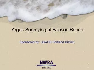
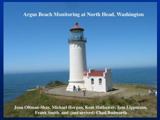
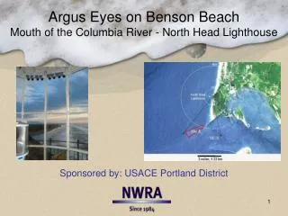
Argus Eyes on Benson Beach Mouth of the Columbia River - North Head Lighthouse. Sponsored by: USACE Portland District. Proving Argus Quantitative Accuracy: Where are the White Rocks?. After installation, USACE Portland District asked,

E N D
Argus Eyes on Benson BeachMouth of the Columbia River - North Head Lighthouse Sponsored by: USACE Portland District
Proving Argus Quantitative Accuracy: Where are the White Rocks? • After installation, USACE Portland District asked, • “where are these two rock fall in State Plane coordinates” • (We want to verify your claim that Argus provides quantitative information)
Proving Argus Accuracy: Comparing MHW Argus/ARE and WA DOE “Buggy Surveys” (RTK GPS) Special processing: Collect shorelines during flood tide only Recalculate shoreline Z using foreshore slope from a first pass
Meso-tidal beach Hsig: 1m – 13m Foreshore slopes: 0.01 – 0.06 N MHW Shoreline 630m Submerged sandbars 500m 200m
Background: Argus at Benson Beach since Feb 2004 • Severe winter of 2005/2006 • Erosion of grass dunes behind beach • Weakened offshore bar system • Followed with two years of erosion • Extreme shoreward shift of MHW shoreline • North Jetty foot weakened • 125k yd3 placed along jetty in 2008 • 367k yd3 placed on beach in 2010
Benson Beach Sediment SystemInterpreted from 7+ years of Argus Eyes • Observed seasonal changes: • MHW shorelines, sandbar movement, and foreshore slopes suggest - • interdependency between offshore sandbar morphodynamics and foreshore change • Differences in foreshore change from one year to the next are a result of difference in the: • strength and intensity of the winter waves • morphology and health of the offshore sandbars
Argus Eyes • Imagery • Snaps, timex, variance, brightness - hourly • Sandbar location tracking maps – 2x/month • MHW (2.0 NAVD88) Shorelines • Shoreline location maps – 2x/month • Dry-beach acreage graphs – 2x/month • Foreshore (1.5-2.5m NAVD88) Bathymetry • Foreshore volume graphs – 2x/month • A proxy for foreshore beach slopes
N MHW Dry-Beach Acreage Foreshore sand volume Middle bar Inner bar 630m 500m 200m
Sandbar Maps – bars moving shoreward April 2006 March 2006 May 2006 July 2006
(bold lines mark early March MHW shorelines) N BEACH 630m Oct 2006 Sept 2010 OCEAN
Natural salient Summer following severe 2005/2006 winter Man-made salient SW WA LDR dredge material placement – Sept 2010
N MHW Dry-Beach Acreage Foreshore sand volume Middle bar Inner bar 630m 500m 200m
(a proxy for beach shape - steep, shallow, plane, concave, convex)
Argus Eyes on the SW WA LDRDredge Material Beach Placement • 1 Aug - 22 Sept 2010 • 367k yd3 (281 m3) placed on Benson Beach • First storm in the last week of Sept • Argus foreshore (1.5-2.5m NAVD88) volume measurements • capture the material placement & movement (reshaping of the foreshore) • Argus sandbar maps reveal the creation of a fourth sand bar by Spring 2011
NN of DS N of DS N DS S DS
Volume (m3) Jetty Lighthouse
Dec 2010 Oct 2010 March 2011 First observed 4-bar system
Benson Beach Sediment SystemInterpreted from 7+ years of Argus Eyes • Interdependency of offshore sandbar morphodynamics and foreshore change • Winter storms >> swash bar pulled offshore >> steep foreshores • Summer calm >> swash bar attaches to shoreface >> shallow foreshores • Health of sandbars affect how much sand is pulled from the foreshore during storms • Feed the bars, save the beach • OR! starved bars feed on beaches
What’s Next? • Quantifying the “health” of a sandbar • The volume/linear-meter of sand in the bar may be a metric of health and behavior (Russeinik et al, 2009) • Kaminsky’s and Ruggiero’s jet ski bathymetry surveys of Benson Beach can provide volume information! • Imagine! We may be able to identify the presence of a “weak” bar system • before a winter of extreme erosion and jetty damage
Argus at North Head Lighthouse would not have been possible without funding from USACE and the joint cooperation of Washington State Parks, Coast Guard, and USACE/Portland District A collaborative effort with WA DOE (Kamininsky), OSU (Ruggiero, Ozkan-Haller, Haller), USGS (Gelfenbaum), Golder (Osborne)
NorthWest Research Associates (NWRA)Redmond, WA NWRA is a scientific research group, owned and operated by its Principal Investigators, with expertise in the geophysical and related sciences.