Download

1 / 26
260 likes | 352 Views
Explore the use of Argus cameras at North Head Lighthouse, WA, USA, for environmental data collection and decision-making processes regarding erosion, sediment features, and wave activity.

E N D
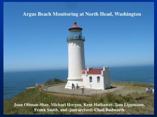
Argus at North Head, WA USAScience for Decision Making Joan Oltman-Shay Chad Budworth Sponsored by: USACE Portland District
Presentation Overview • Background on Location and View Orientation • Directed-Science Objectives and Results • Other Argus Services • Derivative products
Argus at the North Head LighthouseMouth of the Columbia RiverWashington State USA
Eight cameras looking south 50mm lenses Jetties, MCR, and the great state of Oregon in the distance
4km 1km North Head Lighthouse Site E MCR 2 miles; 3.22 km
Panoramic to Plan Views – 26 Sept 04 670m 400m 250m
Directed-Science Objectives • Strategic Objective • Obtain environmental information to aid in decision-making for placement of Columbia River dredge material • Obtain environmental information relevant to the health of the north jetty • Operational Objective for Argus • Monitor erosion rates at Benson Beach • Map sediment features near the jetty • Develop a conceptual model of sediment processes on Benson Beach (adjacent to the north jetty) • Monitor wave activity near the SWS (Site E)
Approach Analyze Argus data for: • 2.0m NAVD88 (MHW) shoreline location • Offshore bar movements • Dry-beach acreage change • Between MHW and an onshore baseline • Intertidal sand volume change • Between 0.69 (MLW+.3) and 2.26m (MHHW) • Run-up • Kent Hathaway: 3 locations along the 3km of beach • Longshore surface currents • Kent Hathaway: can’t use pixels – Tom Lippmann is trying PIV • Integrate offshore wave periods and direction • Either Argus derived, NDBC buoy, or models
Time increasing May 2004 Feb 2004 MHW Shoreline Shape June 2005 Sept 2005
North Jetty Repair Sand Bar SWS Material Added Winter Season 04/05 03/04 05/06
Occurrence of Eroding Waves: Hsig > 4m Seasonal Comparison Annual Comparison beach normal
Occurrence of Accreting Waves: Hsig < 2m Annual Comparison Seasonal Comparison beach normal
Towards a Conceptual Understanding:Nascent Musings • Acreage and Sand volume changes • North and South ends of the beach behaving differently • North side shows no net change after two years • Cumulative accretion and erosion close to zero in the second year • South side shows significant accretion in the 2nd summer • Less erosion at the end of the 2nd winter • Sand bar accretion to the shoreface began before dredge material placement and jetty repair • Argus temporal resolution shows its value here! • Offshore wave conditions different in first and second years • Fewer eroding waves (>4m) in the second year • More accreting waves (<2m) out of the extreme north-west in second year • North side in the shadow of the headland?
Derivative Argus Products • Where are the waves breaking? • Why are the waves breaking there? • Is the nose of the jetty falling off?
Why are the waves breaking there? October 2005 – end of SWS material placement
NORTH JETTY CONDITION FEB 06 vs JUL 05 31 JUL 2005 31 JUL 2005 5 FEB 2006 at 18:20 PST North Jetty foreground and south jetty back ground Visuals from ARGUS Camera at North Head Head of north jetty has receded 30-60 ft shoreward during Jul 05 and Feb 06
North Head Argus • Data is available to Argus community for your own research interests and tool testing • Big waves and lots of bars • Last week 15+m waves offshore of the MCR in 120m depth • 20+ second periods • 3 to 4 sand bars with lots (500+m) of cross-shore movement • Shoreline mapping challenges • Ian: if we limited our shoreline maps to Hsig<1m as you do (yes, the correct and wise thing to do), we would only map the summer months (maybe) • We map when Hsig < 3m to be able to map 1 to 2x/month year round • Geometry challenges • Raw, wild beach with few GCPs. • The jetty is our best GCP, especially over the water! • Recent jetty repairs affect geometry solutions