Download
1 / 20
200 likes | 338 Views
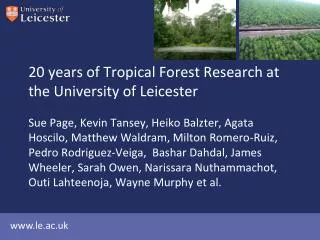
20 years of Tropical Forest Research at the University of Leicester. Sue Page, Kevin Tansey, Heiko Balzter, Agata Hoscilo, Matthew Waldram, Milton Romero-Ruiz, Pedro Rodriguez-Veiga, Bashar Dahdal, James Wheeler, Sarah Owen, Narissara Nuthammachot, Outi Lahteenoja, Wayne Murphy et al.

E N D
20 years of Tropical Forest Research at the University of Leicester Sue Page, Kevin Tansey, Heiko Balzter, Agata Hoscilo, Matthew Waldram, Milton Romero-Ruiz, Pedro Rodriguez-Veiga, Bashar Dahdal, James Wheeler, Sarah Owen, Narissara Nuthammachot, Outi Lahteenoja, Wayne Murphy et al.
Focus of NCEO collaboration • Tropical forest degradation – implications for C cycle • Use & applications of remote sensing – optical & radar (ALOS-PALSAR – Matt Waldram) • Focus on tropical peatlands – especially peat swamp forest in SE Asia • Scale of GHG emissions • Implications for REDD, land-use planning, biofuel policies etc.
Tropical peat carbon pool 11% 3% 8% 10% 65% Best estimate 89 Gt Range 82 - 92 Gt 69 Gt (77%) in Southeast Asia Equivalent to: 3.5% global vegetation & soil carbon pool 15-19% global peatland carbon store Page et al. 2011 Global Change Biology (Page et al. 2011. Global Change Biology )
SE Asia Amazonia Congo Basin ~ 10,000 km2 with depths up to 60 m? Africa?
Peatland typology & extent – Pastasza Fan, Peruvian Amazonia Lahteenoja & Page 2011 Journal of Geophysical Research
Modeling carbon emissions from drainage of tropical peatlands(peat oxidation emissions) Near-current (2005): 355-874 Mt CO2 yr-1 (100–240 Mt C yr-1) Projected (2015-2035): 557-981 Mt CO2 yr-1 (150-270 Mt C yr-1 ) Current tropical peat drainage emissions equivalent to 1.4 – 3.5 % of global emissions from fossil fuels (25,000 Mt CO2yr-1)(excluding initial biomass loss & fire) [based on 91 t ha-1 y-1 CO2 at 1 m & 46 t ha-1 y-1 at 0.5 m drainage] (Hooijer, Page et al. 2010, Biogeosciences)
Modeling carbon emissions from drainage of tropical peatlands • Constraints • Scale of unit heterotrophic CO2 emissions • Usefulness of published data limited by • low data amount in individual studies i.e. data sets too small to describe the phenomenon both spatially & temporally • CO2 emissions from heterotrophic (decomposition) processes and autotrophic (root) respiration not separated • poor method description and data collection procedures • Extent of drained peatlands • Lack of objective up-to-date information on the extent of drained peatlands – in particular industrial plantations
Confirming scale of unit CO2 emissions: Study in plantation on peatland in Sumatra, Indonesia • Study sets a standard for greenhouse gas flux studies from tropical peatlands under agricultural management. • First to purposefully quantify heterotrophic CO2 emissions. • Provides most scientifically- and statistically-rigorous study to date of CO2 emissions. • Mean heterotrophicCO2 emission (±SE) 1053±88 mg m-2 h-1 at 0.78 m average water table depth = 92 t ha-1 y-1 • After correction for diurnal temp fluctuation ~80 t ha-1 y-1 • Carbon loss still considerable even at highest water levels theoretically possible in plantations; loss of forest canopy, higher peat surface temperature, fertilisation all enhance CO2 emissions (Jauhiainen, Hooijer & Page (2012) Biogeosciences
(From: Hooijer, Miettinen, Tollenaar, Page, Malins, Vernimmen, Chenghua Shi, Soo Chin Liew (2012) ICCT White Paper No. 16) Mietinnen ….. & Page (accepted) Global Change Biology-Bioenergy
Policy impact • Two white papers for International Council on Clean Transportation • White Paper 15 – Review of GHG emissions from oil palm plantations on peat • White Paper 16 – Historical, current and projected future extent of oil palm plantations on peat • EU, EPA & CARB biofuel policies
1992- Peat swamp forest disturbance • Paper published in Nature • First estimates of carbon losses as a result of El Nino fires in 1997 • Multi-sensor approaches
2006-2009 Forest fire severity • EC funded • Mapped land cover change and forest disturbance • Fire severity indicators established • Consultancy projects
Other consequences of peat oxidation & fire • Change in organic geochemistry + formation of black carbon • Change in surface water-repellency • Increased fluvial C losses (esp. DOC) • Surface subsidence (~5 cm/yr)* flooding 28 yrs *(Hooijer, Page, Jauhiainen et al, Biogeosciences, in press) *Hooijer, Page & Jauhiainen (2012-in press) Biogeosciences
2007-2011 InSAR observations of peat swamp forest • Surface subsidence following disturbance mapped • Implications for C loss estimates
GIONET: A European Centre of Excellence in Earth Observation research training Research themes: • Forest monitoring • Land cover and change • Coastal zone and freshwater monitoring • Geohazardsand emergency response • Climate adaptation and emergency response
2011-2014 Forest Monitoring of the Congo Basin • EC funded • Mapping forest loss using spaceborne synthetic aperture radar (SAR) and optical sensors Central Congo Basin Data Comparison ALOS-PALSAR 10-m dual polarised RGB composite Source JAXA-METI, 2009 Landsat 5 mosaic (1984, 1986) RGB composite (bands 4, 5, 7 ) Source CARPE-UMD, 2006 Forest /non forest land cover map (derived from SAR data) Source JAXA-METI, 2009
The next ideas ... • Pollution mapping using hyperspectral data – e.g. in Ecuadorean rainforest • Forest biomass mapping across Thailand using multi-sensor EO data sets for REDD+ MRV • Global peat swamp forest mapping & degradation analysis • Biofuels on peat – current & future trends & drivers • Impacts of peatland subsidence on flood risk in SE Asia • Extend C & GHG emission studies (DOC, CH4, N20) • Develop landscape-scale C models (hydrology+fire+vegetation+peat oxidation etc) REDD • Peat swamp forest ecosystem rehabilitation
Centre for Landscape and Climate Research Director: Prof. HeikoBalzter, hb91@le.ac.uk Aims: • Established in 2012, the new Centre for Landscape and Climate Research has the mission to advance research excellence by providing a forum for postgraduate research students, post-doctoral researchers and academic staff to undertake cutting edge research projects. • The research in the centre is investigating how and at which scales change in the water cycle affect ecosystem services such as drinking water supply, carbon uptake and food security. • The centre director, Professor HeikoBalzter, is also Coordinator of the European Centre of Excellence in Earth Observation Research Training GIONET (www.gionet.eu). • The concentration of research activity through the close links between the Department of Geography, the Centre for Landscape and Climate Research, GIONET and SPLINT provides a truly outstanding research environment. • Whether you are thinking of a PhD degree, a Masters by Research (MRes) or a taught MSc/MA course, we provide an intellectually creative and innovative home for your postgraduate degree.
To develop successful partnership • The science underpinning the applications • Interested in high-frequency observations • Interested in large area coverage • Validating observations with field measurement • Accurate monitoring and reporting of deforestation and degradation • Compiling biomass information systems