Download
1 / 25
300 likes | 473 Views
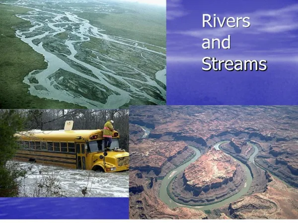
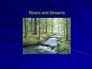
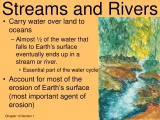
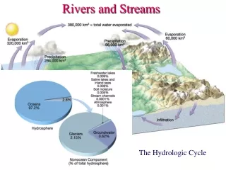
Chapter 2 Fresh Water Section 1 Streams and Rivers. How Do Rivers Begin?. Rivers begin as trickles of water run over the ground and join together in larger streams. Rain that falls can Evaporate immediately Soak into the soil as groundwater Form runoff (water that flows

E N D
How Do Rivers Begin? • Rivers begin as trickles of water run over the ground and join together in larger streams. • Rain that falls can • Evaporate immediately • Soak into the soil as groundwater • Form runoff (water that flows over the ground surface) that can eventually lead to a river.
Factors That Affect Runoff • The nature of the ground surface (water passes through soil easier than cement, so grass/plants will slow water down as it is absorbed) • The rate of rainfall (a lot of rain can’t all soak in, so some becomes runoff) • Whether the land is flat or hilly (water falls faster down a steep slope than over flat ground, so the water moves too fast to be absorbed and forms a stream instead)
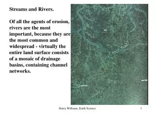
River Systems • The smaller streams and rivers that feed into a main river are called tributaries. • A river and all of its tributaries make up a river system.
Watersheds • The land area that supplies water to a river system is called a watershed or drainage basin. • Grosse Pointe is in its own unique watershed because all of our water drains directly to Lake St. Clair. It is called the Lake St. Clair watershed.However, we also contribute to the Great Lakes Watershed.
Watersheds • One watershed is separated by another by a ridge of land called a divide, and streams flow in different directions on each side.
Rivers Shape the Land • The process by which fragments of soil and rock are broken off from the ground surface and carried away is called erosion.
Rivers Shape the Land • The process by which soil and rock are left behind is called deposition.
Rivers Shape the Land • Rivers wear away landforms through erosion and build new landforms through depositions. • The particles of rock and soil that are picked up and moved by erosion and deposition are called sediments.
Rivers Shape the Land • The faster the water flows, the more energy it has to move heavier sediments. • Three factors affect a river’s speed: • The steepness of the slope (steeper = faster) • The amount of water in the river (more = faster) • The shape of the channel (deeper/broader = faster)
Profile of a River • The many small streams that come together at the source of the river are called the headwaters (usually fast, choppy, and narrow).
Profile of a River • Downriver, the channel becomes deeper and wider due to erosion, it is less steep, has more water in it from tributaries, and continues to move swiftly but much more smoothly.
The Flood Plain • The broad, flat valley (created by years of erosion) through which the river flows is called the flood plain.
Profile of a River • Small obstacles in the river’s channel cause the water to flow slightly to one side or the other, creating a bend in the river.
Profile of a River • The process of eroding and depositing sediments on the curves of a river channel will gradually form loops called meanders.
Profile of a River • The crescent-shaped, cutoff body of water that remains after a river breaks through the ends of a meander is called an oxbow lake.
Profile of a River • The mouth is the point where a river flows into another body of water (a larger river, a lake, or an ocean).
Profile of a River • When the river hits the larger body of water at the mouth, it instantly slows down. • This slow speed allows most of the river’s sediment to be deposited and build up at the river’s mouth, in an area called a delta.
Rivers and Floods • A flood occurs when the volume of water in a river increases so much that the river overflows its channel. • Precipitation can add more and more water to a river, making it faster and stronger.
Can Floods Be Controlled? • A dam is a barrier across a river that may redirect the flow of the river to other channels or store the water in an artificial lake.
Can Floods Be Controlled? • As a river flows onto its flood plain, it slows down and deposits sediments along the channel, slowly building up into long ridges called levees. Man-made levees are also used to make natural levees stronger.
Can Floods Be Controlled? When Hurricane Katrina hit New Orleans, Louisiana in 2005, some of the levees broke and flooded large areas of the city.