Download
1 / 43
450 likes | 602 Views
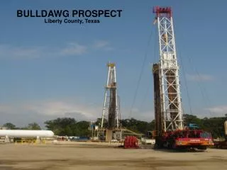
Evaluation of the Sirri Prospect Area. Engineering Staff:. Hamed Kamel PEEG. Fahd Al-Hashmi PGEG. Khaled Aness PGEG. Ahmed Al-Belooshi PEEG. Outline. Project Objectives Field Background Field Seismic Interpretation Field Exploration Plan Field Development Plan

E N D
Evaluation of the Sirri Prospect Area Engineering Staff: Hamed Kamel PEEG Fahd Al-Hashmi PGEG Khaled Aness PGEG Ahmed Al-Belooshi PEEG
Outline • Project Objectives • Field Background • Field Seismic Interpretation • Field Exploration Plan • Field Development Plan • Economic Analysis • HSE Awareness • Recommendations
Objectives • Client’s Letter • Seismic interpretation, exploration and development plans and economic analysis • Give recommendation on whether to proceed with the project or not
(2) – Long 54 38 57.2E and Lat 25 59 27.0N (4) – Long 54 45 50.7E and Lat 25 54 35.0N (1) – Long 54 33 11.0E and Lat 25 39 54.2N (3) – Long 54 26 18.0E and Lat 25 44 45.6N Geographical reference
Seismic Interpretation • Rationale • Methodology • Manual Interpretation • Software Interpretation • Results
N Seismic Manual Interpretation • Contouring maps • Structure analysis • Spill point determination • Finding the depth (velocity * time ) • Results: • Structure: Anticline • OOIP= 7.90 billion bbl. Spill Point
Computer Interpretation • Picking horizons • Miss tied correction • Create TWTT contour map • Depth map • Find Area, volume and reservoir thickness
Top Mishrif Bottom Mishrif Computer Interpretation • Picking horizons
Computer interpretation • Miss-tie correction Before After
Top contour map N N Bottom contour map Computer Interpretation • Create TWTT contour map
N Computer interpretation • Creating Depth maps • Depth (m) = Velocity(m/s) * Time (s) Depth map of the top reservoir
Spill point N Thickness map showing oil water contact Computer interpretation • Constructing a Thickness Map • Thickness= (Bottom of reservoir- Top of reservoir/2)*3800 m/s • Spill point
Seismic Interpretation Results • Anticline structure • Area: 93km2 • Average thickness: 24.6 m • OOIP=Porosity*(1-Sw)*volume = 2.5 Billion bbl
Exploration and Development Plan • Methodology • Location of Exploration wells • Rig selection • Scenarios Demonstration • Production Forecast • Production Facility Options • Economic Indicators
Field Exploration Plan • Location of Wildcat Well: • One well at the center of the potential reservoir • Purpose • Location of Delineation Wells: • Four delineation wells at the borders • Purpose
N Field Exploration Plan Wildcat well Delineation wells
Field Exploration Plan • Rig selection • Jack up IS 300' WD • Reasons • Water depth 300’ • Low Cost $82,333 per day • More working rigs
Field Development Plan • Types of wells: • 500 m Vertical, 1000m Horizontal and 2000m Horizontal • Different drainage area and different cost for each type • Methodology: • At the center of the reservoir
Well Profiles • Production Profiles
Field Development Plan • Production Profile
Field Development Plan • Production Profile
Scenario 1 11 9 3 h 3 11 2 5 11 4 H 5 5 11 6 3 2 2 9 12 9 7 4 4 3 V 10 1 1 1 1 1 2 3 7 7 Field Development Plan Well Type Key : 12 12 3 6 7 2 4 5 6 6 10 5 9 7 8 9
Scenario 2 6 10 h 4 12 10 6 8 H 11 11 5 6 4 5 5 2 4 11 5 7 11 9 3 2 7 11 9 7 7 8 2 3 6 10 10 6 2 10 3 7 1 V 1 1 1 1 8 Field Development Plan Well Type Key: 8 7 8 8 8 4
Comparison summary • Scenario 1: • More wells (55) • ∑ Oil production (1.3 billions bbl) • Scenario 2 : • Less wells (48) • ∑ Oil production (1.7 billions bbl)
Field Development Plan • Data Set
Production facilities • Three different production facilities were applied to each scenario: • FPSO only (Floating Production, Storage and Offloading unit) • Platform only • FPSO & Platform • Select based on the Economic Analysis
Production Facilities • Platform • Construction (2 years) • Cost: $350million • Facilities • Gas – Oil separation facility • Water treatment facility • Pipeline • Fluid separation, processing & treatment • Gas processing • Oil treatment • Water treatment
Production Facilities • FPSO • Oil production cost • 190,000 $/day + Variable rate $14/bbl
HSE Awareness • Seismic survey: • Air guns effect on marine life • Exploration: • Reef life destruction & hydrocarbon leakage • Development: • CO2 emission
Conclusion & Recommendation • Conclusion: • Jack up used for drilling • Both (FPSO+Platform) • Scenario 2 • Recommendation: • Start drilling exploration well • If hydrocarbons found, we recommend PI ENTERPRISES to start drilling using the 2nd scenario • If not, do not proceed with drilling