Download
1 / 25
250 likes | 389 Views
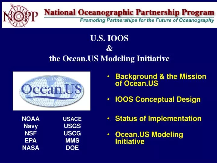
U.S. IOOS & the Ocean.US Modeling Initiative. Background & the Mission of Ocean.US IOOS Conceptual Design Status of Implementation Ocean.US Modeling Initiative. NOAA Navy NSF EPA NASA. USACE USGS USCG MMS DOE. GEOSS. IEOS. Welcome to the Acronym Jungle. IOOS. GOOS. 2.

E N D
U.S. IOOS&the Ocean.US Modeling Initiative • Background & the Mission of Ocean.US • IOOS Conceptual Design • Status of Implementation • Ocean.US Modeling Initiative NOAA Navy NSF EPA NASA USACE USGS USCG MMS DOE
GEOSS IEOS Welcome to the Acronym Jungle IOOS GOOS 2
1998 Congress Called forIntegrated Ocean Observing System (IOOS)Routinely Provide Data/Info Required for More Rapid Detection & Timely Prediction of State Changes • Improve the safety & efficiency of marine operations • Improve national/homeland security • Improve forecasts of natural hazards and mitigate their effects more effectively • Improve predictions of climate change & their effects • Minimize public health risks • Protect & restore healthy coastal marine & estuarineecosystems more effectively • Sustain living marine resources 1 System, 7 Societal Goals 3
2004 U.S. Commission on Ocean Policy • Implement an Integrated Ocean Observing System (IOOS) • Make more effective use of existing resources • Enhance operational capabilities over time to address 7 societal goals • Ecosystem – Based Management • Strengthen Regional Approach • As a means of implementing ecosystem–based management 4
www.ocean.us Ocean.US The National Office for Integrated & Sustained Ocean Observations • Established in 2000 by NOPP to • Prepare & maintain IOOS Development Plans based on data requirements of user groups, • Coordinate integration of IOOS elements, including harmonizing regional & national development of the system, & • Function as the focal point for national & international development of ocean observing systems. • Ocean.US Leadership • Current Director: Mary Altalo (1 January, 2006) • Past Directors: David Martin, Eric Lindstrom, Tom Malone 5
“Airlie House” WorkshopMarch 2002 • IOOS Design Principles • Priority Products & Services for each of the 7 Societal Goals • IOOS Conceptual Design • Began Process of • Specifying observing system requirements • DMAC the Highest Priority • Estimated New Funding for Implementation • $138 M Yr 1 • $500 M Yr 5 6
IOOS Design Principles • Provide data & information needed to address all 7 societal goals by implementing & sustaining an IOOS that is • Responsive to the needs of decision makers, • End – to – End • Multi–scale, Multidisciplinary & Multipurpose • Serve data & information at rates & in forms required by decision makers in each of the 7 societal benefit areas. • Make more effective use of existing assets to • Efficiently link observations & modeling through • Integrated data management & communications • Build on, improve & enhance existing capabilities over time • Enable users from both private & public sectors to contribute to & benefit from IOOS data & information • Adopt & implement national standards & protocols for • Measurements & data telemetry, • Data management & communications, & • Modeling & analysis • Implement performance measures for all of the above 7
IOOS is an “End–to–End” System Efficiently Link 3 Subsystems Decision Support Tools Climate Metadata standards Data discovery Data transport Online browse Data archival Currents & Waves Water level Coastal inundation Waterborne pathogens Population Dynamics Ecosystem Dynamics Satellites Natural Hazards Aircraft Marine Services Fixed Platforms Ships Security Drifters & Floats Public Health Ecosystem Health AUVs Resources Observing – Data Telemetry Integrated DMAC Modeling Analysis 8
Observing & Data Telemetry SubsystemMulti–Scale System Global Ocean Component Coastal Ocean Component GLs Ak NE NW MAB Regional Observing Systems SE Pac C Cal Go Mex S Cal Caribb National Backbone Low Resolution High 9
Coastal Component ofthe IOOS National Backbone • Operated by • NOPP Agencies • RAs • EEZ & Great Lakes • Core variables • Required by regions • Networks • Sentinel stations • Reference stations • Standards/Protocols • QAQC, DMAC • Products Regional COOS’s • Based on data & info • requirements of users • Regional Associations • Design & Manage • Resolution • Variables • Estuaries, Great Lakes, • EEZ • Incorporate • Subregional systems • Elements thereof
First Development Plan Completed by Ocean.US December 2004 Approved at Cabinet level by the Interagency Committee on Ocean Science & Resource Management (ICOSRMI) January 2006 www.ocean.us 11
DMAC Plan • Completed & Approved in 2005 • Provides a Road Map for Implementing Interoperable Mechanisms that Enable • Rapid access to diverse data • From many sources • With the completion of the DMAC plan, Ocean.US is turning its attention to • The Modeling & Analysis Subsystem 12
The 1st IOOS Development Plan calls for a modeling effort that will • Improve, develop, test & validate operational models for all seven societal goals; • Produce more accurate & comprehensive estimates of current states of the marine environment, ecosystems & living resources; • Improve, develop & apply data assimilation techniques to initialize & update models for more accurate forecasts of state changes; & • Optimize the observing subsystem to achieve these objectives The broad objective is to tune the delivery of model-derived products to the time-space scales on which decisions need to be made to achieve the societal goals. 13
Next steps • Promote synergy • between research & operational modeling activities • Promote improvements • in existing operational models • Enable development of operational modeling capabilities • in goal areas where none now exist • Engage Federal Agencies, RAs & other stakeholders • in the design & implementation of the modeling & analysis subsystem of IOOS • Establish a Modeling & Analysis Steering Team (MAST) to Address these Objecives 14
Climate & Marine Meteorology Michele Reinecker (NASA) Steve Payne (Navy) Fred Toepfer (NOAA) Coastal Circulation, Inundation & Waves Frank Bub (Navy) Dale Crockett (TX WDB) Eoin Howlett (ASA) Richard Luettich (UNC) John Harding (Navy) Watershed Hydrology Richard Alexander (USGS) Biogeochemistry Jorge Sarmiento (Princeton) Ecosystem Dynamics Fisheries & Water Quality Carl Cerco (USACE) John Wilkin (Rutgers) Eileen Hofmann (ODU) Anne Hollowed (NOAA) MAST MembersChairman: Chris MooersCo – Chairs: C.J. Beegle – Krause & Frank Aikman 15
Mission of MAST Prepare a 5 – Year Strategic Plan with a Prioritized Action Plan & Budget to Achieve The Following Objectives: • Enhance collaboration between operational & research modeling groups • Establish & maintain an inventory of operational & research modeling capabilities relevant to addressing the 7 societal benefits • Assess performance & skill of existing & emerging operational capabilities in terms of user needs & recommend improvement • Develop community consensus for a research agenda that will help improve operational modeling capabilities • Facilitate transitions of models & model improvements from research to operational use • Assess & recommend improvements to the observing & DMAC subsystems through the use of test beds & OSSEs/OSEs • Explore the use & efficacy of Community Modeling Networks as a mechanism for achieving these objectives • Work with the NOPP, Federal Agencies & other groups as appropriate to attract the required funding 16
IOOS Community Modeling Workshop28 – 29 November 2006 • Objectives • Review present status of operational global & coastal models • Identify R&D needed to advance operational modeling for all 7 societal goals • Provide guidance for preparing the MAST Strategic Plan • Provide guidance for the MAST CY 07 Action Plan • Deliverables • Annotated outline of the MAST Strategic Plan • Recommend short– & long–term priorities for MAST activities • Workshop Proceedings 17
RCOOS/ORION Science and Technology Workshop 2007 • Organizing Committee • Physical Oceanography, Chris Mooers/RSMAS (SEACOOS/MAST) • Marine Biogeochemistry, Rick Jahnke/SKIO (SEACOOS/ORION) • Marine Ecology, Mark Moline/CalPoly (CENCOOS & SCCOOS/ALPS) • Issues • Developing the network of sustained observations needed to meet data requirements of models for all 7 societal goals • Building scientifically sound operational IOOS capabilities • Participants • 3 experts from each RA • Coastal physical oceanographer or meteorologist, biogeochemist, & marine ecologis • Representatives from DMAC, MAST & ORION • Tentative Objectives: Consensus on • The scientific questions that need to be answered to enable credible & periodic estimates of the State of the Coastal Ocean regionally? • The critical missing observational & modeling capabilities & priorities for filling them? • How RAs/RCOOSs & ORION/OOI can best collaborate to enable synergy between IOOS & major ocean research programs 18
Societal Goals & Example Products Used to Determine Observing System Requirements • Climate Prediction • Annual estimates of regional–global sea level changes w/ error bars • Annual quantitative assessments of the impact of global warming on the frequency & magnitude of tropical & extra–tropical stomrs • Maritime Operations & National/Homeland Security • Hourly mesoscale nowcasts & 72 hr forecasts of water levels & 3–D current, temperature & salinity fields • Hourly mesoscale nowcasts & 72 hr forecasts of sea surface vector wind & wave fields & surf conditions • Natural Hazards • Hourly 72 hr forecasts of the time–space extent of coastal flooding caused by tsunamis, tropical storms & extratropical storms • Annual assessments of changes in resilience of coastal populations & infrastructure to coastal flooding • Public Health • Hourly nowcasts & 72 hr forecasts of plumes from large permitted dischargers • Hourly 72 hr forecasts of impacts of HABs on coastal habitats, living marine resources & human health • Ecosystem Health • Annual quantitative assessments of the condition of coastal ecosystems in terms of (i) habitat & species diversity; (ii) water quality; & (iii) near shore bathymetry–topography • Annual assessments of the effects of global warming on the condition of coastal ecosystems as quantified above • Living Marine Resources • Annual estimates of recruitment rates for exploitable fish stocks w/ error bars • Annual assessments of the efficacy of Marine Protected Areas in terms of the extent & condition of habitats & the abundance & distribution of living resources 20
Existing Operational Capabilities Operational Status High Operational Capabilities Marine Weather Marine Ops Hurricanes Public Health Water Quality Ecosystem – Based Management Investments in R & D Operational Status Low 21
IOOS Data & Information Analysis & Modeling Informed Decisions DMAC Coordinated Development of an Integrated System Observations & Data Telemetry 7 IOOS Societal Goals Design of an End– to– End System Enable Science Improve Operational Capabilities Research & Development Research Priorities Users Requirements Ocean.US & RAa Plan & Coordinate Federal Agencies & RAs Implement 22
President’s Ocean Action Plan Committee on Ocean Policy Chair CEQ (Cabinet Level) Interagency Committee on Ocean Science & Resource Management Integration (ICOSRMI) Co-Chairs: OSTP & CEQ ORRAP NSC PCC Global Environment JSOST SIMOR IWGOO NFRA Ocean.US 23
Observing Requirements: Remote Sensing • Sustain & Improve Satellite Time-Series • Surface winds, temperature, waves, currents • Sea surface height • Ocean color
~ 50 % Implemented Global Coastal