Download
1 / 16
160 likes | 180 Views
Discover the rich physical geography of the Middle East where continents meet, seas dominate, and mountains form fertile landscapes. Explore the region's resources, water scarcity, and climate variations.

E N D
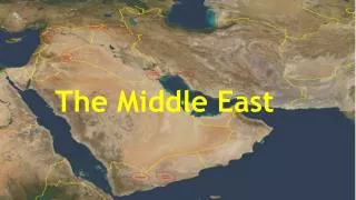
The Middle East Unit 7
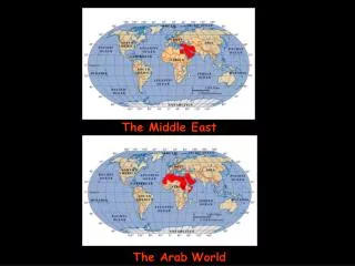
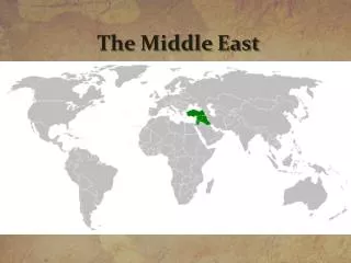
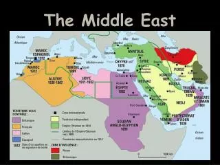
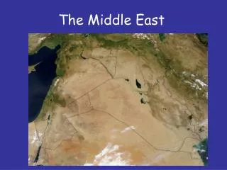
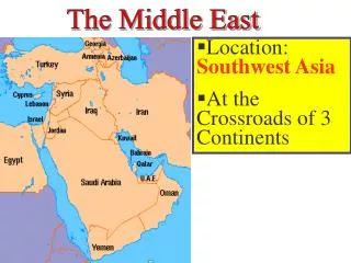
The Middle East Physical Geography • The continents of Europe, Africa, and Asia meet in this region, which has been a crossroads for travelers and traders for centuries. • The Mediterranean Sea dominates the region's many seas and peninsulas. • some areas receive plentiful rainfall, water is scarce across much of the region. • Vegetation varies widely depending upon the climate.
Seas & Peninsulas The region consists of many seas and peninsulas • North Africa, SW Asia, and Central Asia feature numerous seas and peninsulas. • Mediterranean, Red & Black Sea • Arabian & Sinai Peninsula • The Dead Sea, Caspian Sea, & the Aral Sea are landlocked bodies of saltwater • The Aral Sea, which began to dry up when the Soviet Union diverted river source waters for irrigation
Rivers Rivers flow through fertile valleys that once were the birthplaces of early civilizations. • The Tigris & Euphrates rivers help irrigate farms throughout Syria, Turkey & Iraq • Streambeds • Runoff from infrequent, violent rainstorms creates temporary streams in North Africa & SW Asia
Plains, Plateaus, & Mountains • Coastal Plains • The region is dominated by deserts and mountains, • fertile coastal plains such as those bordering the Mediterranean Sea form rich agricultural areas • Highlands: Several mountain ranges have fertile areas along their slopes • Atlas Mountains- N Africa • Asir Mountains- Arabian Peninsula • Caucasus Mountains- • Desert Highlands of Turkmenistan & Uzbekistan
Earthquakes • Three tectonic plates come together in the region, forming mountains and causing earthquakes
Natural Resources • Oil & Natural Gas • Major petroleum, natural gas, and Resources • Minerals • mineral deposits have enriched the region. • Building Diverse Economies s • Some countries that suffered economically during times of price fluctuations of these resources are now diversifying their economies.
Water Resources • Desert • A desert climate predominates in the region, and the scarcity of water makes it a precious resource • Sahara covers 50% of the region • >10 in of rain/year • Steppe Climate • 2nd largest climate region • Semi-arid with light precipitation • Short grasses
Climatic Variations • Exports & Tourists • Fruit crops are grown in countries with a Mediterranean climate, and food grains are produced in the wetter, colder highlands climates. • Climate attracts tourists • Rainfall • Highland areas receive more rainfall • Support more vegitation • Sign of things to come • desertification