Download
1 / 16
170 likes | 459 Views
The Middle East. 8 th Grade World Geography SOL: WG1d, 3a, 4 Ms. Gigliotti. Objectives. SWBAT: Describe what they believe is the Middle East Locate the countries, location, and physical characteristics of the Middle East on a map

E N D
The Middle East 8th Grade World Geography SOL: WG1d, 3a, 4 Ms. Gigliotti
Objectives • SWBAT: • Describe what they believe is the Middle East • Locate the countries, location, and physical characteristics of the Middle East on a map • Describe the physical characteristics, such as water features, landforms, and climate and their effects on the Middle East
Guiding Question • What countries make up the Middle East and what are the region’s physical characteristics?
Do Now • Please take out out a sheet of paper. Put your name, date, and period in the upper right hand corner • Answer the following questions on the sheet of paper • 1. Where do you think the Middle East is? • 2. What countries are in the Middle East? • 3. Once you are done, put your pencil/pen down and look forward so I know you are done • We will discuss your answers as a class
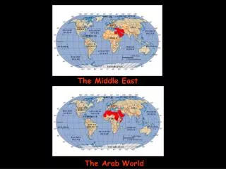
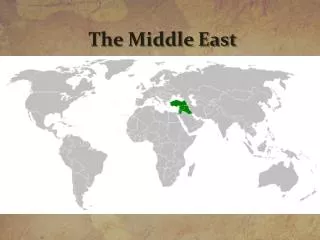
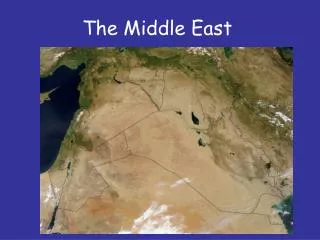
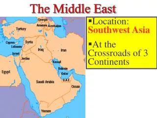
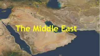
So, Where Actually is the Middle East? Based on this picture, why do you think the Middle East is referred to as the crossroads of Europe, Africa, and Asia?
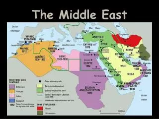
Countries in the Middle East • GDP • Kuwait • United Arab Emirates • Qatar • Israel • Land Size • Algeria • Saudi Arabia • Libya • Population • Iran • Turkey • Egypt
Mountains • There are three mountain ranges in the Middle East: • Atlas, Taurus, and Zagros Zagros Taurus Atlas
Climate • The Middle East has desert and semiarid climates • The Sahara region is the largest desert in the world. It’s 3.5 million square miles and covers most of North Africa • The Sahel region is at the edge of the Sahara
Climate • The Steppe region borders the Sahara to the North and South and averages less than 14 inches of rain a year
The Desert • An oases is a place in the desert where underground water can surface • This makes small-scale farming in the desert possible • Oases allows for villages, towns, and even cities to develop in the desert
Aswan High Dam • Aswan High Dam controls the Nile River’s water flow • The dam also helps control the water’s flowand alluvial soil • Alluvial soil is rich soil made up of sand and mud deposited by moving water • The dam provides Egypt with water for agriculture and hydroelectric power
Water Systems • Seasonal Flooding • Irregular rainstorms can cause flash flooding • Wadis • Streambeds that remain dry until a heavy rain • Flash floods cause wadis to become dangerous • Why?
Exit Slip • On a piece of paper with your name, date, and class period at the top, please pick and answer only ONE set of questions: • What is an oases? What can develop around oases? OR • What is a wadis? What makes wadis dangerous? Why? *Please turn it into your class’ tray when you are done*