Download
1 / 21
280 likes | 647 Views
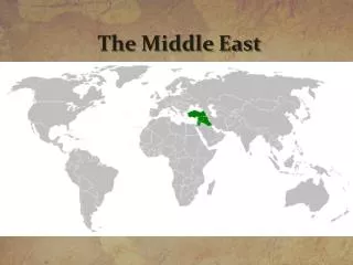
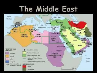
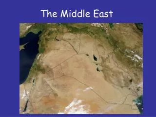
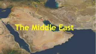
The Middle East. Countries of the Middle East. Iran, Afghanistan,Pakistan,Tajikistan, Kyrgyzstan,Uzbekistan,Turkmenistan,Turkey, Syria,Lebanon,Iraq,Israel,Palestine,Jordan, Kuwait,Bahrain,Saudi Arabia,United Arab Emirates,Oman,Yemen, Egypt. Location.

E N D
Countries of the Middle East Iran, Afghanistan,Pakistan,Tajikistan, Kyrgyzstan,Uzbekistan,Turkmenistan,Turkey, Syria,Lebanon,Iraq,Israel,Palestine,Jordan, Kuwait,Bahrain,Saudi Arabia,United Arab Emirates,Oman,Yemen, Egypt
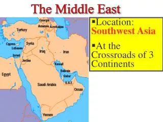
Location • Exact Location: 29° N, 41° E (Saudi Arabia) • Turkey: 35N 5E • Iraq: 33N 44E • Pakistan: 33N 73E • Oman: 23N 58E • Saudi Arabia: 24N 46E • Yemen: 14N 44E • Iran: 35N 51E • Relative Location:
Landforms • Anatolian Plateau • An Nafud Desert • Ar Rub’ Al Khali Desert • Arabian Desert • Asir and Hejaz Mountains • Caucasus Mountains • Dash e-Lut • Elburz Mountains • Hadramawt • Hindu Kush • Karakum Desert • Pamie • Syrian Desert • Taurus Mountains • Tien Shan • Zagros Mountains
Movement • 13 million first-generation migrants from Arab nations • Migration
Features The Great Pyramid of Giza The Lost City of Petra Hagia Sofia The Old City of Jerusalem
Climate • Dry and hot • Global warming • human interactions and ecosystem • settle around the limited fresh water supply • Civilizations concentrate around fertile soil.
Water • water supply -very limited in the Middle east • drinking water -have to use desalination to get it • rivers in the area -Tigris,Euphrates and the Nile river • Used for Ports
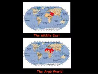
Region: an area that has definable characteristics but it doesn’t have fixed boundaries. • It is primarily a desert with some small areas of fertile land close to the major rivers. The Middle East is a region that roughly encompasses a majority of Western Asia and Egypt.
Interaction with Environment • Farming • Pollute water • Oil
Culture • Ethnic/Social Groups: Arabs, Turks, Persians, Balochs,Pashtuns, Lurs, Mandaeans, Tats, Jews, Kurds, Somalis, Assyrians, EgyptianCopts, Armenians, Azeris, Maltese,Circassians, Greeks, Turcomans, Shabaks, Yazidis, Georgians, Roma, Gagauz, Mhallami and Samaritans. • Religion: IslamJudaism, Christianity, Bahá'í Faith, Yazdânism, Zoroastrianism, Mandeanism, Druze, Yarsan,Yazidism and Shabakism. • Languages: Arabic, Persian, Turkish, Berber, and Kurdish. • Interactions with others: through trade
Economy • Diverse • Oil • Cash crops
Resources • Oil • Natural gas and phosphate • Water • Pollution
Resources • http://www.worldatlas.com/webimage/countrys/asia/middleeast/melnd.htm • http://worldregionsproject.wikispaces.com/Global+Interactions+of+Middle+East • http://en.m.wikipedia.org/wiki/Middle_East • http://en.m.wikipedia.org/wiki/Economy_of_the_Middle_East • http://www.worldatlas.com/webimage/countrys/meriv.htm • http://en.m.wikipedia.org/wiki/Water_politics_in_the_Middle_East