Maximizing Linguistic Insights Through the LL-MAP Project at the Max Planck Institute
The LL-MAP Project, funded by the National Science Foundation and organized with GISLI, aims to innovate language research by integrating linguistic data with geographical information. Collaborating with partners like PARADISEC and the Alaska Native Language Center, it focuses on mapping lesser-known languages, analyzing speaker distribution, and creating an essential resource for students and scholars. The initiative encourages new scientific insights and offers tools for both public users and researchers to visualize and engage with linguistic information effectively.

Maximizing Linguistic Insights Through the LL-MAP Project at the Max Planck Institute
E N D
Presentation Transcript
The LL-MAP Project Max Planck Institute, Leipzig
LL-MAP Project • 3-year project • Funded by National Science Foundation • Organized with GISLI (U. of Stockholm) • Six other founding partners: • PARADISEC • Alaska Native Language Center • Tibetan Himalayan Digital Library • MPI-EVA • Arienne Dwyer of Kansas U • Randy LaPolla of La Trobe U Max Planck Institute, Leipzig
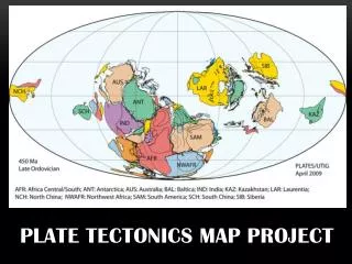
Goals • Use GIS to combine language information with information from other sciences • Provide accurate information on language distribution, particularly for lesser-known languages • Stimulate new scientific insights via novel combinations of data • Provide an informational resource for students, educators, & the general public Max Planck Institute, Leipzig
Immediate Objectives • Create core project: • Organize and serve the resources contributed by project partners • Develop standards and procedures to make the facility extensible to other projects and archives • Create space and tools for scholars to use project data and contribute more Max Planck Institute, Leipzig
Content (1) • Information on topography, flora, fauna… • Language Information • a) Speaker distribution (what is traditionally considered language mapping) • b) Language facts (writing systems, number of speakers, etc.) • c) Language resources (grammars, lexicons, audio & video, etc. Here the map will simply be an interface to the metadata) Max Planck Institute, Leipzig
Content (2) • Speaker distribution (a) • shp files, etc., or georeferenced text data made into shp files. • displayed as maps • Language Facts (b) • georeferenced text data • displayed as feature attributes (through “data browser’) • may be merely links—don’t want to duplicate efforts elsewhere • Language resources (c) • metadata (suggestion is to use OLAC as conduit) • map will be simply an interface to the metadata • metadata displayed as attributes through data browser Max Planck Institute, Leipzig
Aggregation / Collection • For projects with web services • LL can provide an aggregation service based on OpenGIS protocols • Protocols allow LL-Map to choose layers from wms servers across the world and combine them with LL-MAP layers • For projects w/o web services, e.g., individual linguists • LL can provide online geodata collection facilities (producing image files) • Can establish migration path for text data Max Planck Institute, Leipzig
Commitments • To share all unrestricted data with our partners • An argument for the web services model • Those projects with wms / wfs services could aggregate from the LL-MAP service in return • To saliently credit data sources • To provide assistance with data preparation during the project period • To maintain the site and software (including administrative software) after the end of the project Max Planck Institute, Leipzig
Project Interface • Website will have two main areas: • Public area • Scholar’s workbench • Login as • Guest scholar • Resident scholar • Website will also support administrative functions (login required) • Review area where Advisory Board can approve / disapprove maps and data for public display • Admin area where designated staff can accept / decline requests to become resident scholars Max Planck Institute, Leipzig
Public Area • Users can • Combine layers to create new map displays • Perform queries & view table data • View / print maps • Download map images (raster data) Max Planck Institute, Leipzig
Scholar’s Workbench Scholars can • Add their own data • Draw polygons & points • Add Attributes (text data) • Combine their layers with LL-MAP layers • View / print maps • Save their project information on the site • Guest scholars: 3 weeks • Resident scholars: 1 year • Make project available to other scholars (in Scholar’s Workshop) • Submit to Advisory Board for inclusion in public interface Max Planck Institute, Leipzig
Interface • LINGUIST List Development server • Google Interface • ESRI interface for advanced work http://linguistlist.org/llmapdev/ Please use Explorer 7! Max Planck Institute, Leipzig