Download
1 / 22
220 likes | 397 Views
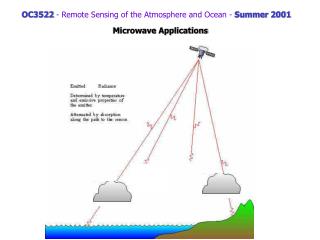
OC3522 - Remote Sensing of the Atmosphere and Ocean - Summer 2001. A Brief History of Environmental Satellite Systems (suggested reading Chapter 4 - Kidder & Vonder Haar, Reference Appendix A - List of Meteorological Satellites, and Remote Sensing Tutorial at http://rst.gsfc.nasa.gov ).

E N D
OC3522 - Remote Sensing of the Atmosphere and Ocean - Summer 2001 A Brief History of Environmental Satellite Systems(suggested reading Chapter 4 - Kidder & Vonder Haar, Reference Appendix A - List of Meteorological Satellites, and Remote Sensing Tutorialat http://rst.gsfc.nasa.gov)
First Generation • TIROS series - research satellites with: TV cloud imagery scanning IR radiometer low resolution E.R.B. experiments • DMSP - Defense Meteorological Satellite Program (classified until 1973) IR; cloud cover information • ESSA (TOS) became operational system • Nimbus series - NASA research series with: passive radiometric sensors for sounding atmosphere survey land and ocean surfaces 7th operated for about 10 years experiments became operational instruments on several systems (IR/MW sounding, MW imaging, Ocean color, ERB) • ATS - geostationary research series first multispectral imagery from geostationary orbit SMS and then GOES became operational system
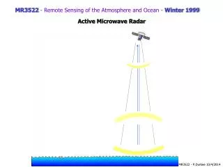
Second Generation • Landsat - land (earth resources) research • NOAA - series of operational polar orbiters • SMS/GOES - operational geostationary • Third Generation • TIROS-N/NOAA - operational polar orbiters, advanced sounders and imagers • GOES - added sounders from geostationary orbit • Additional research systems: SAGEERBESeasat - active and passive MW for ocean remote sensing (1978) GEOS-3 - altimeter (1975) Landsat - 4/5 and many other Current Generation - too many to list completely
Defense Meteorological Satellite Program (DMSP) OLS - operational line scan Infrared (8-12 mm) Visible (0.4-1.1 mm) Sat: F13 Thu Jan 1 01:04:29 1998
Special Sensor Microwave/Imager n=19 GHz n=22 GHz n=37 GHz n=85 GHz
26 Dec 1996 18:24 Z Channel 2(from JHU/APL) InterestingImages
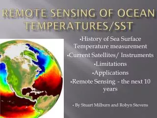
History of Satellites Ocean Sciences http://www.oc.nps.navy.mil/~rtt/history.html Oceanography - early 1900’s invariant ocean SIO founded in 1912; WHO 1930 - post WWII - ocean’s not invarient - 1950’s multiship international surveys begin Repeat Hydrographic surveys - 1960’s/70’s Growth in technology; current meter advancement, drifters - 1970/80s - satellite oceanography SEASAT - 1978 (CZCS; Altimeter; SAR) NIMBUS - CZCS 1978 TIROS - AVHRR (SST) 1978 GEOSAT - US NAVY - 1985 ERS 1/2 - SST/SSH/Winds/Waves - 1991 SSMI - 1992 (ICE) TOPEX/Poseidon - SSH/Winds/Waves 1992 RADARSAT - 1995 SeaWifs - 1997 GFO - US NAVY - SSH/Winds/Waves - 1998 SeaWinds - 1998
http://coastwatch.nmfs.hawaii.edu/topex/pictures/latest_hawaii.gifhttp://coastwatch.nmfs.hawaii.edu/topex/pictures/latest_hawaii.gif
http://topex-www.jpl.nasa.gov/applications/images/coral-reef-monitoring.gifhttp://topex-www.jpl.nasa.gov/applications/images/coral-reef-monitoring.gif
Mystery Plankton Bloom in the Bering Sea June 5, 2001 http://seawifs.gsfc.nasa.gov/SEAWIFS.html http://www.es.ucsc.edu/~swifs/oceanscience.htm#Productivity
A B C http://www.ccrs.nrcan.gc.ca/ccrs/tekrd/radarsat/images/pei/rpei01e.html
Objectives: Seasat A was the first satellite designed for sensing of the Earth's oceans with active microwave instruments. Specific objectives were to collect data on sea-surface winds, ocean topography, sea-surface temperatures, wave heights, wave length and direction, atmospheric water, and sea ice features. The mission ended after 116 days due to a failure of the vehicle's electric power system. The mission demonstrated the feasiblity of using microwave sensors to monitor ocean conditions, and laid the groundwork for future ocean missions. The major difference between Seasat-A and previous Earth observation satellites was the use of active and passive microwave sensors to achieve an all-weather capability. http://www.earth.nasa.gov/history/seasat/seasat.html