Download
1 / 24
240 likes | 392 Views
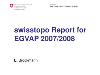
swisstopo Report for EGVAP 2008/2009. E. Brockmann. Content. Routine GNSS operation: Status report: Processing, availability Comparison with radio sondes Study of the influence of snow

E N D
swisstopo Report for EGVAP 2008/2009 E. Brockmann
Content • Routine GNSS operation: • Status report: Processing, availability • Comparison with radio sondes • Study of the influence of snow • Tomography approach (project MeteoSwiss, ETH Zurich with ZTD data + double-difference data from swisstopo; results prepared by D. Perler, ETH Zurich)
Processing remarks • Bernese Software 5.0 (+) – close cooperation with University of Berne • Same strategy since November 2006 (GPS week 1400) • Number of sites (and satellites) slightly increased – not yet analyzed 6 super stations included Nov. 12, 2008 ~90 sites ~90 sites32 + 15 sat.
GNSS processing • Since Nov. 06: GPS+GLONASS combined processing • Mid 2007: Permanent network in Switzerland enhanced (GPS-GLONASS combined receivers installed) • Since Oct. 07: ambiguity resolution for hourly processing • [March 2008: absolute antenna model, 3 degrees elevation cut-off, gradient estimation, GNSS as input for tomography] • Today (Nov. 09): 32 GPS and 15 GLONASS satellites – March, 2009 the magic number of 51 GNSS was reached
Processing remarks (2) • rms of unit weight estimated for the GPS phase observables: higher during summer times – evtl. Meteo more difficult to model (?)
EUMETNET – EUREF – MOU: swisstopo use • signed in London, June 2007: Data exchange and usage of radiosonde and synop (meteo) for geodetic scientific use • Routinely 13 collocations with radio sonde data analyzed at swisstopo GNSS site RS site
GNSS validation: PAYE Reference: PP, GNSS, absolute antenna PCV Relative antenna model causes bias RRT solution with bigger variations (small network) GLONASS influence is small for daily PP amb-fix solutions
Validation using different processing options and external sources Radio sonde comparison of 13 sites: ~ positve bias last weeks
Validation with radio sonde data: PAYE • reference: GNSS postprocessing • Absolute antenna phase center related since Mid 2007Trimble Cephyr antenna • Seasonal variations clearly visible
Radio sonde – GPS: PAYE (D. Perler) • Relative antenna phase center till March 2008 • Antenna change (GPS -> GLONASS): June 2007Trimble Microcentered TRM33429.20+GP -> Cephyr antenna TRM55971.00 ( ) • Jump + seasonal variations + day/night differences substracted
Radio sonde – GPS: PAYE (D. Perler) • Results from 2 years: 0:00, 12:00 UTC measurements • Mean ZTD with seasonal variations substracted • At noon: ZTD of radio sonde is 6 mm smaller as GPS ? ???
Validation with radio sonde data: PAYE • reference: Real-time monitoring • All plots available on http://www.swisstopo.ch/pnac – similar monitoring system as EGVAP with traffic light symbols • Radio sonde data with a time delay available
Availability • Meteo processing and coordinate monitoring closely related • Availability is important: 99.66% LPT_;96.49% LPTR average Last 52 weeks
Example heavy snow fall: PAYE December 2008 - Status PAYE
Example heavy snow fall: PAYE (2) December 2008 – coordinates 20 cm off (height) ! 1 point = 1 hour 1 point = 1 hour 1 point = 30 Seconds (kinem.) Positioning service monitor
Example heavy snow fall: PAYE (3) December 2008 - ZTDs • ZTD parameters are highly biased in case of heavy snow falls – as also the corresponding coordinates…
Example heavy snow fall: PAYE (4) December 2008 – ZTDs eliminated in postprocessing
Example heavy snow fall: PAYE (5) Case 2, January 2009 – picture of the antenna – only a small bias in the coordinates (3 cm in height) • Antennas are quite sensitive to surrounding – replacement of 6 antennas in May 2009 with chokering antennas (after extensive snow tests in the Alps); further antenna replacements planned.
Tomography • GANUWE Project • Swiss project funded by the Swiss Federal Office of the Environment FOEN • Partners: ETH Zurich + MetoSwiss • External partner: swisstopo • Goal: Make tomography usable in numerical weather prediction • Follow up project of phD (Kruse, Troller) and “local networks” (Lutz) • Results prepared by D. Perler (ETHZ)
Improvements Simulation of more satellite systems:gain for GNSS tomography • Data • GLONASS supported • ZTD estimates based on absolute phase center variations • More GNSS stations • Computational • Kalman filter implementation (instead collocation) • Voxel parametrization (constant, multi-linear, spline) • Simulator (point measurements, ZTD, Slant-delay, Double-differences)
GNSS tomography: dataflow measurements GNSS-double-differences swisstopo MeteoSwiss GNSS-ZTD TomographysoftwareAWATOS 2 Weathermodel Surfacemeteo MeteoSwiss Radio sondes Spectrometer
Results with real Data from the GPS Network • Comparison between tomographic solutions and radio sounding observations • Non-constant parameterized solutions have smaller standard deviation than the constant parameterized ones. • Spline/bilinear solution at noon oscillates above 6km.
video Results with data from the GPS network • Outlook: • project with dense network (2-3 km resolution) and low-cost L1 receiver planned
“Climatology” for Geodesists Derived from10 years GPS analysis rise 1 mm/yr downward movement Thank you for your attention