Download
1 / 22
220 likes | 376 Views
1. FY09 GOES-R3 Project Proposal Title Page. Title : GOES-R Risk Reduction for the Geostationary Lightning Mapper Project Type : Product Development Status : Renewal Duration : 2 years Leads: Steve Goodman (NOAA/NESDIS) William Koshak, Rich Blakeslee, Walt Petersen** (NASA/MSFC)

E N D
1. FY09 GOES-R3 Project Proposal Title Page • Title: GOES-R Risk Reduction for the Geostationary Lightning Mapper • Project Type: Product Development • Status: Renewal • Duration: 2 years • Leads: • Steve Goodman (NOAA/NESDIS) • William Koshak, Rich Blakeslee, Walt Petersen** (NASA/MSFC) • Other Participants: • Monte Bateman*, Bill McCaul (USRA) • Robert Boldi, Larry Carey, Dennis Buechler (UAH) • Paul Krehbiel (New Mexico Tech) • Eric Bruning, Rachel Albrecht (NESDIS CICS Post-Docs) • Chris Schultz, Dan Proch, Yuanming Suo (UAH GRA students) • Henry Fuelberg (Scott Rudlosky , FSU GRA) • NWSFOs, NCEP/SPC, Hazardous Weather Testbed, SPoRT *Bateman Proxy Task transition from R3 to AWG effective 8/1/08, but no net cost savings to R3 due to small increases in percent time of several other NSSTC R3 personnel. ** Petersen became new NASA/MSFC civil servant in May 2008.
2. Project Summary • Exploratory Research • Cell Tracking: Define and track thunderstorm cells through space & time. This supports lightning jump algorithm. • Lightning Jump:Investigate connections between lightning flash rate changes and severe weather (particularly tornados). • Lightning Warning: Determine optimum methodology for providing warning of potential lightning threat to a region. • Lightning Forecast: Develop cloud-resolving WRF model simulations to predict total lightning flash rates as a function of space & time. • QPE: Investigate connections between precipitation processes, updraft strength, and lightning flash rate. • Photogrammetry: Image sharpening and improvements of geolocation accuracy to subpixel levels. • Flash Type Discrimination: Investigate feasibility of discriminating ground flashes from cloud flashes based on the diffuse cloud-top optical emissions. • Continue upgrade of LMA networks, the evaluation of LMA data utility, and the improvement of associated training modules at WFOs. • Develop GLM proxy dataset for testing of GLM algorithms (filtering, clustering, cell tracking, lightning jump) under development. [This is funded by R3 only up to 8/1/08.] .
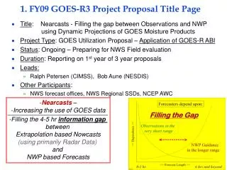
3. Motivation/Justification • Supports NOAA Mission Goal(s): • Weather & Water (high impact weather, severe storms, air quality-NOx) • Commerce & Transportation (aviation weather hazards) • Climate (inter-annual to decadal change) • Ecosystems (forest and wildland fires) • Justification: • Exploratory research is specifically targeted to clarify and exploit the fundamental information content of space-based lightning optical measurements. Such explorations have been carefully chosen to maximize return-on-investment (ROI) of GLM instrument. • Operational and research applications of LMA data and the development of GLM proxy data allow us to optimize algorithm development & testing, thereby assuring best possible algorithm utility and societal benefits.
4. Methodology • GLM Proxy Data • Inter-compare LMA channel w/ LIS optical to determine how best to use LMA data as proxy to GLM data. • Applications of LMA data (such as in lightning jump algorithm) will extend to GLM using the proxy data with user assessment at NWS. • NMT version 10.8.1 LMA s/w release has been inspected; it has been determined that just uploading 1 file & changing 1 line of code is needed to implement 10.8.1 (a minor effort)- required for NCEP/SPC to receive real-time proxy data as McIDAS Areas for evaluation. • Latency issue resolved: Timing in filename is actually okay; latency is 10-15 sec (nominal) • Providing Data: LDM protocol is preferred (protocol s/w is on Branch machine at NSSTC) • Re-sampling of LIS data will also serve as a GLM proxy. • Exploratory Research • There are 7 different exploratory research projects involved (see slide 2) each with their own methodology. A common approach is that they will each use heritage satellite lightning data, proxy GLM datasets, and/or other lightning datasets from field campaigns to test the feasibility of the investigated algorithm. A large sampling involving many case studies is necessary to both achieve and quantify confidence.
5. Summary of Previous Results Background work was presented in previous project plans 5
6. Expected Outcomes • Proxy Data • Improved rules will be obtained for mapping LMA data to proxy GLM data. • A more robust proxy based on re-sampled LIS data will be obtained. • Next generation filtering/clustering will be successfully demonstrated on proxy data. • Transition R3 to AWG: this task will be done under AWG funding effective 8/1/08. • Cell Tracking • Better performance of hazard cell tracking/predicting algorithm. FAR down, POD up. • Operational demonstrations at NWS WFOs and SPC • Draft ATBD completed near end of FY09. • Lightning Jump and QPE Algorithms • Ample case studies will clarify & substantiate optimal methodologies for relating lightning to severe Wx, ice-precipitation processes, updraft strength. • WFO training modules will be upgraded to reflect what was learned. • South African Weather Service provided sample CG lightning data from their National Network; initiate collaboration with Hydrology Team (Kuligowski) using SEVERI (ABI proxy)-GLM proxy data for Rainrate and Nowcasting Algorithms. • Draft ATBD for the Lightning Jump algorithm completed near end of FY09 • Lightning Warning and Forecast Algorithms • Warning: Get probability that ground flash occurs within T minutes of cloud flash. • Forecast: Improved confidence that WRF convection is in right place @ right time. • Photogrammetry Algorithm • Expect to demonstrate flash image sharpening and improved geolocation. • Flash Type Discrimination Algorithm • IDL split screen views of OTD/LIS ground and cloud optical illuminations will help clarify feasibility of flash type discrimination.
7a. FY08 Milestones Proxy Data: 1) NLDN-based, 2) OKLMA-based, and 3) LIS re-sampling-based proxy have each been developed for latency testing of the Lightning Cluster Filter algorithm. The LIS re-sampling maps 5x5 km LIS pixel footprints into 8 x 8 km GLM footprints. Cell Tracking: Developed algorithms ( using Functional Template Correlation and Fuzzy Logic) to automatically identify and track cells with potential to produce hazardous weather and quantify their potential for becoming hazardous. Lightning Jump & QPE: Several case studies were completed that compare LMA and radar data (WSR-88D, dual-Doppler, ARMOR dual-polarimetric) for studies of lightning, ice-precipitation, and updraft interconnections. See showcase slides for additional bullets regarding Lightning Jump accomplishments. Significant h/w upgrades to DC LMA network; several storms observed and archived. WFO training module completed; clarifies benefits of LMA data & uses in AWIPS framework. Lightning Warning: Completed data set preparations for 20 cases for the lightning warning product. Produced image of the GLM FOV combined for GOES-E and GOES-W with the climatological total lightning shown (LIS/OTD) within the FOV for use in briefings/communication/outreach. 7
7. FY08 Accomplishments • Lightning Forecast: Conference paper published on predicting total lightning flash rates using WRF model, and another in preparation. Full journal paper accepted pending revisions. • Photogrammetry: Acquired EE UAH student experienced in image processing techniques; introduced student to LIS data processing and HDF data formats, and photogrammetry literature. • Flash Type Discrimination: Improved partitioning of OTD ground & cloud flashes using NLDN data. Developed and ran a Bayesian network (and several linear Gaussian Classifier systems ) on a OTD-based proxy dataset of flash-level optical data. Determined that the overlap in the optical distributions prohibited successful flash-type discrimination, so that additional data mining to the group and event level is required to fully determine feasibility.
7. FY08 Accomplishments McCaul, E. W., Jr., S. J. Goodman, K. M. LaCasse, and D. J. Cecil, 2008: Forecasting lightning threat using cloud-resolving model simulations. {Wea. Forecasting}, accepted. Deierling, W., and W. A. Petersen, 2008: Total lightning activity as an indicator of updraft characteristics. J. Geophys. Res., in press. Deierling, W., W. A. Petersen, L. Latham, S. E. Ellis, and H. J. Christian, Jr., 2008: The relationship between lightning activity and ice fluxes in thunderstorms. J. Geophys. Res., 113, D15210, doi:10.1029/2007JD009700 Goodman, Steven J., R. J. Blakeslee, and W. J. Koshak, Geostationary Lightning Mapper for GOES-R and Beyond, GOES-R Users Conference-V, American Meteorological Society, January 20-25, 2008, New Orleans, LA. Goodman, S. J., R. J. Blakeslee, W. Koshak, W. Petersen, D. E. Buechler, P. R. Krehbiel, P. Gatlin, and S. Zubrick, 2008: Pre-launch Algorithms and Risk Reduction in Support of the Geostationary Lightning Mapper for GOES-R and Beyond, 3rd Conference on the Meteorological Applications of Lightning Data, American Meteorological Society, January 20-25, 2008, New Orleans, LA. Schultz, C. J., and W. A. Petersen, 2008: The utility of lightning jumps in severe thunderstorms in the Tennessee Valley. 3rd Conference on the Meteorological Applications of Lightning Data, American Meteorological Society, January 20-25, 2008, New Orleans, LA. Goodman, Steven J., R. J. Blakeslee, and W. J. Koshak, Geostationary Lightning Mapper for GOES-R, Joint 2007 EUMETSAT Meteorological Satellite & 15th AMS Satellite Meteorology and Oceanography Conference, Am. Meteorological Society, Amsterdam, The Netherlands, September 24-28, 2007. 9
7. FY08 Accomplishments Gatlin, P. and S. J. Goodman, Severe Weather Precursors in the Lightning Activity of Tennessee Valley Thunderstorms, 3rd Conference on the Meteorological Applications of Lightning Data, American Meteorological Society, January 20-25, 2008, New Orleans, LA. Solakiewicz, R. J., and W. J. Koshak, Potential use of a Bayesian network for discriminating flash type from future GOES-R Geostationary Lightning Mapper (GLM) data, Proceedings of the 20th International Lightning Detection Conference (ILDC), Tucson, Arizona, April 21-23, 2008. McCaul, E. W., Jr., and S. J. Goodman, Use of vertically integrated ice in WRF-based forecasts of lightning threat. {online preprints}, 24th Conf. Severe Local Storms, Savannah, GA, Amer. Meteor. Soc., Paper 3B.3, 2008. Johnson, E. V. and W. A. Petersen, 2008: Behavior of lightning and updrafts for severe and non-severe storms in north Alabama. Preprints, 12th Annual Severe Storms and Doppler Radar Conference, West Des Moines, IA, March 27-29. Petersen, W. A., K. R. Knupp, D. J. Cecil, and J. R. Mecikalsi, 2007: The University of Alabama Huntsville THOR Center instrumentation: Research and operational collaboration. Invited, 33rd International Conference on Radar Meteorology, American Meteorological Society, Cairns, Australia, August 6-10, 2007. Deierling, W., W. A. Petersen, and S. E. Ellis, 2007: Convective rainfall amounts, ice water content and total lightning for individual storms from different climate regions. 33rd International Conference on Radar Meteorology, American Meteorological Society, Cairns, Australia, August 6-10, 2007. 10
Accomplishment Showcase: GLM FOV + Lightning Climatology Total lightning is from LIS (Jan 1998 - Dec 2005) and OTD (April 1995 - March 2000). The GLM FOV is a 16 deg circle and a 15.1 deg square projected to the earth.
Accomplishment Showcase: Proxy based on LIS-resampling • LIS pixels are shown as lavender; they are represented in the LIS dataset by dark-blue center points • GLM pixels are gray squares • LIS pixels are assumed to be all 5x5 km squares (they are not) • GLM pixels are fixed 8x8 km squares • At this stage, the GLM pixels are binary (on/off) • If any part of a LIS pixel falls into a GLM pixel, it is turned on • Once we have processed all the LIS pixels in a group, the GLM pixels are reported as a list of center points, shown as red square dots. • This example shows LIS pixel splitting. No attempt is made to estimate the amount of radiance that might fall into each GLM pixel. That is planned for the next version.
Accomplishment Showcase: Proxy based on LIS-resampling (cont.) • This is an average LIS group • It shows 13 LIS pixels mapping into 13 GLM pixels • We do not get a drastic reduction in the number of pixels by (essentially) halving the resolution • The artificial gaps in the LIS data are because the LIS pixels are neither uniform nor square.
Accomplishment Showcase: Proxy based on LIS-resampling (cont.) • This shows a large LIS group • 53 LIS pixels mapped into 38 GLM pixels
Accomplishment Showcase: Max Event Rate for Proxy Tests GLM Event Rate Similar to LIS Group Rate
Accomplishment Showcase: Max Event Rate for Proxy Tests (cont.)
Accomplishment Showcase: Cell Tracking Lightning Storm Interest VIL Example of Combining Total Lightning, and VIL to produce Storm Interest.
7b. FY09 Major Milestones • FY09 • Proxy Dataset Tests [Bateman, Bruning, Proch, Weiss, MacGorman] • (Transitioned to an AWG activity effective 8/1/08; included to show continuity). • Initial use of proxies are to test Lightning Cluster Filter Algorithm (LCFA) Latency. • VHF-based proxy and evaluate LCFA output results. • LIS-based proxy and evaluate LCFA output results. • Cell Tracking [Boldi] • Incorporate images from ABI to construct a convective classification of electrified storms. Classification to be used in the modeling of the evolution of the cell being tracked. • Complete draft ATBD for Cell Tracking Algorithm (near end of FY09) • Lightning Jump & QPE Algorithms [Petersen, Carey, Schultz, Albrecht, Goodman] • Identify & evaluate additional storm cases for Lightning Jump & QPE algorithms. • Lightning (storm level LMA analysis) trending in AWIPS implemented. • Complete additional AWIPS warning decision assessments at select WFOs. • Finalize Upgrades to DC LMA network. • Collaborate with Hydrology team on blended ABI-GLM rainrate and nowcasting algorithm. • Complete draft ATBD for Lightning Jump Algorithm (near end of FY09) • Lightning Warning and Forecast Algorithm [Buechler, McCaul] • Warning: Determine typical duration between 1st cloud flash and 1st CG in storm • Forecast: Have NSSL complete WRF ensemble runs to which we apply forecast algorithm to, and evaluate results. • Photogrammetry Algorithm [Carey, Suo] • Apply a test photogrammetric technique to image sharpen & geolocate LIS flashes. • Flash Type Discrimination Algorithm [Koshak] • Complete IDL code to plot split screen views of OTD/LIS ground and cloud flashes.
8. Funding Profile (K) • Summary of leveraged funding • NASA MSFC VP61 Investment Funding was applied to support senior post doctoral scientist (Dr. Richard Solakiewicz) in NASA Postdoc Program (NPP) for exploratory research in flash discrimination . • NASA EPSCoR funding is currently in place to support proxy dataset development (OU student Stephanie Weiss, with guidance from Dr. Don MacGorman NOAA/NSSL). Additional correspondence with ground-based validation studies being conducted with Bill Beasley of OU.
9. Expected Purchase Items • FY06 • 480 K • FY07 • 364.352 K • FY08 • 510 K • FY09 (year 2 of FY08 proposal) • 523.529 K • 388.549 K(to NSSTC) • 91,730 Direct Civil Service Labor • 10,637 Civil Service Travel* • 154,756 Other Direct Costs (Subcontractors including Students, Travel, Equipment)* • 70,878 Facilities & Administrative Costs • 60,548 CM&O. • 135 K (to CICS Post Docs) • FY10 (New Proposal) *Travel includes presentations at annual fall AGU and AMS meetings. Students include Chris Shultz (lightning jump work) with assistance from Patrick Gatlin, and Elise Johnson (updraft strength & flash rate connections). Equipment purchases include computer upgrades and general supplies.