Download
1 / 27
270 likes | 381 Views
GOCE OBSERVATIONS FOR DETECTING UNKNOWN TECTONIC FEATURES. Braitenberg C. (1 ) , Mariani P. ( 1 ) , Reguzzoni M. (2) , Ussami N. (3) (1) Department of Geosciences, University of Trieste, Trieste ( ITALY),

E N D
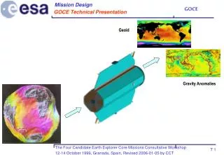
GOCE OBSERVATIONS FOR DETECTING UNKNOWN TECTONIC FEATURES Braitenberg C. (1), Mariani P. (1), Reguzzoni M. (2), Ussami N. (3) (1) Department of Geosciences, University of Trieste, Trieste ( ITALY), (2) Geophysics of the Lithosphere Department - OGS, c/o Politecnicodi Milano - Polo Regionaledi Como, Como, Italy (3) Departamento de Geofisica, Instituto de Astronomia, Geofísica e CiênciasAtmosféricas, Universidade de São Paulo, São Paulo, Brasil Home page: http://www2.units.it/~braitenberg/ e-mail: berg@units.it
Goal • Locate density changes in Earth’s crust • Crustal parameters necessary for: • Exploration purposes • Seismic risk estimation • Volcanic risk estimation • Remote and unaccessible areas: superficial properties known • gravity study useful geophysical means of investigation
TOPIC • Sensitivity analysis of GOCE for tectonic structures • Model: spherical shell of variable density or thickness • Input: simulated GOCE degree error curve • Rms error of tensor components at satellite height • Error curves of existing gravity field models (EGM2008)
DENSITY AND TECTONICS • GOCE measures gravity and gravity gradient • -> sensitive to tectonic structures with density changes. • -> structures without density change are transparent • -> GOCE only: upper limit of degree N=200; tectonic structures greater than l/2 min= 100 km
Earth Density PREM Earth model (Anderson, 1989)
Spherical shell model • Spherical shell model: mass layer expanded in spherical harmonics • Gravity models in spherical harmonic expansion
Shell model for sensitivity analysis • Mass model: sheet mass with average radius R • Harmonic expansion of sheet:
Anomalous potential and derived quantities Potential Gravity Gravity gradient R: shell radius r: calculation point
Resolution power for geological structures • Degree error variance: corresponds to smallest detectable field generated by mass source • Invert for smallest dectable sheet mass • At density discontinuities : • mass layer interpreted as oscillation of boundary Boundary oscillation:
Gravity anomaly cumulative and single degree error λ/2= 200km 100km 55km GOCE error curve:. Dr. Mirko Reguzzoni, POLIMI & OGS
Invert degree error curves • Mass-Layer: Crust-Mantle discontinuity • We set: average depth (30 to 70 km) and density contrast across boundary (500 kg/m3) • We find: minimum decetable oscillation amplitude of boundary.
Minimum detectable Moho undulation amplitude Single degree error curves
GOCE improvement • Up to one order of magnitude improvement for degree range 52 to 200 • Average depth important. • Greater depth with reduced resolution • Depth depends on geodynamic context: Craton (45 km), High topography (up to 70 km), normal crust: 35 km
Basement resolution • Mass layer represents basement - sediment transition • Average depth 0 km to 10 km • Density contrast: greatly variable • Sediments follow exponential density increase due to compaction
GOCE resolution • Single degree error curves give meter level resolution • Basement depth not important • Density contrast predominant effect
GOCE Gradient measurements • Use tensor components at satellite height • Infer crustal density variations • Question: how does sensitivity compare to sensitivity of airborne gravity?
Observation error levels GOCE • GOCE root mean square error of data along orbit (after processing) • Diagonal tensor elements [mE] (Migliaccio et al., 2008)
Rms error airborne gravity (Van Kann, 2004)
Lower crust density sensitivity • Model: layer 10 km thick above Moho (35 km depth) • Trr observed at satellite height • rms: 0.1 mE to 100 mE • dg observed at 1000 m height • rms: 0.01 mgal to 10 mgal
Sensitivity density lower crust • rms of 1 mgal at 1000m has comparable sensitivity with 1mE rms at satellite height (at wavelengths of 170 km) • GOCE sensitivity competes with aerogravity surveys • Sensitivity for GOCE better at longer wavelengths
Example Tibetan crust • Terrestrial data are scarce and lacking in Himalaya • Tibetan plateau and Tarim basin contain spectral components accessible to GOCE • Further investigation is needed of crustal densities
Tibetan Moho (Braitenberg et al., 2003; Shin et al., 2009)
Power spectrum Tibetan Moho (Shin et al., 2009)
Conclusions • GOCE expected to contribute improvement to: • Crustal density structure for wavelengths between 900 km and 220 km. • In particular: crustal thickness variations and basement undulations • Crustal densities – 1 mE at satellite height retrieves as 1 mgal airborne • Advantage: truly global