Download
1 / 34
380 likes | 729 Views
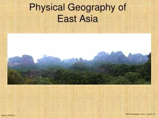
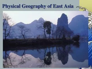
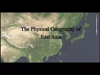
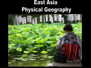
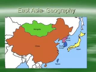
East Asia- Geography. Mountains and Plateaus. Kunlun Mountains are the source of two great rivers in China. Qinling Shandi Mountains divide north and south China. Landscape is among the roughest in the world. Mountains.

E N D
Mountains and Plateaus • Kunlun Mountains are the source of two great rivers in China. • Qinling Shandi Mountains divide north and south China. • Landscape is among the roughest in the world.
The Plateau of Tibet, the Tarim Pendi Basin, and the Taklimakan Desert are sparsely populated. • Gobi Desert stretches from China into Mongolia, 500,000 square miles. • Texas and California combined!
Peninsulas and Islands • Eastern coast of China includes several peninsulas which have allowed for major trading port cities like Shanghai. • North and South Korea lie on the Korean Peninsula. • Chinese islands include Hainan and part of Hong Kong. • Japan and Taiwan are island nations.
3 Great Rivers • Yellow River (Huang He) 3,000 miles in northern China. Flooding common. • Yangtze River (Chang Jiang) longest river in Asia 3,900 miles from Tibet. Flooding common. • West River (Pearl) (Xi Jiang) southern river with important mineral resources in basin.
Resources • China’s river basins in the east create fertile farmland. • Forests are abundant in China, Japan, Taiwan, North, and South Korea. • Japan buys forest products from other countries to preserve their forests.
China has petroleum, coal and natural gas. • China’s abundance in resources have made it more self sufficient than Japan. • Korea and Japan have coal reserves.
China’s rivers provide irrigation, hydroelectric power, and transportation. • Three Gorge Dam is on the Yangtze River to control floods and produce electricity. • East Asian people look to the sea for food.
Climate Zones • Subarctic climate zone is along Mongolia and China’s northern boarder with Russia. • Cool to cold in the summer, brutally cold winter. • Highland climate zone are found in western China. • Higher latitude and altitude the colder. • Both zones are sparsely populated.
Humid Continental zone in Northeastern China, North Korea, northern South Korea, and northern Japan. • Coniferous forests and agriculture • Humid subtropical zone in southeastern China, southern South Korea, southern Japan, and northern Taiwan. • Deciduous and coniferous forests, logging, and agriculture.
Semiarid zones is the Mongolian Plateau. • Short grasses for grazing of livestock. • Desert are in the west central mainland. • Taklimakan Desert and Gobi Desert where dinosaur fossils have been found from millions of years ago.
Tropical wet found along China’s southeastern coast, island of Hainan, and the southern tip of Taiwan. • High temperatures, heavy rainfall, and high humidity.
East Asia- HEI Dam Overcrowded beaches
Three Gorges Dam • Largest dam in the world built on the Yangtze River. • Goal is to generate power, control flooding, and allow ships to sail further in to China. • More than 1 mile wide and 600ft high.
Consequences • Almost 1.5 million people are displaced due to the construction and flooding. • Historical sites and scenic sites are submerged. • Animal habitat shortage, chemical leaks, climate and temperature change, erosion, landslides have occurred.
http://dsc.discovery.com/videos/discovery-atlas-china-revealed-three-gorges-dam.htmlhttp://dsc.discovery.com/videos/discovery-atlas-china-revealed-three-gorges-dam.html
Urban Japan • 60% of Japanese people live on about 3% of the land. • 80% of people live in cities along the coast. • Japanese have adapted to small houses with little furniture. • Many people live in apartments.
Common for a family of 4 to live in 1 bedroom house. • Landfills are used to dispose of waste and then rebuild on.