Download
1 / 12
140 likes | 403 Views
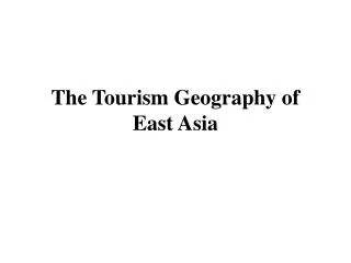
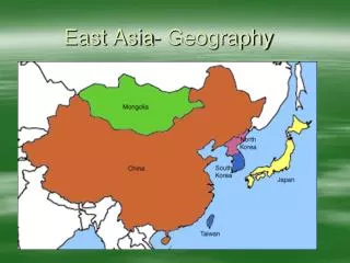
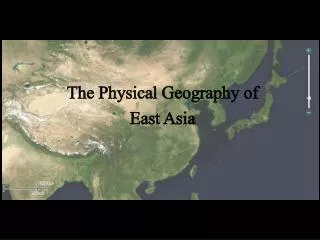
The Physical Geography of East Asia. Peninsulas, Islands, and Seas. Korean Peninsula What 2 countries are located in the Korean Peninsula? Japan ( 1 of 2 island countries in East Asia, what is the other? ) Archipelago South China Sea

E N D
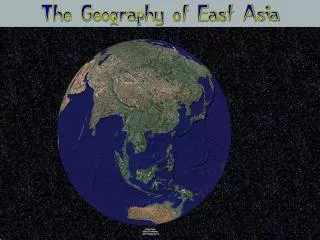
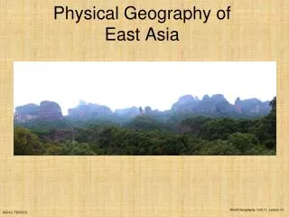
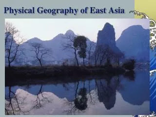
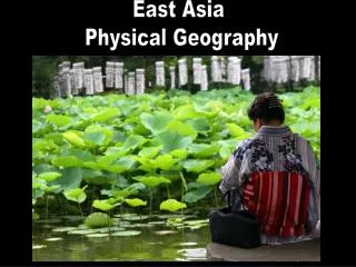
The Physical Geography of East Asia
Peninsulas, Islands, and Seas • Korean Peninsula • What 2 countries are located in the Korean Peninsula? • Japan (1 of 2 island countries in East Asia, what is the other?) • Archipelago • South China Sea • From Taiwan to the Philippines it carries 1/3 of the world’s shipping traffic.
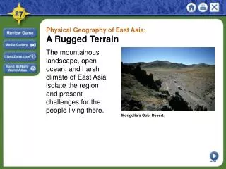
The Ring of Fire • Is caused by movement in the tectonic plates • Earthquakes, volcanoes & tsunamis http://www.youtube.com/watch?v=k4w27IczOTk&feature=related • http://dsc.discovery.com/videos/the-science-of-tsunamis-tsunami-speed.html • East Asia is vulnerable to earthquakes because it is located between tectonic plates
East Asian Mountains Ranges • Kunlun Shan & Tian Shan (Western China) • Atlay Mountains (North) • Natural barrier between Mongolia & China • Himalaya (South) Great Wave off Kanagawa Katsushika Hokusai 1829-32 • Mount Fuji rises above the plains of Honshu, Japan’s biggest island.
China’s Plateaus, Basins & Deserts • Mongolian Plateau mainly grassy pastures which are ideal for grazing. • Plateau of Tibet • East Asia’s highest plateau region • Tarim Basin is just one of the many broad flat highlands located between China’s inland mountain ranges. • The Taklimakan Desert lies to the west • Gobi Desert lies to the north.
River Systems • China’s Rivers • Originate high in the Plateau of Tibet and flow eastward to the Pacific Ocean. The Yellow River (Huang He) named after the yellowish topsoil blown by winds from the western deserts. This rich soil makes the North China Plain agriculturally productive. Historically, the flood waters have killed hundreds of thousands of people. • The Yangtze River (Chang Jiang) in Central China, is Asia’s longest river (3,965 miles) and flows through gorges and plains and empties into the ocean at Shanghai. • The Xi River or West River is Southern China’s most important river. It flows into the South China Sea and has created a huge, fertile delta. The Grand Canal, which is the world’s longest artificial waterway, connects Hangzhou in the south to Beijing in the north.
River Systems • Japan and Korea have short, swiftly flowing rivers which provide hydroelectric power. North Korea’s Amnok River (or Yalu River) forms a border with China.
Natural Resources • China contains a wide range of mineral resources, including iron ore, tungsten, tin and gold. The Taklimakan Desert has large oil deposits, while Northeastern China and Korea have an abundance of coal. • Japan, South Korea, and coastal China have the world’s busiest deep-sea fishing industry. Seafood farming is also a major industry in East Asia. • Only 10% of China is suitable for farming, but still remains to be the world’s leading producer of rice. South Korea’s two yearly crops are rice and barley. Mongolia and Japan have limited farmland with poor soil. Only 25% of Taiwan is farmable, and their hardwood forests are the important resource.
Climate Regions • Mid-Latitude Climates • Southeastern quarter of East Asia has humid subtropical climate. Summers are warm and rains are heavy. Northeastern quarter has humid continental climate, with cold, snowy winters. • Eastern half of the region consists of forests, which include evergreen and deciduous trees. Bamboo grows in warmer areas and is a source of food for some rare mammals, such as giant and red pandas. • Desert and Steppe Climates • Mongolia and inland northern China are very dry because the surrounding mountains block the rain. Gobi and Taklimakan deserts are cold and windy.
Climate Regions • Highland Climates • The higher the elevation, the colder the temperature. The Plateau of Tibet has an average high temp of only 58ºF (14ºC). • Tropical Rain Forest Climates • Hainan, an island off of China’s southern coast, shares a rainforest climate with Taiwan. Temperatures are always warm, and summer is rainy.
Monsoons and Ocean Currents • Monsoons – bring seasonal weather patterns to East Asia. Summer monsoons blow from southeast to northwest, causing soaking rains from April to October. Winter monsoons blow in the opposite direction, bringing icy winds from November to March. Farmers depend on summer monsoon rains for their crops. • Ocean Currents • Warm Japan Current flows northward toward southern Japan, bringing moisture and warm temperatures. The cold Kuril Current flows southwest from the Bering Sea, bringing cold winds and lower temperatures to Japan’s northern islands. • The interaction of ocean currents and monsoon winds can give rise to violent typhoons. Typhoons form in the Pacific Ocean and blow across coastal East Asia. They tend to be most severe between late August and October.
You should be able to answer the following questions • What do East Asia’s Rivers provide? • What are China’s main waterway systems? • What is a typhoon? • What country is the leading producer of rice? • What factors come together to create a typhoon? • What are the effects of a typhoon?