Download
1 / 10
100 likes | 180 Views
Utilizing geo-databases and analysis, this project aims to develop land use plans under future hydrological scenarios in the coastal zone. Through site characterization, mapping extrapolation domains, and multi-criteria modeling, stakeholders can make informed decisions for sustainable development.

E N D
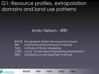
G1: Resource profiles, extrapolation domains and land use patterns Andy Nelson - IRRI BWDB Bangladesh Water Development Board IRRI International Rice Research Institute IWM Institute of Water Modelling LGED Local Government Engineering Department SRDI Soil Resource Development Institute BWDB IRRI IWM LGED SRDI
G1 BWDB – IRRI – IWM – LGED - SRDI outputs & methods WP1 Geodatabase of the coastal zone WP2 Characterisation of test sites WP3 Extrapolation domains of technologies and policies WP4 Land use plans under future hydrological scenarios
G1 BWDB – IRRI – IWM – LGED - SRDI outputs & methods WP1 Geo-database of the coastal zone • identification and acquisition of data • metadata and data format agreements • geo-database development and documentation WP2 Characterisation of test sites • geo-referencing of test sites • identification of key site characteristics • identification of links between geodatabase and sites
G1 BWDB – IRRI – IWM – LGED - SRDI probability 100 50 25 5 1 0 outputs & methods WP3 Extrapolation domains of technologies and policies • Essentially, this is an analysis of land use suitability • From WP2 we know what is needed for a technology to succeed • From WP1 we know the factors and constraints across the region • Ecological niche models such as MaxEnt allow us to extrapolate ‘this works here, where else may it work?’ and conversely where is may not work. • The results are probability maps or domains for each technology • Round table discussion with partners on preliminary results • Final domain maps generated • Evaluation and synthesis of domain maps
G1 BWDB – IRRI – IWM – LGED - SRDI outputs & methods WP4 Land use plans under future hydrological scenarios • Preparation of current land-use plans • Identification of future scenarios and drivers of change • Multi criteria land-use modeling to determine the likely or possible land use based on competing demands and limiting factors • Roundtable discussion with partners on preliminary results • Final land-use models • Evaluation and synthesis of land-use maps
G1 BWDB – IRRI – IWM – LGED - SRDI outputs 2010 Rice growing areas (by water & by season) 01.Submergence-DC-rice-water-other crops 02. Irrigated-GW/SW-DC-rice-water-other crops 03. Irrigated-GW-TC-rice-mixed crops/rice-other crops 04. Rainfed-SC-fallow-fallow-rice 05. Irrigated-SW-DC-vegetables/rice-fallow-rice 06. Irrigated-GW/SW-TC-mixed crops-other crops-rice 07. Submergence-DC-rice-water-rice 08. Irrigated-GW-DC-rice -fallow-rice 09. Irrigated-GW/SW-TC-rice-rice/other crops-rice 10. Irrigated-GW-TC-rice-rice/other crops-rice 11. Irrigated-GW/SW-DC-fallow-rice-other crops 12. Irrigated-GW/SW-DC-rice-rice-other crops 13. Irrigated-GW/SW-DC-other crops-rice-rice 14. Irrigated-GW/SW-DC-rice-rice-rice 15. Water bodies / aquaculture 16. Forest/Savanna SC/DC/TC : Single/Double/Triple crop Other crops / other land use Map developed by IRRI (2011) SW/GW : Surface water/Groundwater
G1 BWDB – IRRI – IWM – LGED - SRDI outputs Boro rice (2009-10) Area: 5,011,634 ha Aus rice(2010-11) Area: 1,103,738 ha Aman rice(2010-11) Area: 5,816,240 ha
G1 BWDB – IRRI – IWM – LGED - SRDI timeline
G1 BWDB – IRRI – IWM – LGED - SRDI Agriculture & aquaculture systems G2 Data curators Impact on water resources Coastal zone projects G3 Water governance & management G4 Basin stakeholders Coordination, change enabling G5 CPWF linkages G1 WP1 – Geodatabase development WP2 – Site characterisation WP3 – Mapping extrapolation domains WP4 – Future land use planning
G1 BWDB – IRRI – IWM – LGED - SRDI Thank you