Download
1 / 22
240 likes | 371 Views
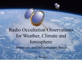
Radio Occultation Observations for Weather, Climate and Ionosphere. Overview and Infrastructure Needs C. Rocken. Overview. Radio Occultation (RO) introduction Societal and scientific impact of RO Weather Climate Ionosphere Future missions - and infrastructure needs. Tangent point.

E N D
Radio Occultation Observations for Weather, Climate and Ionosphere Overview and Infrastructure Needs C. Rocken
Overview • Radio Occultation (RO) introduction • Societal and scientific impact of RO • Weather • Climate • Ionosphere • Future missions - and infrastructure needs
Tangent point The LEO tracks the GPS phase while the signal is occulted to determine the Doppler vGPS LEO vleo The velocity of GPS relative to LEO must be estimated to ~0.1 mm/sec (10 ppb) to determine precise temperature profiles
Evolving COSMIC Constellation Temperature [C] at 100 mb (16km)
ECMWF SH T Forecast Improvements from COSMICAssimilation of bending angles above 4 km Sean Healy, ECMWF
Impact of COSMIC on HurricaneErnesto (2006) Forecast With COSMIC Without COSMIC Results from Hui Liu, NCAR
Impact of COSMIC on HurricaneErnesto (2006) Forecast With COSMIC GOES Image GOES Image from Tim Schmitt, SSEC
Upper Air Temperature Trends Pressure (hPa) Figure from S. Leroy
Estimates of the Uncertainty in RO Data for Climate Monitoring: Inter-Comparisons of Refractivity Derived from Four Independent Centers The uncertainty of the trend of fractional refractivity anomalies is within +/-0.045 %/5 yrs (+/-0.06K/5 yrs), which is mainly caused by sampling errors.
Comparability of CHAMP to COSMIC:Long-term stability Global COSMIC-CHAMP Comparison from 200607-200707 • Comparison of measurements between old and new instrument • CHAMP launched in 2001 • COSMIC launched 2006 • Challenges: a. Different inclination angle b. Different atmospheric • paths • c. Temporal/spatial mismatch d. Reasonable sample number Within 90 Mins and 100 Km
3-D structure of the feature during daytime (constant LT) Weaker EIA Stronger EIA Weaker EIA Stronger EIA Weaker EIA 12:00 LT ↑ Tiger Liu, NCU
Characteristics of RO Data • Limb sounding geometry complementary to ground and space nadir viewing instruments • Global 3-D coverage 40 km to surface • High accuracy (equivalent to <1 K; average accuracy <0.1 K) • High precision (0.02-0.05 K) • High vertical resolution (0.1 km surface – 1 km tropopause) • Only system from space to resolve atmospheric boundary layer • All weather-minimally affected by aerosols, clouds or precipitation • Independent height and pressure • Requires no first guess sounding • Independent of radiosonde calibration • Independent of processing center • No instrument drift • No satellite-to-satellite bias • Compact sensor, low power, low cost
RO phase observation RO excess phase observation must be know to <0.1 mm/sec From Phase to Excess Phase
IGS Clock Estimation Network Data from (parts of) this network are presently used to estimate GPS satellite clocks in real-time (@UCAR) or for double differencing GPS clocks (@JPL). Hydrogen masers (57) are indicated in brown, cesiums (32) in green, and rubidiums (30) in blue. Stars indicate clocks at BIPM timing laboratories (includesstandard labs at NIST, Paris, Braunschweig, ….) Figure courtesy J. Ray
Coverage of possible future LEO constellations12 sat constellation-24 Hours 28 GPS Add 24 GLONASS Add 30 Galileo Future constellations will track Galileo + possibly Glonass
GNSS Infrastructure Needs for RO • Weather • Near-Real-Time (<15 min) global ground fiducial data (1-sec from ~50 sites GPS + Galileo + Glonass) • High quality GNSS orbits (real-time / predicted) and clocks (5 sec) • Climate • Stable long-term (decades) reference frame • Reliable fiducial data & meta-data • Space Weather • Real-Time reference data • Satellite + tracking station DCBs • All will need PCVs for transmitters and receivers
Summary • Atmospheric sensing with RO has important operational and scientific applications • All applications depend in GNSS infrastructure provided by the non-atmospheric community • Future RO missions are planned and the atmospheric community (climate community) will need many decades of infrastructure support