Download
1 / 29
290 likes | 349 Views
Introducing a cutting-edge Radio Occultation Instrument for Strateole-2 mission focusing on GPS data transmission, observational geometry, accuracy improvements, and gravity wave analysis in the stratosphere.

E N D
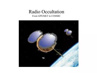
Radio Occultation (ROC) Instrument for Strateole Jennifer Haase and Weixing Zhang Scripps Institution of Oceanography
GPS Radio Occultation Concept GPS satellite at positive elevation Stratospheric balloon Zero elevation Atmospheric refractivity Is retrieved at the indicated tangent points rballoon rearth rtangent ratmo Negative elevation (occultation)
Observation geometry • Maximum of 115 occultations • per day, 58 of which are setting. • Actually transmitted to ground 6. • Large tangent drifts ~250km.
Important Points • Data transmission may be limiting factor: • 3 Mbytes per day => 6 profiles of 120 possible • Accuracy ~ 1% in refractivity ~2K (still working to improve this) • Penetration to the lower atmosphere will be less than for Concordiasi, expect 7-9 km altitude • Upgrades desired: • possible 2 way transmission for precise on-board positioning • on-board processing for excess phase
PSC18 and PSC19 711 occultations total 639 dropsondes total o PSC18 o PSC19 o dropsondes
Excess Doppler for PRN25 compared with simulated excess Doppler
Dropsonde/model comparison Refractivity difference between a nearby dropsonde refractivity profile and: retrieved ROC refractivity profile (blue), NCEP refractivity (black), AMPS refractivity (green) or ARPEGE (green)
Improved GPS analysis • Corrected phase data for millisecond time offsets • New PPP with ambiguity resolution software • Uses ground network to resolve corrections (ambiguities) then calculates absolute position • Now reanalyzing • occultation data
Estimating accuracy of position • Inclined GPS antennas for recording high elevation navigation signals and low elevation occultation signals. Relative position of ant2 relative to ant1 Difference between absolute position of ant2 and ant1 Rms 7 cm horizontal, 20 cm vertical ROC
Complete time series • PSC18 • 54 days • PSC19 • 42 days
Gravity wave analysis • Case study when balloon passing over Antarctic Peninsula • PSC19on 2010.311
Gravity wave analysis • Perturbation time series • Comparison between PPPAR and CNES solutions Fit the trend using 3-order polynomial 41 points window (Vincent & Hertzog, 2014) CNES-based results PPAR-based results
Gravity wave analysis • Perturbation time series • Zoom in PPAR-based results CNES-based results
Gravity wave analysis • Perturbation time series • Zoom in PPAR-based results CNES-based results
Gravity wave analysis • Perturbation time series • FFT results PPAR-based results CNES-based results 285 sec
Comparison with WRF simulation • WRF simulation • Domain • Two-way nesting • Horizontal resolution: 21 km (d01) and 7 km (d02) • Vertical: 61 levels from the ground to 10 hPa • Period • From: 2010-11-06_00:00:00 • To : 2010-11-08_00:00:00 • Physical scheme
Comparison with WRF simulation • The horizontal and vertical wind speed at 17.4 km height is ~consistent with PPPAR results
Comparison with WRF simulation • Cross-section view of potential temperature and wind speed along the balloon trajectory
WRF model / dropsonde comparison • Note dropsonde not on the same day • Looking for gravity wave characteristics
Next steps in preparation for Strateole • Next steps are to raytrace through the atmospheric model perturbed by gravity waves in 2D to calculate accumulated delay • Perform an inversion to see how mapped refractivity represents actual refractivity • Estimate probability of recording gravity wave from balloon position simultaneously with temperature profile variations from occultation measurements
Balloon Rotation Study • Two receivers (V181 and V182) on 2010.286 • Get the baseline solutions using GrafNav • The baseline azimuth time series (angles vs. north) 3 order polynomial fit 41 points window
Balloon Rotation Study • Panel temperature time series on 2010.286
Conclusions • Successful mission – exceeded expectations for a prototype mission • Retrieved 6-9 profiles per day for each balloon as expected with equally good quality for rising and setting occultations • During the two balloon flights: • a combined total of 107 days, • more than 700 occultations were recorded (number limited by the data transmission rates) • More than 32% of the profiles (227) descended within 4km of surface • Very good outlook for contributing to the goal of improving atmospheric models in the Antarctic
PSC18 and PSC19 flights • Total of 711 occultations with duration greater than 7 minutes of continuous data below the horizon • 639 total dropsondes on 13 balloons
Gravity wave analysis • Perturbation time series • Zoom in PPAR-based results CNES-based results