Download
1 / 92
950 likes | 1.22k Views
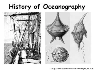
Topic 1 The History of Oceanography. GEOL 2503 Introduction to Oceanography. Early Evidence of Humans and the Sea. By 5000 BC: copper fishhooks Middens Egyptian drawings of fishnets By 1500 BC Phoenicians sailed out of Mediterranean Sea to Britain. Polynesians.

E N D
Topic 1The History of Oceanography GEOL 2503 Introduction to Oceanography
Early Evidence of Humansand the Sea • By 5000 BC: • copper fishhooks • Middens • Egyptian drawings of fishnets • By 1500 BC • Phoenicians sailed out of Mediterranean Sea to Britain
Polynesians • Began migration from Asia 20,000 years ago • Were sailing to mid-Pacific islands by 2,500 years ago Things were happening in the Pacific early on!
Ancient Greeks • What we now call the Mediterranean Sea was known as Thalassa (Greek goddess of the sea) • Known lands surrounded by Oceanus an endlessly circling river • Beyond Oceanus was monsters, whirlpools, edge of earth
The world according to the Ancient Greeks. Thalassa Oceanus
Pytheas • 350-300 BC • sailed to England, Norway, Germany • navigated by sun, stars, wind • recognized relationship between moon and tides • he didn’t understand the cause, but described what we now know as tides
Calculated circumference of Earth at 25,000 miles Ptolemy didn’t believe that figure, thought the circumference was about 18,000 miles Eratosthenes (264-194 BC)
Vikings • Colonized Iceland and Greenland • Knowledge of navigation increased • Made it to Mediterranean by 455 AD • Oceanic voyages by 8th century • Little Ice Age drove them from North America
Time Line of Little Ice Age and Impact on Voyages WARM COLD The Medieval warm period was a time of exploration for the Vikings. With the onset of the Little Ice Age exploration became treacherous and fewer voyages were completed.
Early Compass • The Chinese invented the first compass about 1000 AD. • This compass consisted of a bowl of water with a magnetized needle floating on top, pointing to the poles. www.computersmiths.com
European Great Age of Discovery Spain Christopher Columbus Ferdinand Magellan Amerigo Vespucci Vasco Balboa Juan Ponce de Leon England Francis Drake Henry Hudson Portugal Vasco da Gama Prince Henry Bartholomeu Dias
Prince Henry, the Navigator (b. 1394 - d. 1460) Prince Henry of Portugal Opened first school of navigation in 1416 Sent several expeditions down the west coast of Africa. He establish trade routes to India and the East. He spread Christianity to other countries. http://www.mariner.org/age/biohist.html#princehenry
Christopher Columbus • Christopher Columbus (1455-1506) • Four voyages across Atlantic Ocean • Thought he had found Asia • Ptolemy’s mistake mislead him http://www.nmm.ac.uk/education/fact_files/fact_columbus.html
Columbus’ Ships Ships of Columbus’s day average around 4 knots. Top speed for these vessels averaged 8 knots.They usually covered 90-100 miles in one day. Replicas of the Pinta and Santa Maria, built for the 1992 quincentennial. Notice the tiny sail on the Santa Maria the flag ship of the fleet. http://www1.minn.net/~keithp/ships.htmps
Amerigo Vespucci: 1454-1512 • Spanish merchant and explorer • Prepared maps and routes to the New World • Voyages led to Argentina and Patagonia • Accepted South America as a new continent, not Asia, thus “America” is named for him. • The New world was named after him in 1507 by Martin Waldseemuller, a German mapmaker http://oz.plymouth.edu/~lts/wilderness/explorers.html
Vasco Núñez de Balboa (1475-1519), Spain In 1511, Indians told him of a sea on the other side of the Isthmus of Panama, and stories of gold. September 1513, Balboa led an expedition of about 90 Spaniards and Native Americans to find the sea. Three weeks later, he climbed a mountain peak. From there, he sighted the Pacific Ocean for the first time. Called it the South Sea. • First European to cross Isthmus of Panama to Pacific Ocean
Juan Ponce de Leon (1460-1521) • Searching for fountain of youth • Sailing down the coast of Florida, caught in Florida Current and pulled northward • Ascribed this to the devil, but his records became the first description of ocean currents • Discovered Florida Juan Ponce de Leon http://library.thinkquest.org/J002678F/ponce_de_leon.htm
Juan Ponce de Leon’s Sailing Route
Ferdinand Magellan (1480-1521) • Rounded South America in 1520 to Pacific • Killed in the Philippines • One of his three ships made it across Indian Ocean and around Cape of Good Hope back to Atlantic Ocean • Crew was forced to eat shoe leather and rats to avoid starvation • Magellan himself didn’t make it, but his expedition was the first to circumnavigate the globe
Sir Francis Drake and the Circumnavigation Sir Francis Drake (1540-1596) On September 26, 1580, Sir Francis Drake became the second man to sail around the world. He was the first Englishman to complete the circumnavigation. http://www.springfield.k12.il.us/schools/springfield/eliz/SirFrancisDrake.html
Sir Francis Drake’s Ship:Golden Hinde Courtesy of http://mmbc.bc.ca/source/schoolnet/exploration/images/boatchart/goldenhind.jpg
Henry Hudson 1575? -1611) He went on four voyages between 1607 and 1611: 1st Voyage – to find the NW passage to the Far East (for trade with China and Japan) by going across the North Pole 2nd – Search for NW passage by way over Russia 3rd – Search for western passage across North America 4th – Final voyage searched for NW Passage through theArctic. http://www.newnetherland.org/ship.htm
Henry Hudson (1570-1611) • Died in Hudson Bay • Searching for northwest passage http://www.mariner.org/age/images/hudson.gif
Captain James Cook (1728-1779) • 3 Pacific voyages 1761-1779 • Sailed around Antarctica • Last large land mass was studied and outlined • Killed in Hawaii 1779
HMS Resolution www.hawaiianeyes.com
Ben Franklin (1706-1790) --Made first map of Gulf Stream 1769 --Worked with Capt. Timothy Folger, but Franklin gets credit --Reduced sailing times to Europe
Figure 01_11 Sea surface temperature from satellite shows flow of the Gulf Stream
Sextant • 18th century instrument • Measure angle of elevation of stars, moons, and planets • Find latitude
Polaris (North Star) Observer at 90° N 90° Horizon (tangent line) 45° Observer at 45°N
Polaris (North Star) Observer at 0°
Nautilus Robert Fulton designed the first usable submarine in 1800 Commissioned by Napoleon
Charles Darwin (1809-1882), Voyage of the Beagle (1831-1836) Studies led to theory of evolution Theory of formation of atolls is big contribution to oceanography His work led directly to the Challenger Expedition 38
Charles Darwin was the first to realize how atolls form. This was his great contribution to oceanography. 41
U.S. Ex. Ex. • Perhaps the least known investigation • Official name: The United States South Seas Exploring Expedition of 1838-1842 • Charles Wilkes (1798-1877) leader • See the Smithsonian Institution website: http://www.sil.si.edu/DigitalCollections/usexex/ • See http://www.history.navy.mil/index.html for a lot of general information
Also known as “Wilkes Expedition” • Traveled over 80,000 miles • Confirmed the existence of a continental landmass in the Antarctic Ocean (Cook?) • Collected thousands of plant and animal specimens • Charted much of the Pacific • Helped sealing and whaling industries in the northeast.
Charles Wilkes and the ships of the United States Exploring Expedition, 1838-1842
Ex. Ex. Flagship: USS Vincennes Built in 1826, 127 feet in length, crew of 190. http://www.history.navy.mil/photos/images/h66000/h66524k.jpg
Wilkes Land is named in honor of Charles Wilkes, whose surveying determined that Antarctica is a continent.
The expedition reports comprise 20 volumes and 11 atlases, published between 1844 and 1874.