Download
1 / 23
230 likes | 252 Views
This article explores the early history of oceanography, from the contributions of ancient civilizations to the advancements made during the Renaissance. It covers topics such as early Polynesian navigation, Phoenician exploration, the Dark Ages, and the Age of Discovery.

E N D
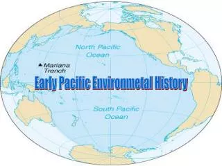
HISTORY OF OCEANOGRAPHY,Part 1:Contributions of theAncients to Early Ocean Science Oceography: North Surry High School
Outline • EARLY History (to ~500 A.D.) • DARK AGES (~5th to ~14th Centuries) • RENAISSANCE (~14th to 16th Centuries) • EARLY OCEAN SCIENCE
EARLY History (to ~500 A.D.) • Polynesian ancestors spread from SE Asia or Indonesia to New Guinea and the Philippines by about 20,000 years ago. ( ) • Mid-Pacific islands have been colonized from about 500 B.C. ( ) • An explosive dispersion led to the settlement of Hawaii about 450-600 A.D. ( )
EARLY History (to ~500 A.D.) • Phoenicians: • Sailed Mediterranean Sea and eastern Atlantic, Indian, and western Pacific oceans • 2000 B.C. sailed to Great Britain for tin • 600 B.C. circled Africa from the Red Sea to Mediterranean in 3 years - not repeated for 2000 yr until Portuguese in 15th century • by ~500 B.C. world considered "round" (spherical) by Greeks • But, many people still considered the world flat • Continents were surrounded by oceans • Oceans were considered limitless • One could sail too far or "fall off"!
EARLY History (to ~500 A.D.) • by 400 B.C. tides were somewhat understood • by 250 B.C., simple early maps of known world, • Especially of coastal areas • Contained directions (compass rose) • Some had a distance scale • No modern latitude or longitude • Babylonians developed 360° concept for a circle • Egyptians developed: • Surveying & the necessary mathematics • Why? • Recovery from annual floods of the Nile River which enriched the valley soils. • Improved navigation developed: • By stars, • By coastal features • Pilot books were kept, e.g., James Clavel's "Shogun" novel • Ptolemy 2nd century A.D. invented latitude & longitude
DARK AGES (~5th to ~14th Centuries) • Much knowledge lost • Theological opposition to science • Irish monks sailed North Atlantic & visited Iceland (NA?) before Vikings • Vikings explored North Atlantic & eastern NA: • Climate was warmer until ~1200 A.D. • Settled Iceland & Greenland • Lief Ericson explored: • Baffin Island • Labrador • Newfoundland ("Vineland") • Nova Scotia(???) • Basque & Portuguese also visited North America • Fished off New England & possibly Newfoundland coasts A postage stamp from the Grenadines of St. Vincent depicting an early Viking ocean-going vessel of the type used by Leif Ericson (Eriksson) and other Norwegian sailors on trips to Iceland, Greenland and North America. ~1200 AD Norse boat
DARK AGES (~5th to ~14th Centuries) • Moslem Arabs sailed widely & traded with India & China • Acquired magnetic compass from China • Spread of Moslem power (Near East, North Africa, Spain) • Crusades (end of 11th to end of 14th centuries) • Religious wars also had an economic incentive • A tremendous demand for spices by rising middle class Europe • Christian Constantinople fell to Arabs in 1453 • Importance of better navigation for improved trade recognized • Southern Europe acquired magnetic compass from Arabs • By 1300's, Europeans were sailing and trading by sea widely • Stimulation from Moslem interference: • Controlled land routes for European trade with Far East for ~500 years • Caused European search for southern and western sea routes to East Indies • Resulted in European rediscovery of the American continents • Possibilities for acquiring great wealth was a powerful incentive to fund marine expeditions westward and exploration of the Americas
RENAISSANCE (~14th to 16th Centuries) • By ~1500 A.D. many Europeans accepted that Earth was "round" • Spain & Portugal: • Became the major European maritime nations • Led exploration & colonization • "Age of Discovery" from late 1400's to early 1500's (~1490-1520) • Southern European navigators doubled size of their known world • 1488 Diaz (Portugal) sailed to southern tip of Africa • 1492 Columbus (for Spain) discovered Caribbean area, Bahamas, etc. • 1492 Amerigo Vespucci also "discovered America" • A German cartographer gave his name to the Americas on a map in 1507 • 1497 Vasco Da Gama sailed around southern tip of Africa & up east coast of Africa in search of a route to India • 1513 Balboa (Spain) discovers Pacific Oc. by crossing Isthmus of Panama • 1504 Juan de la Cosa made first depth soundings (depth determinations) at sea • 1518-1522 Magellan's (Portugal) expedition sailed completely around the world, proved that Earth was "round," took many depth soundings, discovered many islands in the Pacific, e. g., Phillipines.
Track of the Magellan Expedition (1519-22) • A diagram showing the track of the Magellan expedition, the first voyage around the world. Magellan himself did not survive the voyage; only 18 out of 270 sailors managed to return after three years of voyaging.
RENAISSANCE (~14th to 16th Centuries) • Mercator (late 1500's): • 1569 map projection • All straight lines are along a true compass direction • Adopted latitudes & longitudes • 1585 included oceanic depth soundings on his maps • By ~1600: • Major unknowns were the polar regions: • Arctic Ocean • Antarctic Ocean & Continent • Known that ocean temperature cold below surface • Known that oceans universally salty • Henry Hudson's Search for the "Northwest Passage" to the Orient • Discovered Hudson River (New York City) • In Canada: • Explored northeastern North America • Hudson Bay & Hudson Strait named after him
EARLY OCEAN SCIENCE • Because colonies were distant, Europeans recognized further need for better charts & navigation in 1700's • Motivations were: • Commerce • Political expansion • Military defense • Safety at sea • Travel, etc. • Tides: • Had been related to the phases of the Moon by ancients • Ship captains & explorers accumulated information on local • Tides • Currents • Water depths of shallow areas
EARLY OCEAN SCIENCE • Instruments were available for determining latitude • Chronometer improved in England by late 1700's for determining longitude accurately (John Harrison's 4th marine time piece) astrolabe sextant Chronometer
EARLY OCEAN SCIENCE - James Cook • 1768 -1780 3 voyages to explore & map Pacific Ocean • 1st explorer to make major use of instruments • Often considered the start of scientific oceanography • Used an accurate chronometer to determine longitude • Explored Australia, New Zealand, western NA • Mapped South Pacific, parts of west coast of NA • Rediscovered Hawaiian Islands • Predicted presence of Antarctic Continent • (because of icebergs!) • (Discovered in 1820 by a Russian) • Ben Franklin urged American Revolutionary forces to leave his ship unharmed during the Revolutionary War (1776-80)
EARLY OCEAN SCIENCE • Currents charted on old maps for Mediterranean & Arabian seas • Ben Franklin • U.S. Postmaster General • Discovered North Atlantic Gulf Stream Current • Used ship's logs of "ship's drift" • Map (1786) suggested faster routes across Atlantic • Improved intercontinental communication, travel, & trade/commerce • James Ross' during early 1800's • First major deep-sea soundings • Recognized deep-sea life
EARLY OCEAN SCIENCE - Wilkes Expedition to the Antarctic (1838-1842) • Wilkes Exploring Expedition (1838-1842)to Antarctica explored and charted a large section of the east Antarctic coast and made observations that confirmed this landmass as a continent. The 19-volume report was a landmark in early American marine science. (USS Vincennes in Disappointment Bay)
EARLY OCEAN SCIENCE - Ferrel & Maury • Ferrel (USA) explained (1850) how winds cause surface currents • Matthew Maury was a U.S. naval captain (major works = 1842-55) • Made ship drift charts from captains' ship log books • Charted ocean currents of the world • His charts resulted in significant reductions in ship travel times during the era of the fast sailing "clipper ships" • Using ~800 available deepsea soundings, he published (1854) a bathymetric map of North Atlantic ocean floor, but Mid-Atlantic Ridge not apparent.
EARLY OCEAN SCIENCE - Marine Biology • Developed slowly in the pre-1872 era • Microscopic marine life was being studied • Edward Forbes • Studied marine life • Founded marine ecology • But, like many people, thought no deep-sea life • Voyage of the Beagle (late 1831-1836) • Explored Atlantic, South American Coasts, Eastern Pacific Ocean and islands • Naturalist on board was Charles Darwin! • Copy of 1st geology textbook (Lyell) • Recognized sea-level changes • Developed modern reef atoll theory • Studied biological diversity everywhere • Studied species evolution on islands
EARLY OCEAN SCIENCE - Marine Biology • 1871 Founding of MBL (Marine Biological Laboratory) at Woods Hole, Mass. • Later, WHOI & other marine institutions were also located there • Marine biology changed with the voyage of HMS Challenger (British) from December, 1872, to May, 1876.
A diagram showing Eratosthenes' method for calculating the circumference of the Earth. He used simple geometric reasoning based on the assumptions that the Earth is spherical and that the sun is very far away. (The diagram is not drawn to scale.)
DEVELOPMENT OF MODERN OCEANOGRAPHY • A postage stamp from the former German Democratic Republic (East Germany) depicting Alfred Wegener. Wegener, a German meteorologist, explorer, and geologist, proposed the theory of continental drift in a 1912 lecture. His suggestion that all the Earth's land masses had once been part of a single supercontinent, termed Pangaea, was widely ridiculed at the time. Although Wegener's mechanism for drift -- centrifugal forces created by the Earth's rotation -- proved completely untenable, his writings did set the stage for more modern investigations and the current general acceptance of sea-floor spreading and continental drift.
Balboa (Spain) Discovers Pacific Ocean - 1513 • A postage stamp from the Cook Islands depicting the Spanish conquistador, Vasco Nunez de Balboa (1475-1517). Balboa, by marching across the Isthmus of Panama, became the first western explorer to sight the Pacific Ocean, which he claimed in the name of Spain in 1513. Balboa's discovery led to efforts, by Magellan and others, to circumnavigate the Americas and sail westward to Asia.
Ferdinand Magellan • A postage stamp from Chile depicting the Portuguese navigator Ferdinand Magellan and one of his vessels. Magellan left Seville in August of 1519 with five ships and sailed across the Atlantic and Pacific Oceans as far as the Philippines (where he was killed in 1521). One of his ships managed to return to Spain in 1522 with only 18 of the original 270 crew for 5 ships, completing the first navigation of the globe; this demonstrated finally that the world was round and that the 'New World' was separate and far removed from the East Indies.
Christopher Columbus'3 ships on 1st voyage • A postage stamps from the Bahamas & Nicaragua showing a portrait of Christopher Columbus and the three sailing vessels (the Nina, Pinta, and Santa Maria) used on his first voyage of discovery to the "New World" in 1492. It took considerable courage to embark on an oceanic voyage in these remarkably small vessels. • Below, a reproduction of the Santa Maria. The people on board give a sense of scale emphasizing the remarkably small size of such vessels of exploration.