Creating Your School Map Presentation
Learn how to design a professional map for your school project using essential elements such as title, legend, scale, and north arrow. Follow detailed steps for layout, text design, and adding finishing touches for a polished final product.

Creating Your School Map Presentation
E N D
Presentation Transcript
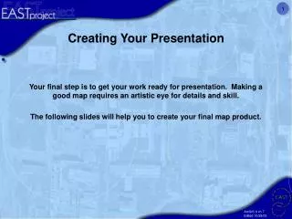
Creating Your Presentation Your final step is to get your work ready for presentation. Making a good map requires an artistic eye for details and skill. The following slides will help you to create your final map product.
Making a Map from your Data You are now ready to produce a map of your school. 1. Open up your project and make sure your view is showing what you would like to have appear in your map.
2. Go to the View menu then select “Layout View.” 3. Your layout view will appear similar to this example.
4. Go to the file menu and select Page and Print Setup… In the setup, select Landscape under Paper and Map Page Size. Click OK.
5. You can re-size your map area by clicking on the map image and clicking and dragging at the “handles.” You can re-position the map area by clicking and dragging the whole image.
Designing Your Map There are five essential elements which should accompany your map data in the layout. These elements have a visual hierarchy of importance. For example you don’t want to use a large north arrow that keeps people from looking at your title or legend. • Title: Pick words that accurately describe what your map is about. If the data you are mapping could change then including the date might be a good idea. • Legend: A key that explains the symbols on your map. • Scale: An indication of distance measurements on the map. • North Arrow: Shows direction. • Source: Where did the data come from and the name of the person or people who created the map.
Text Tool Font Tools 6. To place a title, or any text information, click the text tool at the bottom, place the cursor at the desired location and begin typing. Change the font from the font tool along the bottom of the map.
7. To edit text, double-click on the text you wish to edit. When the properties window pops-up, click the Text tab. You may edit your text here. Click OK.
Before creating a legend, you will need to give your feature classes a sensible name. For example, “parking_” does not make sense in a legend. Double click on the feature class name in the legend. Click on the General tab and type in the new name. Click OK
9. After you have changed the layer names to your liking, click on the Insert menu and go to Legend. 10. When the legend menu pops up, make sure you have the map layers you wish to show under legend items. You do not need your image name in the legend.
11. You may use the defaults here if you like. 12. You may choose a border, background color or drop shadow. Or use the defaults if you like.
13. On the next few screens you may use the defaults if you like or select your own colors and sizes.
14. To place a north arrow, click the insert menu and select North Arrow. 15. Select the north arrow of your choice and click OK. Re-size if needed and place it where you wish.
Prior to placing your scale bar, make sure your map units are set to meters. Double click the “Layers” label in the table of contents. Click the General tab and change the map units AND display units to meters. 17. To place a scale bar, click the insert menu and select scale bar.
18. To place a scale bar, click the insert menu and select scale bar. Place the scale bar on the map so you can see it, but remember it is towards the bottom of the visual hierarchy list .
Don’t forget to save 20. A neatline is a border to “contain,” your map. Depending on how you design your map it might be a good idea to include a neatline so that your map and its elements are kept together. An example of this would be if you were going to insert your map into a chapter in a book and had text flowing around it. By now you should be familiar with the “Insert” menu. See if you can figure out how to insert, format, and place a neatline around your map. Play around with the line weight (thickness) so that it contains your elements, but does not overpower the visual hierarchy.
21. Once you are satisfied with your final product, export your map to a .jpg file.
22. Open a new Power Point file and on the first slide, write the following information: • The name of your school • The date you completed this project • The names of the students who worked on the project. • For the next slide, insert your map .jpg to cover the entire slide. • For the final slide, cut and paste your pie chart. • Your Power Point project should resemble the following three slides.
Center High School School Mapping Project August 23, 2004 By: Rupert Giles and Willow Rosenberg
Save your PowerPoint, containing your map and your land use graph, with your school name as it’s title (example: center_high.ppt). • Send the PowerPoint as an e-mail attachment to Malcolm Williamson (malcolm@cast.uark.edu) and Fiona Trewby (ftrewby@cast.uark.edu ). They will notify you if anything additional is needed, or confirm that it has been accepted. • Congratulations! You have completed a real GIS/GPS mapping project that can be used as a starting point for many other projects around your school and community. We hope that you’ve had some fun as you’ve learned, and we hope to see you at the various training workshops and at the EAST Conference. • Best regards from your EAST Geospatial Support Team • Bonnie Brown Angie Smith • Jack Cothren Peter Smith • Fiona Trewby Malcolm Williamson • Paxton Roberts Benjamin Gilley