Download
1 / 41
410 likes | 563 Views
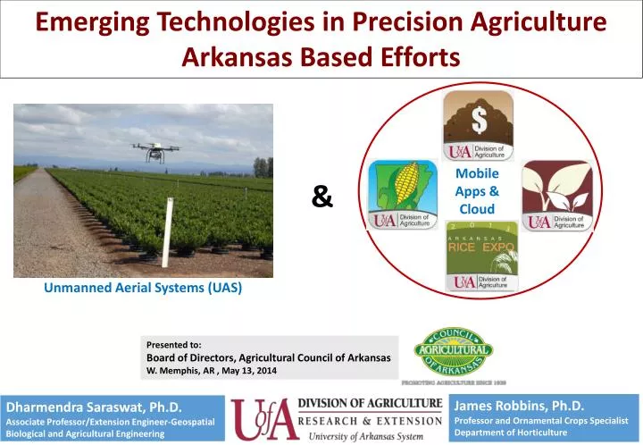
Emerging Technologies in Precision Agriculture Arkansas Based Efforts. Mobile Apps & Cloud. &. Unmanned Aerial Systems (UAS). Presented to: Board of Directors, Agricultural Council of Arkansas W. Memphis, AR , May 13, 2014.

E N D
Emerging Technologies in Precision Agriculture Arkansas Based Efforts Mobile Apps & Cloud & Unmanned Aerial Systems (UAS) Presented to: Board of Directors, Agricultural Council of Arkansas W. Memphis, AR , May 13, 2014
"...when you are trying something new, hard, or innovative, failure is not only inevitable, but it is also sometimes necessary ..." Amy Elliott at TEDxVirginiaTech
Outline • Unmanned Aerial System (UAS) - currently most talked about aerospace industry • - background, potential applications, • requirements, limitations and • opportunities, and our experiences 2. Mobile Apps and Cloud technology for Agriculture - status, progress, and future plans
UAS- Background “we’ve come a long way baby”
What is an Unmanned Aerial System (UAS)? • There is nothing unmanned about an unmanned system! • What are they called: • Unmanned Aircraft System (UAS) (FAA and Congress) • Unmanned Aerial Vehicle (UAV) • Remotely Piloted Aircraft Systems (RPAS) (ICAO and Air Force) • Drones
UAS Classification by Size *Source: : Congressional Budget Office, Policy Options for Unmanned Aircraft Systems, Publication 4083, Washington, DC, June 2011
UAS Classification by Weight *Source: : Weibel and Hansman, 2004. Safety considerations for operation of different classes of UAVs in the NAS. Chicago, IL.
What UAS Options are Available to You? Rotary Mikrokopter $ 3- $15k http://www.mikrokopter.us/ MicroDrone MD4-200 DraganFly X6 € 50,000.00 $36,000.00 http://www.draganfly.com http://www.microdrones.com DJI Phantom (<$1000) http://www.dji.com/product/phantom-2/
Fixed Wing Swinglet CAM http://www.sensefly.com $ 20- $25 K Trimble-Gatewing http://uas.trimble.com/ Precision Hawk
3 D’s of UAS Use Dull • Persistence beyond manned capabilities Dirty • Poisonous/Radioactive Environments Dangerous • Anti-Access/Area Denial Operations
Economic Impact of UAS in Arkansas • AUVSI’s 2013 Economic Report: 2015-2017 : Economic Impact- $80M, Taxes- $0.94M, Jobs Created- 411 2015-2025: Economic Impact- $481M, Taxes- $5.63M , Jobs Created- 608
What is gained by UAS adoption? Source: Ehsani et al., 2012
‘Agriculture is a very sophisticated industry and farmers are very data hungry — and they have not been well served, historically, in providing that data. They need on-demand data, they need it very high resolution and they need it often.’ ‘Meet the New Drone That Could Be a Farmer’s Best Friend’, Rachel Rohr, Modern Farmer, January 21, 2014
Resolution Comparison ~ 50 cm/pixel (20 inch/pixel) ~ 5 cm/pixel (2 inch/pixel)
How will UAS be used in a agriculture? Crop monitoring (nutrient, water, pest) Chemical applications Land & building management Crop & livestock inventory management
Emerging Commercial UAV Uses DuPont Pioneer • This year DuPont Pioneer is providing remote sensing imagery services to growers though Pioneer Field 360 services. Monsanto FieldScript • FieldScripts is planned to launch in Illinois, Indiana, Iowa and Minnesota in 2014 FS Green Plan Solutions (GROWMARK) • Illinois, Iowa, Wisconsin, and Ontario Trimble Acquired Gatewing, a Belgian company Leica Geosystems Collaborated with Swissdrones
Challenges to Widespread Adoption Privacy Safety “The challenge for industry is that the public perception of this technology is being shaped by one percent of its [potential] use.”- Peter W. Singer, Director for 21st Century Security and Intelligence, Brookings Institute
‘I certainly don’t want ‘em flying over my house ‘ Beafore says. But he emphasizes surveillance is not what his UAVs are about. The first uses will probably be agricultural, checking crops for mold or standing water. “The corn doesn’t care,” he says. Frank Beafore, SelectTech Geospatial, ‘New York, Texas among test sites for commercial drones, Marketplace, December 12, 2013
Safety of Operation- MIT Study Ground Impact of UAV accident *Source: : Weibel and Hansman, 2005. Report No. ICAT-2005-1
Challenges- System Issues • Extend battery life (stay aloft for 5-15 minutes - limited ground coverage) • Variety of UAV types (semi-autonomous, hand launched etc.) • Research data on reliability is missing (500 hrs, 1000 hrs etc. useful life) • Weather robust • Missing data network to download images and videos from multiple UAVs • Minimize solar flare impact on navigation
Challenges- Operational Needs and Funding • Insurance • Focus on data collection, analysis, and interpretation • Sensors- Thermal imagery- reliable temperature measurement, uncooled vs cooled camera • Software support • Greater Funding Support • The Commonwealth of Virginia announced it will award more than $2.6 million over three years in Federal Action Contingency Trust (FACT) funds to Virginia Tech • Hawaii ($100,000),Maryland through ($500,000), Nevada ($4M), North Dakota ($1M), for UAV test site
Our Experience • Inventory Management • a. Christmas Tree Farms • b. Open Field Nurseries • c. Citrus Orchards • 2. Row-Crops • 3. Others
Diameter Estimation/Plant Grade- Citrus Source: Ehsani, UFL
Citrus disease/stress detection Thermal Camera Source: Ehsani et al., 2012
False color image NDVI Image (dark soil vs. regular soil. The dark green shows higher biomass and healthier crop Visually, this variety in particular seems to be doing better than others on the dark soil Source: Ehsani, UFL Source: Ehsani et al., 2012
Mobile Technology- On the Rise Source: Time, January 13, 2014
Mobile Apps and Farm Community 70% of ag respondents access agriculture related information on their mobile phones 71% of farmer’s under the age of 39 say they own a smartphone *Source: www.paulsenmarketing.com ** Source: agriculture.com, John Walter, 11/02/2011
Reality of Internet Speed 19 to 30% of rural households in southeastern USA lacks broadband internet* Map Source: Connect Arkansas *Source: The Congressional Research Service, July, 2013
Mobile App Design Focus • Provide research based, updated information, 24/7, at right location- i.e. field or work place • Download Once, Use it Bunch • Fulfilling the mission of land grant university system
Mobile Apps Status- since January 2013 Released Educational Apps • Corn Advisor- both Android and iOS • Manure Valuator- both Android and iOS • Hort Plants- iOS • Cotton Advisor- Android Undergoing Beta Testing- Educational Apps • CE Budgets- both Android and iOS • Soybean Advisor- both Android and iOS • Drought Advisor- Android • WeedID- both Android and iOS
Cloud Application https://fttcloud.uaex.edu Features Housed in a dynamically scalable cloud computing environment, the FTTCloud allows: a) digital establishment of relationships across user types, b) visualization of field data voluntarily entered by users, c) sharing of field data among the trusted user base, and d) a snapshot of its statewide adoption status.
Conclusion • UAS technology is moving ahead at a faster pace than regulations • Precision agricultural is expected to be the largest beneficiary • FAA’s regulations are eagerly awaited • Mobile phone apps and cloud technologies are helping bring RTTP protocol to reality • Exciting times lay ahead
Acknowledgments • Colleagues in the U of A Division of Agriculture • Staff and students in geospatial program