Download
1 / 1
10 likes | 91 Views
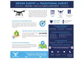
Drones can be used to collect topographic surveys over vast areas, which would normally take a lot of time using conventional survey methods. The drone takes digital pictures while coordinating and marking control points on the ground. If you are looking for Drone Topography survey, then you are at right destination. Skylarkdrones offers drone for survey. For more details visit our website.<br>https://www.skylarkdrones.com/

E N D
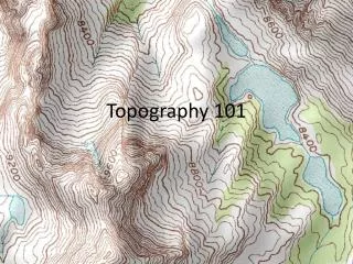
Drones for Topographic Surveying The practise of topographic surveying has changed as technology advanced. The hard days of manually calculating map points are long gone. With the extensive use of global positioning systems (GPS), historically labor- and time-intensive jobs can now be finished in half the time. Unmanned aerial vehicles (UAVs), sometimes known as drones, are one of the most interesting technology advancements for topographic surveying. How are drones being used for topographic surveying? Drones can be used to collect topographic surveys over vast areas, which would normally take a lot of time using conventional survey methods. The drone takes digital pictures while coordinating and marking control points on the ground. A digital terrain model that captures the topography of the ground is made using the same methods as traditional photogrammetry. Other survey types, such as building surveys, where difficult rooftops can be examined, and quarry inspections, where safety concerns might preclude complete access, can benefit from the use of drones. Drones offer a number of benefits to topographic surveyors. They can: Reduce overall survey time Topographic surveyors can obtain an aerial view of the land they are surveying by using an aerial survey drone. With the appropriate software and data collection sensors (such Lidar scanners), drones can significantly cut the time required to generate extremely accurate topographic survey mapping. Link with ground control points For a drone-led topographic survey to be accurate, established ground control points are essential. A drone can integrate its data collection with precisely geolocated orthophotos and point clouds using specialised software. Offer increased team safety A variety of specialised sensors, cameras, and other data collection tools can be added to drones to produce the greatest topographic survey possible. We anticipate that drone surveying will advance over time into a more advanced topographic surveying technique that becomes the norm everywhere. If you are looking for Drone Topography survey, then you are at right destination. Skylarkdrones offers drone for survey. For more details visit our website.