Download
1 / 15
150 likes | 213 Views
Learn the relationship between Terrestrial Water Storage (TWS) and groundwater storage using traditional groundwater wells and geodetic GRACE satellite data. Explore the measurement methods and interpret changes in groundwater levels.

E N D
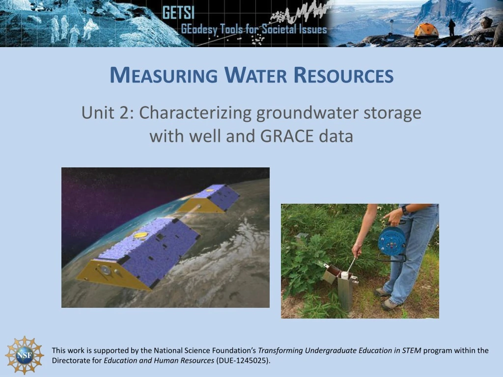
Measuring Water Resources Unit 2: Characterizing groundwater storage with well and GRACE data
Outline • Terrestrial Water Storage (TWS) defined • Relationship between TWS and groundwater storage • Traditional measurement: Groundwater wells • Depth to water table and groundwater storage • Geodetic measurement: GRACE (Gravity Recovery and Climate Experiment) satellite • Uses gravity to measure changes in mass
USGS Groundwater Wells https://water.usgs.gov/ogw/
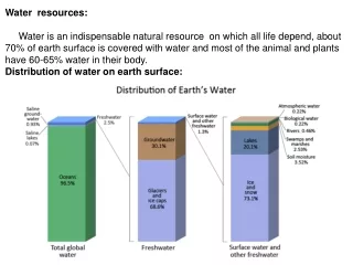
Terrestrial Water Storage (TWS) 1. Terrestrial water storage: All water stored on the land surface surface water, soil moisture, groundwater, snow, ice, vegetation water content, and permafrost. 2. TWS: storage term in the basin scale water balance: P = Precipitation ET = Evapotranspiration R = Loss to Rivers Two options for units: P, ET, and R as km3/yr or mm/yr; TWS as km3 or mm.
Terrestrial Water Storage (TWS) and groundwater • In many locations, changes in groundwater storage dominate variations in TWS. • In some locations, seasonal variations in snow or soil moisture are also important
Depth to water table measured at a well 1350.62 m Measure groundwater levels Depth to water 7 m Well depth 18 m Water level = (surface elevation) – (depth to water)
Relating changes in water table to changes in storage In > out replenished, water table/level goes up In < out depleted, water table/level decline Note: Another term you will hear is “specific yield” which is the “drainable porosity” in an unconfined aquifer – meaning the actual amount of water that will leave an aquifer, somewhat less than the total water than may be present.
Why divided by porosity? Groundwater volume change Area Area Groundwater level change in aquifer = height height
Porosity & Specific Yield Example: Sand with clay has lower porosity (and hence lower specific yield) than sand alone • Some end-member values for specific yield: • Sandstone 20% (0.2) • Clay 2% (0.02)
GRACE Mission: Gravity Recovery and Climate Experiment • “GRACE consists of two identical spacecraft that fly about 220 kilometers apart in a polar orbit 500 kilometers (310 miles) above Earth. GRACE maps Earth's gravity field by making accurate measurements of the distance between the two satellites, using GPS and a microwave ranging system. It is providing scientists from all over the world with an efficient and cost-effective way to map Earth's gravity field with unprecedented accuracy. • The gravity variations studied by GRACE include: changes due to surface and deep currents in the ocean; runoff and ground water storage on land masses; exchanges between ice sheets or glaciers and the ocean;……”
GRACE data characteristics: • 2-6 month latency • Monthly data (some months missing) • Coarse spatial resolution (~100’s km) GRACE original mission ran 2002-2017 (5-year expected duration was far outlived although by late 2016 GRACE was under modified operations to prolong battery life) GRACE Follow-on mission launched May 2018.
Unit 2 Student Exercise: Traditional and geodetic methods for monitoring groundwater change in High Plains Aquifer • Groundwater wells • GRACE data