Background on GPS Satellites
90 likes | 275 Views
Background on GPS Satellites. Lecture 11a. The Invention of GPS. U.S. military invented GPS in February 1978 when it launched the first satellite NAVSTAR (Global Positioning System)

Background on GPS Satellites
E N D
Presentation Transcript
Background on GPS Satellites Lecture 11a
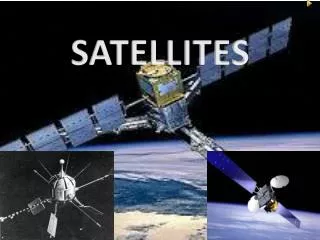
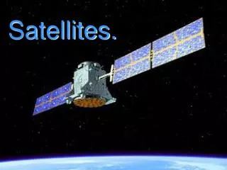
The Invention of GPS • U.S. military invented GPS in February 1978 when it launched the first satellite NAVSTAR (Global Positioning System) • It included 24 satellites, each circling the earth twice daily at medium earth orbit (12,600 to 14,760 miles above the planet) Chalmers Johnson, Nemesis: The Last Days of the American Republic (Metropolitan Books, 2006)
How GPS Works • A GPS receiver on a ship, car, aircraft, bomb or handheld device decodes a time signal from four of the satellites, which carry atomic clocks. It then calculates a position based on the different times and distances from the various satellites. Chalmers Johnson, Nemesis: The Last Days of the American Republic (Metropolitan Books, 2006)
U.S. Air Force & GPS • The U.S. Air force is in charge of the GPS system under the command of the Second Space Operations Squadron at Schriever Air Force Base Colorado. • The cost operating the GPS system is around $400 million per year. The Air Force keeps 28 satellites operational at all times with a failure rate of 2 per year. Chalmers Johnson, Nemesis: The Last Days of the American Republic (Metropolitan Books, 2006) http://www.schriever.af.mil/
GPS Goes Public • Until August 31, 1983, GPS was exclusively a U.S. military system • That year Soviet fighters shot down a Korean Air Lines Boeing 747 that had apparently drifted into Soviet air space. • It was recognized that if the airliner was equipped with a GPS system the catastrophe could have been avoided. Chalmers Johnson, Nemesis: The Last Days of the American Republic (Metropolitan Books, 2006)
“Selective Availability” • The U.S. military made GPS available for civilian use but with “Selective Availability”, they degraded its accuracy by adding signal errors (10 m horizontal 30 m vertical). • They also had the ability to switch off GPS on a regional basis and jam receivers in a war zone. Chalmers Johnson, Nemesis: The Last Days of the American Republic (Metropolitan Books, 2006)
GLONASS • During the Cold War the Soviets launched their own GPS system in 1982 called GLONASS (Global Navigation System) • It was a primitive system when compared to NAVSTAR, with only 12 active satellites in 2004. Chalmers Johnson, Nemesis: The Last Days of the American Republic (Metropolitan Books, 2006)
GALILEO • The European Union is now working on its own GPS system known as GALILEO which is scheduled to be operational in 2010. • GALILEO will be available to all world users civilian and military. It will include 30 satellites in orbit, 27 active and 3 spares. • It will be more accurate than the U.S. system (accurate to less than a meter) and will have greater penetration into urban centers. • In addition, it will have atomic clocks ten times more accurate than those on the U.S. GPS satellites. Chalmers Johnson, Nemesis: The Last Days of the American Republic (Metropolitan Books, 2006)