Download
1 / 31
360 likes | 613 Views
Satellites. Amy Cha Laura Collins Brad Robertson. Satellites Overview. History How Satellites Work Satellite Frequency Bands and Antennas Orbit Distance, Pros & Cons, Applications Types: Low-Earth-Orbit (LEOs) Medium-Earth-Orbit (MEOs) Global Positioning System (GPS)

E N D
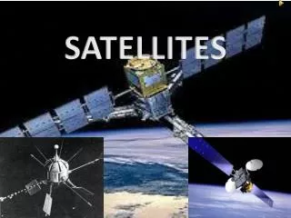
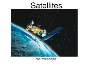
Satellites Amy Cha Laura Collins Brad Robertson
Satellites Overview • History • How Satellites Work • Satellite Frequency Bands and Antennas • Orbit Distance, Pros & Cons, Applications • Types: Low-Earth-Orbit (LEOs) Medium-Earth-Orbit (MEOs) Global Positioning System (GPS) Geostationary (GEOs) • Satellite Tracking System (J-Tracker, J-Pass)
History of Satellites • The First Satellites The theory of satellites was simple enough - shoot something out into space at the right speed and on the correct trajectory and it will stay up there, orbiting Earth, for years - if not forever. If the orbit is the right distance in space the satellite will keep pace with the rotation of the Earth. • Pioneer Satellites (1957) Early in October 1957 communications stations started picking up a regular beeping noise coming from space. The signals were coming from Russia's Sputnik 1, the world's first man-made satellite. It was January 1958, before a Jupiter rocket successfully launched Explorer 1, the first American satellite.
History of Satellites • NASA's Syncom programme (1963) GEOs In July 1963 the Hughes Aircraft Corporation launched the experimental Syncom 2 for NASA, the world's first geosynchronous communications satellite. Its earlier sister, Syncom 1, had been blown up on launch earlier that year, but the second version was a huge success. It carried the first live two-way satellite call between heads of state when President John F. Kennedy in Washington, D.C., telephoned Nigerian Prime Minister Abubaker Balewa in Africa. The third Syncom satellite transmitted live television coverage of the 1964 Olympic Games from Tokyo.
History of Satellites • Early Bird (1965) The world's first commercial communications satellite was Early Bird, built for the Communications Satellite Corporation (COMSAT) by Hughes. The satellite was launched on April 6, 1965, and placed in commercial service after moving into geosynchronous orbit 22,300 miles above the equator. That meant it was always on station to provide line of sight communications between Europe and North America. Early Bird didn't have a battery - and worked only when its solar panels were exposed to the sun.
History of Satellites • Later communications satellites The launch of the Intelsat 3 satellites in 1969 created a global TV and speech communications network that spanned the Atlantic, Pacific and Indian Oceans. The introduction of multiple-beam antennas in the 1980s brought new improvements in efficiency, as a satellite's power could now be concentrated on small regions of the Earth, making possible smaller-aperture (coverage area), lower-cost ground stations. The Capacity (the number of simultaneous television and speech channels carried) grew as well.
A Earth Station sends message in GHz range. (Uplink) Satellite Receive and retransmit signals back. (Downlink) Other Earth Stations receive message in useful strength area. (Footprint) How Satellites Work
Satellite Frequency Bands and Antennas (Dishes) • The size of Satellite Dishes (antennas) are related to the transmission frequency. • There is a inverse relationship between frequency and wavelength. • As wavelength increases (and frequency decreases), larger antennas (satellite dishes) are necessary to gather the signal.
Satellite Frequency Bands and Antennas (Dishes) C-Band Ku-Band • Most commonly used bands: C-band (4 to 8 GHz) , Ku-band (11 to 17 GHz) , and Ka-band (20 to 30 GHz ).
Low-Earth-Orbit (LEO) • Altitude (375-1000 miles) • Revolution time: 90 min - 3 hours. • Advantages: • Reduces transmission delay • Eliminates need for bulky receiving equipment. • Disadvantages: • Smaller coverage area. • Shorter life span (5-8 yrs.) than GEOs (10 yrs). • Subdivisions: Little, Big, and Mega (Super) LEOs.
0.8 GHz range Small, low-cost Vehicle tracking, environmental monitoring and two-way data communication. Used for short, narrowband communications. Little LEOs Applications
2 GHz or above range Can offer global services, which can be subject to regulatory requirements. Used for technology devices such as high-speed, high-bandwidth data communications, and video conferencing. They carry voice and high-speed data services. The main uses are data communications and real-time voice delivery to hand-held devices. Big LEOs Applications
20-30 GHz range Mainly handles broadband data. These systems are optimized for packet-switched data rather than voice. They share the same advantages and drawbacks of other LEOs and are intended to operate with inter-satellite links to minimize transmission times and avoid dropped signals. Mega (Super) LEOs Applications
Hubble Telescope • Classification: LEO • Orbit: 375 miles, 600 km. • Revolution time: 100 min. • Speed: 17,000 miles/hr • Concerns: Orbit decay from gravity and solar output. During “solar maximum”, the densities at all altitudes are enhanced, and the drag effects on satellites are much larger than during times of solar minimum.
According to the U.S. Space Command (USSC), there are more than 8,000 objects larger than a softball now circling the globe. Of these, over 2000 are satellites (working and not). Space Debris
Middle-Earth-Orbiting (MEO) • MEOs orbits between the altitudes of 5,600 and 9,500 miles. • These orbits are primarily reserved for communications satellites that cover the North and South Pole. • Unlike the circular orbit of the geostationary satellites, MEOs are placed in an elliptical (oval-shaped) orbit. • Approximately a dozen medium Earth orbiting satellites are necessary to provide continuous global coverage 24 hours a day.
GPS: What is it ? A constellation of 24 satellites • The Global Positioning System (GPS) is a worldwide radio-navigation system formed from a constellation of 24 satellites and their ground stations. • They are constantly moving, making two complete orbits in less than 24 hours. • These satellites are traveling at speeds of roughly 7,000 miles an hour. GPS Satellites Name: NAVSTAR Manufacturer: Rockwell International Altitude: 10,900 nautical miles Weight: 1900 lbs (in orbit) Size: 17 ft with solar panels extended Orbital Period: 12 hours Orbital Plane: 55 degrees to equatorial plane Planned Lifespan: 7.5 years Current constellation: 24 Block II production satellites The spacing of the satellites are arranged so that a minimum of five satellites are in view from every point on the globe.
GPS: How it works Satellites are reference points for locations on Earth • The whole idea behind GPS is to use satellites in space as reference points for locations here on earth. • GPS satellites use a "triangulate," system where the GPS receiver measures distance using the travel time of radio signals. • By using triangulation, we can accurately measure our distance and find out position from three satellites position anywhere on earth. EX. THE BIG PICTURE If a particular satellite is 11,000 miles above it. Then we know that it’s radius is 11,000 miles! EX. THE BIG PICTURE Basic calculations measuring distance Velocity * Time = Distance Velocity = speed of light (186,000 miles per second. ) Time = a lot of analysis and calculations!
Even though the satellites positions are constantly monitored, they can't be watched every second. The atomic clocks they use are very, very precise but they're not perfect. Minute discrepancies can occur, and these translate into travel time measurement errors. The signal may not actually get to the ground station receivers first. It may bounce off various objects before it gets to the receivers. GPS: Problems in the System Satellites are precise but are not perfect.
GPS: Who Uses GPS ? GPS has a variety of applications • Land: diverse uses; ex. surveying, recreational. Etc • Sea: navigation by recreational boaters, commercial fishermen, and professional mariners • Air: navigation by general aviation and commercial aircraft
Geosynchronous-Earth-Orbit (GEO) • Orbit is sychroneous with the earths rotation. • From the ground the satellite appears fixed. • Altitude is about 23,000 miles. • Coverage to 40% of planet per satellite.
Basics of GEOs • Geostationary satellites are commonly used for communications and weather-observation. • The typical service life expectancy of a geostationary satellite is 10-15 years. • Because geostationary satellites circle the earth at the equator, they are not able to provide coverage at the Northernmost and Southernmost latitudes.
GEOs and Weather • The altitude is chosen so that it takes the satellite 24 hours to orbit the Earth once, which is also the rotation rate of the Earth. • This produces the cloud animations you see on TV. • Can take images approximately every minute.
Facts about GEOs • Instruments on GEOs are designed to last 3-9 years. • Measurements that are taken are in the form of electrical voltages that are digitized, and then transmitted to receiving stations on the ground. • Instruments usually have: • Small telescope or antenna. • A scanning mechanism. • One or more detectors that detect either visible, infrared, or microwave radiation.
GEOs • Satellites are positioned every 4-8 degrees. • Aproximately 300 GEO satellites are in orbit.
Disadvantages: It takes longer for the signal to get to earth and back to satellite. Increased difficulty of telephone conversations. GEOs are not positioned in the farthest northern and southern orbits. Pros and Cons of GEOs • Advantages: • Weather images can be displayed. • Television broadcasts are uninterrupted. • Used to track major developments such as hurricanes 24 hours a day.
GEOs • Provides images of nearly one-third of the Earth's surface every 23 minutes with 4 km resolution. • While the United States maintains and operates its GEOs, the European community is served by its European Space Agency (ESA) Meteosat satellite, and Japan with its GMS satellite.
Satellite Tracking System NASA J-Tracker NASA J-Pass
Conclusion • History • How Satellites Work • Satellite Frequency Bands and Antennas • Orbit Distance, Pros & Cons, Applications • Types: Low-Earth-Orbit (LEOs) Medium-Earth-Orbit (MEOs) Global Positioning System (GPS) Geostationary (GEOs) • Satellite Tracking System (J-Tracker, J-Pass)
How Do Satellites Work? By William Cook, 1996 The Living Earth – Earth View Advanced Communications Technology Satellite (ACTS) Stevens – Low Earth Orbiting LEO CompassRose International Publications – Introduction to Global Satellite Systems searchNetworking.com Definitions - Satellite LEO Illustration HST Project Science Office Hubble Picture Hubble Image Space Debris More Space Debris What is Medium Earth Orbit? About GPS Global Positioning Overview What is GPS? Geo Satellites Geostationary Operational Environmental Satellites GMS - Geostationary Meteorological Satellites GOES - Information on the GOES Data Collection System Feng Yun 2 NASA: J-Tracker Sources