Download
1 / 28
280 likes | 297 Views
This study aims to calibrate Inherent Optical Properties (IOP) estimates from space in turbid CASE 2 waters by incorporating satellite IOP derived bio-optical models. The correlations between In Situ and satellite-derived AOP's and IOP's are assessed, with a focus on adaptive sampling of coastal waters at LEO 2001.

E N D
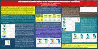
Comparisons of Satellite Derived Optical Properties to In Situ Coastal Measurements at LEO 2001 L. Alex Kahl, Michael Crowley, Oscar Schofield, Robert Arnone, John Kerfoot,Trish Bergmann, Inst. Of Marine and Coastal Sciences – Rutgers University New Brunswick, NJ Naval Research Lab – Stennis, MS California Polytechnic State University – San Luis Obispo, CA
What are We Working Towards? We want to calibrate Inherent Optical Properties (IOP) estimates from space in turbid CASE 2 waters. We want to incorporate satellite IOP derived Bio-optical models. EcoSim 0.14 0.13 0.12 0.11 0.10 0.09 0.08 0.07 0.06 0.05 0.04 0.03 0.02 0.01 0.10 0.085 0.07 0.055 0.04 0.025 0.01 Depth (m) Phytoplankton Pigment (mg/m3) Phytoplankton Pigment (mg/m3) Range (km) Range (km)
The Goals of My Talk • Discuss Adaptive sampling of the coastal waters at LEO 2001 • Assess the correlations between In Situ and satellite derived AOP’s and IOP’s
Ocean Color Satellite Spectral Break Down Visible Near IR IR 2 5 AVHRR CZCS SeaWiFS Oceansat FY1-C MODIS 4 3 1 6 3 1 2 5 4 6 1 2 3 4 7 8 5 6 8 1 2 3 4 7 5 6 5 3 4 8 7 9 1 2 10 7 5 6 12 11 10 13 14 17 23 16 15 27 28 30 29 32 31 18 8 4 2 3 1 9 20 25 19 21 24 26 Microns 0.4 0.43 0.49 0.53 0.58 .63 0.7 0.8 0.9 1 2 3 4 5 6 7 8 9 10 11 12 NOTES: 1) FY1-C channels 1-5 are identical to AVHRR ch. 1-5 (ch. 2 is close) 2) Channels 7, 8, 9 & 1 are spectrally, very wide
Calibration of the LEO Remote Sensing Platforms • 5 Aircraft - PHILLS, PHILLS-2, AVIRIS, Proteus & SPECTIR • 4 Ships [RV Endeavor, RV Walford, RV Arabella, RV Caleta] • HydroRad • TSRB • ac-9 • HydroScat 6 • An Optical Robotic Node [400 profiles]
LEO 2000-2001 1000s km2 100s km2 10s km 1 point
FY1-C vs. SeaWiFS SeaWiFS FY-1C Afternoon Morning Chlor-a Chlor-a Research Research Area Area A cloud-free FY1-C pass over LEO area. Typical afternoon cumulus obstruct SeaWiFS view of LEO.
Satellite Geometry to Validate SeaWiFS Data Omitted from regression l
Processing, and not the sensor has limited SeaWiFS products in CASE 2 waters. 1 SeaWiFS SeaWiFS Channel 5 Channel 5 August 1, 2001 Enhanced August 1, 2001 Haze/ Humidity f f 0.1≤ Pixel Values ≤ 45 0.1≤ Pixel Values ≤ 4.0 1Arnone, R.A., P. Martinolich, R.W. Gould, R. Stumpf, S. Ladner, Coastal Optical Properties Using SeaWiFS, Ocean Optics XIV Conference Papers Vol. 1, 1998
Cross-calibrating Products USA & China FY1-C Chlor-a August 2, 2001 12:31 GMT Chlor-a 3 mg/m 0.2 1 2 40N 3 Field 4 Station 6 38N In Situ measured chlorophyll-a SeaWiFS derived chlorophyll-a 76W 74W 72W 70W
Cross-calibrating Products USA & India 40N Field Station Field Station 38N 38N 74W 72W 74W 72W SeaWiFS Chlor-a Oceansat Chlor-a August 2, 2001 August 2, 2001 17:10 GMT 17:46 GMT Chlor-a Chlor-a mg/m3 mg/m3 0.5 1 3 5 7 0.5 1 3 5 7 40N f f • j j f f Oceansat has a ground resolution 360 m. SeaWiFS has a ground resolution 1100 m.
Oceansat Chlor-a Kilometers July 31, 2001 0 1 2 17:10 GMT Field Station Sample Site 39.5N Sample Site Chlor-a mg/m3 2 3 Old 4 3.25 mg/m3 6 2.27 km 7 8 9 Corrected 6.85 mg/m3 39.5N Corrections using CODAR HF - RADAR • Frontal Boundary f • f • f • f f Field Station • • Corrected Image: • r2 improved from • 0.69 to 0.75 • Slope moved closer to 1 • Intercept moved closer to 0
July 23, 2001: Arnone’s SeaWiFS derived Rrs r2 AOP Correlations Wavelength In Situ vs. Satellite Remote Sensing Reflectance Generally 0.60< r2 <0.90 August 2, 2001: Arnone’s SeaWiFS derived Rrs r2 Wavelength
IOP’s derived from Rrs 1 For coastal waters a(λ) = 0.051[ bb(λ)] / Rrs Using the Petzold volume scattering function2 bb(λ) ≅ 0.02 b(λ) 1Arnone, R.A., P. Martinolich, R.W. Gould, R. Stumpf, S. Ladner, Coastal Optical Properties Using SeaWiFS, Ocean Optics XIV Conference Papers Vol. 1, 1998. 2 Gould, R.W., R.A. Arnone and P. Martinolich Spectral Dependence of the Scattering Coefficient in CASE 1 and Case 2 Waters,, Applied Optics Volume 38, Issue 12, 2377-2383, April 1999.
IOP Transects bb 532 a 488 0 5 10 15 20 25 0 5 10 15 20 25 0.02 0.016 0.012 0.008 0.004 0 0.9783 0.7826 0.587 0.3913 0.1957 0 Depth (m) mg/m3 Depth (m) mg/m3 0 2 4 6 8 10 12 14 16 0 2 4 6 8 10 12 14 16 Range (km) Range (km) RV Walford transects during LEO 2001
Future Goals SeaWiFS a412/bb555 Aug. 2, 2001 41N a412/bb555 10 20 40 60 80 100 AVHRR SST SeaWiFS SeaWiFS Aug. 1, 2001 Chlor-a 40N a490/bb555 18:00 GMT 41N 41N Aug. 2, 2001 Aug. 2, 2001 o SST C Chlor-a a490/bb555 21 MFS mg/m3 8 21.5 0.2 11 22 2 13 22.5 4 14 39N 40N 40N 5 15 40N 23 6 16.5 23.5 18 MFS 24 MFS 74W 72W 75W 73W MFS 9 41N 200m 39N 39N 39N 73W 75W 74W 73W 72W 74W 75W 75W 73W 74W 72W
Conclusions Human quality assurance of imagery is still necessary in coastal oceans. Access to wide array of space based data allows for multiple satellite passes in one day and subsequent adaptive sampling . Satellite derived IOP’s that we verified using ship based data show promise, even in CASE 2 turbid waters.
Acknowledgements National Undersea Research Program THE STATE UNIVERSITY OF NEW JERSEY RUTGERS Shelly Blackwell, Christina Orrico, Paul Bissett, Sherwin Ladner, Rick Gould, Liz Creed, Bob Chant, Josh Kohut, Sage Lichtenwalner, Paul Marlinovich, Dave Kohler, the crew of the RV Endeavor, & Fred Grassle Want to download this talk? http://marine.rutgers.edu/cool/agu2002
FY-1C Channel 9 SeaWiFS Ch. 5 2 3 Reflectance R R Reflectance a a 3 July 21, 2001 June 18, 2001 3.5 d d 12:47 GMT 16:56 GMT i i 4 a 4 a n 6 n 4.5 c c 8 5 e e 40N 40N 30N 30N 20N 20N 80W 70W 60W 70W 80W g g g g fLEO fLEO • i • m l FY-1C Relative Azimuth peak is 180° at LEO SeaWiFS Relative Azimuth peak is 60° at LEO
Apparent Optical Properties Wavelength
Old PointlR2 increased > 0.06 Slope closer to 1Intercept closer to 0Corrected Pointi
j h “Good Days”
Slope <1 For all wavelengths