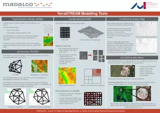
digital elevation model(dem)
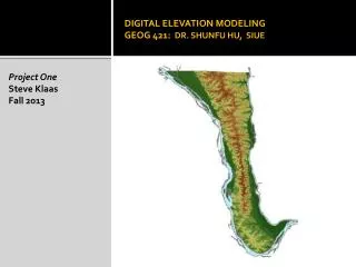
Digital Elevation Model(DEM) is used to represent terrains in digital format.

digital elevation model(dem)
E N D
Presentation Transcript
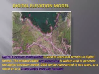
DIGITAL ELEVATION MODEL Digital Elevation Model(DEM) is used to represent terrains in digital format. The method called remotesensing is widely used to generate the digital elevation model. DEM can be represented in two ways, as a raster or as a Triangulated Irregular Network
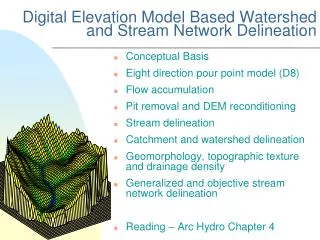
DEM PROCESS FLOW DEM inputs generated will not produce a proper representation of the terrain. So they need to be edited to client specifications. The main application of DEM are, GIS Services Surface Analysis Orthophoto generation Global Positioning System Aerial Photography Bare Earth Surface Model
For more Queries about DEM Services Visit :-http://www.sblgis.com/gis-digital-elevation.aspx Contact us :- SBL Sri Niketan, Palace No. 10,Cochin Kerala -682301 India Phone - 91 484 2784057 mail to :- gayathril@sblinfo.com