Download
1 / 1
50 likes | 257 Views
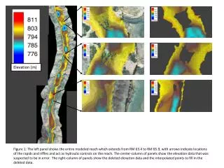
TerraSTREAM Modelling Tools. A Digital Elevation Model (DEM) is a representation of a terrain. Two main DEM models Uniform grid (Grid) Triangulated Irregular Network (TIN ). High resolution elevation models results in noisy and unpleasant looking contours.

E N D
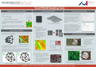
TerraSTREAMModelling Tools • A Digital Elevation Model (DEM) is a representation of a terrain. • Two main DEM models • Uniform grid (Grid) • Triangulated Irregular Network (TIN) • High resolution elevation models results in noisy and unpleasant looking contours. • Traditional approaches typically either smooth the terrain before computing contours, or remove small (circumference) contours. There is very little control over what features are removed. • Using the topological simplification module in TerraSTREAM we can remove depressions in the terrain based on their volume, area or height. This results in visually pleasing contour maps where insignificant features are removed but large features are unchanged. A grid DEM is a uniform grid of height values. 11 14 15 13 20 12 20 14 TerraSTREAM can construct both TIN and grid DEMs from massive point clouds using provable efficient algorithms. Before topological simplification 23 18 22 25 Height grid 3D visualization of a height grid 32 A DEM is usually constructed from a finite set of height measurements also called a point cloud (e.g., LAS LIDAR data). • Adaptive construction • We adaptively break grid into tiles containing “few” input data points • We interpolate in each tile independently, also considering data points in neighbor tiles (to ensure smoothness along boundaries) 3 2 4 3 2 4 After topological simplification 7 5 8 7 5 8 A TIN DEM is a planar triangulation of the point cloud with an elevation value associated with every vertex. 7 1 9 7 1 9 3 2 4 3 2 4 7 5 8 7 5 8 3 7 1 9 7 1 9 • Often grid DEM points are interpolated from very distant input points. User would like to know “trustworthiness” of each grid point. • We compute nearest input point for each grid DEM cell. • I/O-efficient algorithm: We compute nearest points by adapting known nearest-neighbor algorithms and exploiting uniformity of grid. Visualizations of our measure. Areas with very close input points are green, areas with relatively close input points are blue and areas with distant input points are red Contour line visualization of a grid. There are obvious flaws in the vicinity of buildings (where no input points are available) TIN DEM Visualization of triangulation TerraSTREAM implements an algorithm for constructing delaunay triangulations of massive point clouds. User-defined constraints sometimes improve the quality of Delaunay triangulations, if the point data is not detailed enough. TerraSTREAM can construcrt constrained Delaunay triangulations. Tiling of a point data set A tile to interpolate and its neighbors • Linear interpolation over TIN DEM • Construct a Delaunay triangulation of input point cloud • Linearly interpolate a height value for each grid cell from the corners of the triangle containing the center of the grid cell Delaunay triangulation Constrained Delaunay triangulation MADALGO – Center for Massive Data Algorithmics, a Center of the Danish National Research Foundation