Download
1 / 15
150 likes | 169 Views
Learn how to integrate data from distributed sources using Google Earth to make informed decisions about boating trips in the Great Lakes region.

E N D
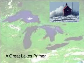
Planning a Great Lakes Boating TripIntegrating Data from Distributed Sources Using Google Earth David Hart GIS Specialist University of Wisconsin Sea Grant Institute ICAN-Great Lakes Meeting Madison, Wisconsin Tuesday, September 14, 2010
The Boating Trip “Use Case” • Boaters use a variety of independent (and sometimes insufficient) sources of information to make decisions about when and where to go boating. • This can lead to missed opportunities, inefficient trips, and impaired safety. I drove from Madison to Milwaukee on a beautiful day in early November 2006 to take panorama photos for our Wisconsin Coastal Guide. It was sunny for the entire drive until I got within 500 yards of Lake Michigan, when I entered a fog bank so thick I couldn’t tell if I was next to the lake or in a city. McKinley Marina, 11/7/06
What information would you want to make a decision to go boating?
Mariner Interview • Milwaukee Yacht Club, 48’ Trawler Yacht • Sails every year in northern Lake Huron • Active in the Coast Guard Auxiliary • Keen interest in real-time weather information for the Great Lakes
Mariner Interview • What are some of your current sources for boating information? • Great Lakes Open Lake Forecasts, NWS • (http://www.nws.noaa.gov/om/marine/forecast.htm) • Nautical Charts (buy pre-loaded at West Marine) • Coast Pilot, NOAA • old school dissemination, but can be downloaded now • (http://www.nauticalcharts.noaa.gov/nsd/coastpilot.htm) • includes aerial photo of harbor • Light List, U.S. Coast Guard • (http://www.navcen.uscg.gov/pubs/LightLists/LightLists.htm) • The key question -- Is the light still working today? • for example: In Ludington, is the North lighthouse still operating as advertised?
Mariner Interview • What are some of your current sources for boating information? • Great Lakes Cruising Guides, Lakeland Boating • (http://www.lakelandboating.com/cruise_guide.cfm) • example: Lake Michigan Ports ‘o Call • accommodations, sightseeing, emergency, transit, repairs • Great Lakes Cruising Club • (http://glcclub.com/) • membership organization, requires login • appoints port captains who prepare harbor reports • western shore of Lake Michigan has one report) • Michigan Harbor Guide, Michigan DNR • way ahead of Wisconsin
Mariner Interview • General Insights • Port facilities info (are there marinas? power supply? where are the nearest services?) • Plan trip on availability of dockage – can be similar to hotel reservations • Visibility and waves are a huge issue for boaters. Boaters are comfortable with zulu time. • Wave steepness very important, GL waves have very short, rapid period. Oceans have swells.
Mariner Interview • Recommendations • Latest obs layer • link to NOAA buoy report in dialog box, from buoy report get wave height and period • fog, humidity, temperature vs. dew point, wind is critical, barometric pressure ok, water temp • Need “geo-regulations” – e.g.) vessels over 40’ must go 4 mph in Milwaukee harbor and for 30 minutes before and after fireworks = no wake • Need oblique view of harbors – e.g.) Pictometry • Webcams are becoming very important • Regarding integration of information – how old is this info? • How do boaters get internet access in coastal waters? • Help small communities get public wi-fi, should be in all downtowns
Great Lakes Mapping Mashups • In order to help train Great Lakes managers and users make their own spatial decision support tools, we need… • Ideas… A gallery of examples of how data observations and mapping mashups are used to support decision-making about the Great Lakes • Data… How can we discover, acquire, and integrate Great Lakes data • A sandbox… A place to play
Great Lakes D-S Gallery http://www.netvibes.com/glos-workshop-resources#GLOS_Workshop_Resources
Great Lakes Data Sources • Keyhole Markup Language • Web Map Services • Web Feature Services • ESRI Services
Data Integration Tools (Clients) Virtual Globes • Google Earth, NASA WorldWind, ArcGIS Explorer Mapping Services and APIs • Google Maps, Yahoo Maps, Bing Maps Open Source Desktop GIS Clients • gvSIG, Quantum GIS, uDig, MapWindow Commercial Desktop GIS Clients • ArcMap
Data Integration Tools (Browser) • ScribbleMaps • National Map Viewer 2.0 • GeoCommons • ESRI ArcGIS On-Line
Questions? David Hart University of Wisconsin Sea Grant Institute dhart@aqua.wisc.edu http://www.seagrant.wisc.edu/gis/ http://coastal.lic.wisc.edu/ Water is the most critical resource issue of our lifetime and our children's lifetime. The health of our waters is the principal measure of how we live on the land. -Luna Leopold