Download
1 / 17
170 likes | 312 Views
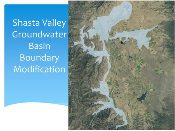
Tooele Valley Groundwater Change Application Guidelines. S. Ross Hansen P.E., L.S. Region Engineer. 9/7/2011 Tooele Water Users Workshop. Overview. History of the Groundwater Change App. Policy. What is the Tooele Valley Groundwater Change Application Policy.

E N D
Tooele Valley Groundwater Change Application Guidelines S. Ross Hansen P.E., L.S. Region Engineer 9/7/2011 Tooele Water Users Workshop Surveying principles
Overview • History of the Groundwater Change App. Policy. • What is the Tooele Valley Groundwater Change Application Policy. • Conceptual Future Groundwater Flow. • Future Change App. Administration. Surveying principles
Vocabulary • Acre-foot - An acre of land 1’ deep water • CFS - Cubic Feet per Second • G.W. – Groundwater • POD – Point of Diversion • S.E. – State Engineer • State Engineer’s Office a.k.a. Division of Water Rights • UGS - Utah Geological Survey • USGS – United States Geological Survey Surveying principles
Tooele Map Surveying principles
History of the Groundwater Change Policy • In 2007 we were inundated with cross valley change application filings • Meeting were held on: • August 28, 2007 S.E. expressed concern that moving multiple paper rights to the East side of the valley could cause future interference issues. • April 24, 2008 to propose a change application policy be implemented • Comments were submitted pursuant to the meeting • July 22, 2008 to implement the policy. • Effective date of policy April 16, 2008 Surveying principles
Understanding the Tooele Valley Groundwater Change Application Policy • How it was derived • Policy summary • What it does • What it doesn’t Surveying principles
Hydrologic ConnectionRecharge / Discharge Surveying principles
Total Recharge: 75,297 Total Permitted Use: 83,969 Total Difference: -8,672 Percent over: 12% Water Right Distribution Recharge: 16,910 Permitted Use: 27,404 Difference: -10,494 Percent over: 62% Recharge: 43,160 Permitted Use: 48,595 Difference: -5,435 Percent over: 13% Recharge: 15,226 Permitted Use: 7,970 Difference: 7,257 Percent under: 48% Surveying principles
Tooele Valley Groundwater Change Application Policy • Policy Summary • Can’t Cross Into Eastern Zone • Buffer 3 Miles East Perpendicular to Flow Path • Change App. Specifics • Multiple Water Rights • Each Water Right Will Be Evaluated Individually • Most Restrictive Water Right Will Govern • Multiple Points of Diversion • Based On Eastern Most Well • Applications Will Still Be Considered On Their Own Merit Surveying principles
3 mile Map graphically showing 3 mile buffer and East zone Surveying principles
Understanding the Tooele Valley Groundwater Change Application Policy • What the policy does: • Creates some semblance of order and certainty • Allows WR holders to predict outcome before filing • Allows the S.E. to make more timely decisions on change application • Protects the East side from further over- appropriation • Stops future interference issues Surveying principles
Understanding the Tooele Valley Groundwater Change Application Policy • What the policy does not: • It does not “divide” the valley into 3 sections • The SE continues to administer the valley as one hydrologic system • It is not the “end all” answer when considering change applications • Each application is considered on its own merits Surveying principles
Total Recharge: 75,297 Total Permitted Use: 83,969 Total Difference: -8,672 Percent over: 12% Water Right Distribution Recharge: 16,910 Permitted Use: 27,404 Difference: -10,494 Percent over: 62% Recharge: 43,160 Permitted Use: 48,595 Difference: -5,435 Percent over: 13% Recharge: 15,226 Permitted Use: 7,970 Difference: 7,257 Percent under: 48% Surveying principles
Hydrologic ConnectionFuture conceptual drawing Surveying principles
Future of Change Application Administration • Continue to administer and make decisions based on current policy • If data is brought before us we will consider it and incorporate if need be Surveying principles
Where to Get More Policy Info. • Water Rights web site • http://waterrights.utah.gov/ Surveying principles
QUESTIONS?? Thank you Surveying principles