Download
1 / 27
270 likes | 393 Views
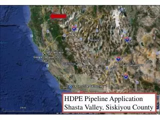
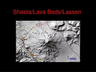
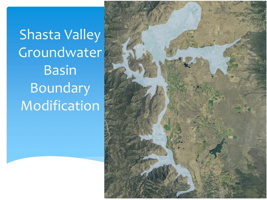
Shasta Valley Groundwater Basin Boundary Modification. Sustainable Groundwater Management Act (SGMA). September 2014 – Governor Brown signs legislation requiring groundwater resources be managed by local agencies Governor emphasized “groundwater mgmt best accomplished locally”

E N D
Sustainable Groundwater Management Act (SGMA) September 2014 – Governor Brown signs legislation requiring groundwater resources be managed by local agencies Governor emphasized “groundwater mgmt best accomplished locally” SGMA establishes requirements for how groundwater basins will be managed over the long-term – through Groundwater Sustainability Agencies and Groundwater Sustainability Plans (GSP) Requires agencies of high & medium priority basins to halt overdraft & bring groundwater basins into balance
Groundwater Sustainability Plan (GSP) • 6 Undesirable Results that must be assessed & managed through minimum thresholds • Groundwater storage reduction • Chronic lowering of groundwater levels • Water quality degradation • Interconnected surface water depletion • Land subsidence • Seawater intrusion
Groundwater Sustainability Plan (GSP) • Multiple requirements must be implemented into the GSP based on DWR determined BMP’s • Hydrogeologic Conceptual Model • Groundwater model • Water budget and balance • Establish minimum thresholds & measureable objectives for 6 sustainability factors • Management areas • Planning & Implementation horizon
Groundwater Sustainability Plan (GSP) Monitoring Network – wells, surface flows, water quality, subsidence, data collection & storage Recharge, banking, conjunctive use opportunities Achieve sustainability no later than 2042 May, but not required to address undesirable results prior to 1/1/15 Developed from consulting assistance through RFP process
SGMA & Residential Use “de minimis” extractor “means a person who extracts, for domestic purposes, two acre-feet or less per year”. – SGMA definition 10725.8 – Measuring devices & reporting does not apply 10730 – A “GSA” shall not impose a fee pursuant to this subdivision on a de minimis extractor unless the agency has regulated the users pursuant to this part
Potential Results from boundary change • Inclusion in locally controlled plan, built on local knowledge, studies, & input • Reliable water availability knowledge & planning based on GSP • Recharge benefits – within basin boundary • Legislation language • Project & funding opportunities – Grant & GSP related projects can only apply within the basin boundary • Seat at table & input to GSA & GSP development • A “process” is in place to determine overdraft regionsor negative groundwater supplies, & develop strategy to improve
Potential Results from boundary change • More regulation & oversight • Potential for additional fees, costs, etc… • Public process • Worst case scenarios around California - potential restrictions, shut-offs, or capping • Not expected in Siskiyou County • Potential data & access intrusion
Proposed boundary • Pluto’s cave region provides abundant groundwater • Shasta River connection • Over 52% of groundwater irrigation use • Encompasses large “manageable” use • Covers remaining water use in Gazelle/Grenada subregion
Justification for revising the boundary “g-water body of valley appears to be hydrologically continuous with all geologic units (Mack 1960), including Plutos Cave basalt, volcanic rocks of the western Cascades, & Debris Flow” – Bulletin 118 (2004) “Basalt is highly vesicular & fractured, contains lava tubes, and transmits large volumes of g-water” – Ward (2011)
Justification for revising the boundary Probably the greatest significance of the volcanic debris avalanche is the role it plays in regulating and redirecting the natural flow of groundwater to the Shasta River. The avalanche deposits resulted in a barrier to the subsequent flow and deposition of the Pluto’s Cave basalt. The juxtaposition of the less permeable avalanche deposits with the more permeable Pluto’s Cave basalt impedes the flow of groundwater from the basalt, giving rise to numerous springs (including Big Springs) along the line of contact between the formations. (Ward, 2011)
Supporting Technical Reports “Geology & Groundwater Features of Shasta Valley, Siskiyou County California” Mack (1960) “Shasta Valley, Siskiyou County Groundwater Data Needs Assessment” DWR/Ward (2011) “Managing Groundwater for Environmental Stream Temperature” Buck (2013) “Shasta Valley Groundwater Basin” Bulletin 118 (2004) “Template for components that would be desirable in order to prepare a groundwater management plan for the Shasta Valley Siskiyou County, California” Davids Engineering, Inc. (2012)
Spring 07-17 depth change -13.749 -3.182
Fall 07-17 depth change -12.749 -6.582
Proposed boundary DWR Production Well Count per Township Range and Section
Proposed boundary • DWR Domestic Well Count • per Township Range and Section
Process to submit Proposed Basin Boundary Modification Public outreach & accompanying documentation – On-going Provide comment & subsequent recommendation to the GSA board of directors – Flood Control directed continued research Information gathering & boundary line development - Currently Public meetings regarding proposed draft line – 5/31 Groundwater advisory committee recommendation - June Notify DWR by writing, of intent to modify - June GSA decision & approving resolution - June Submit application
Timeline for Boundary Adoption Notification of Intent to DWR – Public outreach workshop – May 31 Public Hearing – June 12th Resolution approving GSA to submit application – June 12th Finalize application June 13th to 30th Submit Application – June 30 (or when ready) 30-day public comment – June 30-July 30 Draft release – Fall 2018? Final modifications release – Fall/Winter 2018 Basin adopted under Bulletin 118 – 2020?
Public comment • GSA welcomes all comments from public • Letters/email of support or opposition • Send to: mparker@co.siskiyou.ca.us Subject – Shasta Groundwater Basin Boundary • Public Hearing • Official comment during DWR review period (6/30-7/30)