Download
1 / 25
250 likes | 347 Views
Explore the vital role of transportation in shaping settlement and growth in Mississippi from early river travel to the modern interstate highway system. Discover the impact on trade, industry, and urban development.

E N D
CHAPTER 3 Transportation, settlement, & growth
TRANSPORTATION • Has always been linked to: • Settlement • Growth • Determines where people live and businesses develop • The main source of transportation in early MS was rivers
TRANSPORTATION • 3 most important rivers for travel and trade • Mississippi • Yazoo • Big Black
ROADS • Early roads were Indians Trails and Buffalo Paths • Rivers were better than roads for the following reasons • Roads were more difficult and dangerous than boat • Couldn’t carry as much as boat • Roads were more expensive • The first roads were called post roads
ROADS • The Natchez Trace was the most famous road ever created in MS • Connects Natchez to Nashville • Stands (hotels or inns) were built along the Natchez Trace
ROADS • Roads then were not like today • Mainly dirt trail • Widened by cutting trees • Muddy • Couldn’t carry much • No bridges • Used ‘fords’ to cross rivers • Ford - shallow spot of water that can be crossed • Not as efficient as water, but went were water wasn’t located
STEAMBOATS • Created by Robert Fulton • Made upstream transportation possible • Carry as much as several flatboats • It allowed for the interior of MS to be opened for cotton plantations
RAILROADS • By 1900, Steamboats had mostly been replaced as way to travel & move goods • Civil War increased the need for Railroads • Reasons: ship soldiers and supplies • Advantages to the Railroad • Could be built anywhere • Faster & safer than steamboats • Opened settlement and economic development to areas without rivers • Economic development = more farmland
HIGHWAYS • 1920’s cars, trucks, & buses began appearing in MS • Roads were a problem • Dirt & gravel not good enough • Washed out and couldn’t handle loads • Bridges were unsafe or didn’t exist • No bridges crossed MS River (now 4) • Demands for government to build roads increased
HIGHWAYS • 1930’s – modern highway system began with federal money • Link major MS towns together and big towns in neighboring states • 1940’s bridges built over MS River at Vicksburg, Natchez, & Greenville
HIGHWAYS • 1960’s – 1970’s Federal Interstate Highway System constructed • At least 4 lane divided highway with same system across the country • Even #s go East and West • Odd #s go North and South • 3 digits are bypasses • About 42,800 miles and growing
INTERSTATES • MS’s Interstate’s • 55 runs the length of the state from Memphis to McComb • 20 runs across the state from Atlanta to Texas (crossing Meridian and Vicksburg • 10 runs across the coastal states • 59 runs from Hattiesburg to New Orleans
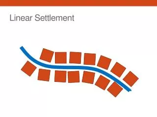
MS Counties, Towns, & Cities • Till 1940, MS almost all rural • Made living by farming • Lived off land, shopped at country stores, country doctors • Identified with their county • Paid taxes to county, law enforcement – sheriff • County school districts • Only in last 60 years have people moved to towns and cities
COUNTIES • 1st counties – Adams & Jefferson – 1799 • 13 counties in 1817 • Wayne County was 1st county east of Pearl River • Large land areas – small population
COUNTIES • Indian Treaties signed over land • 1820 – Treaty of Doak’s Stand • Choctaws ceded area of west central MS • Organized into Hinds County • Later split into 14 counties • 1830 Treaty of Dancing Rabbit Creek • Choctaws ceded the rest of their land in MS • 1832 Treaty of Pontotoc Creek • Chickasaw Indians cede their land in NE MS • Became 13 counties in MS
COUNTIES • New land – government wanted it settled so sold land cheap to draw in new settlers • RR and lumber boom in 1880 brought in more people to Piney Woods • Big counties started splitting up because people lived to far from county seats
TOWNS • Still today more people in MS live in rural area • MS is 4th most rural state in USA • Civil War only 4 towns of size: • Natchez, Vicksburg, Columbus, & Jackson • River cities – steamboats • After Civil War – Vicksburg would be MS largest city for 40 years • Steamboat and railroad center
TOWNS • 1910 railroad made Jackson & Meridian large towns • 1930 Jackson becomes and stays largest town in state • Metropolitan areas • Area with population of more than 100,000 • Several towns and cities grown into each other
TOWNS • MS Metropolitan Areas • Jackson Metro Area • Inside Hinds, Madison, & Rankin Counties • Gulf Coast • Desoto County – South Memphis • Hattiesburg
2010 CENSUS • About 2,967,000 people in MS • Most people in state still live in rural area even if they work in cities • Houston • 3,500 • Chickasaw County • 18,000
2010 CENSUS • Largest Cities • Jackson – 173,000 • Gulfport – 68,000 • Southaven – 49,000 • Hattiesburg – 46,000 • Biloxi – 44,000 • Largest Counties • Hinds – 245,000 • Harrison – 187,000 • Desoto – 161,000 • Rankin – 142,000 • Jackson – 140,000