Download
1 / 48
480 likes | 582 Views
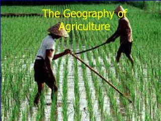
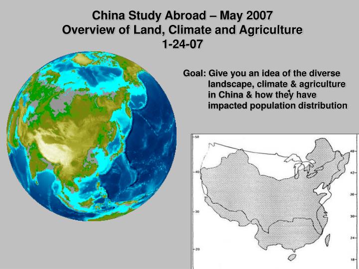
China Study Abroad – May 2007 Overview of Land, Climate and Agriculture 1-24-07. Goal: Give you an idea of the diverse landscape, climate & agriculture in China & how they have impacted population distribution.

E N D
China Study Abroad – May 2007 Overview of Land, Climate and Agriculture 1-24-07 Goal: Give you an idea of the diverse landscape, climate & agriculture in China & how they have impacted population distribution
Ames and (Beijing or Shanghai or Hangzhou) lie at about the same latitude. • Tallahassee, Florida and (Beijing or Shanghai orHangzhou) lie at about the same latitude. Where is China? Ames Beijing ~ 41 N ~ 30 N Tallahassee Shanghai
Where is the “Roof of the World”? • What happens to topography moving from western China to the eastern seacoast? 6,500 ft 3,200 ft 300-600ft 16,000 ft Topography of China
Trans-Siberian Railroad Mongolia Kashgar Gobi Desert North Korea Taklamakan Desert Plateau of Tibet Himalaya
Identify four major rivers in China. Amur River 2,760 miles Huang He/Yellow River 3,400 miles Yangtze 4,000 miles Brahmaputra Xi Jian – Pearl 1,200 miles Mekong Irrawaddy
Created a huge Fertile flood plain For agriculture
Three Gorges Dam 370 mi • 600 ft high • 1.5 miles wide • 300+ mile long lake • Largest artificial lake • Reduce flooding • Provide electricity • Improve shipping
$ 75 billion 10% of China’s electricity 140 villages displaced 2,000,000 people relocated 1,600 factories lost 80,000 acres of ag land Concern with large sediment load filling reservoir June, 2003 closed dam Fully functional 2009
Identify Major Oceans/Seas Amur River 2,760 miles East Sea Huang He/Yellow River 3,400 miles Yangtze 4,000 miles Xi Jian – Pearl 1,200 miles
Major Deserts in ChinaCreated By: Mary Irlbeck(http://www.dainst.org/index_3462_en.html)
China has 10 deserts in all; they include: -Badain Jaran Desert -Lop Desert -Dzoosotoyn Elisen Desert -Ordos Desert -Gobi Desert -Shapotou -Hami Desert -Taklamakan -Kum-tagh Desert -Tengger Desert
Badain Jaran Desert • LOCATION: Located in provinces of Gansu & Ningxia of China as well as Inner Mongolia • SIZE: 49,000 sq. kilometers (30, 000 sq. miles) • Home to tallest stationary dunes in the world • Home to over 100 spring-fed lakes that lie between dunes
LOCATION: Located in China & southern Mongolia SIZE: 1,295,000 sq. kilometers (500,000 mi²) (One of the largest deserts in the world) Is known to be a cold desert, common to see frost & occasionally snow on it’s dunes Gobi Desert
Lop Desert • LOCATION: Located in the Xinjiang Uygur Autonomous Region of China • Two characteristic features of this almost dead-level region are: 1. Broad, unbroken expanses of clayintermingled with sand; often arranged in terraces 2. Absence of drift-sand and sand dunes, except in the south
Taklamakan • LOCATION: Located in the Xinjiang Uyghur Autonomous Region of the People’s Republic of China • SIZE: 270,000 sq. kilometers • Largest sand-only desert in the world • Known as “Desert of Death” or “Place of No Return” • Remains of mummies (from up to 4,000 years ago) also found here
Tengger Desert • LOCATION: Located in the Gansu Province in China • SIZE: 36,700 square km • Composed of more sand than rock, so dust storms frequently occur (Agricultural practices & grazing have contributed to this problem)
What are the major climatic zones of China & Korea? Temperate Semi-arid Temperate Continental Subtropical Humid Temperate Arid Tropical Wet-Dry Subtropical Humid Tropical Wet Highlands
0-4 in 4-20 in 20-40 in > 60 in 40-60 in
January (-8 – 75 F) July (45 – 104 F)
Where are the forests & grassland in China? Forest Grassland Cropland
Trans-Siberian Railroad Pyongyang Beijing Seoul Daegu Tokyo Hangzhou Shanghai Taiwan Bangkok Hongkong Singapore
How much of China is arable land? USA 3,717,000 sq mi 300,000,000 people arable land 19% income $37,000 China 3,705,000 sq mi 1,300,000,000 arable land 10% income $3,600
Is rice grown near Beijing? Where are the major rice growing areas? Where do you go to see corn grown? Arable Land China – 0.2 acres/person US – 1.6 acres/person
Farmland continues to expand at the cost of deforestation 20,000 ha/yr reduction in subtropical/tropical forest in Yunnan Province
Pig Building Fruit Orchard Fish Pond Chickens grazing
Sustainability of Agriculture in China Northern China in mid- and upper Yellow River Basin is problematic Rice production in southeastern is arguably considered sustainable
What Countries Border China? Land boundaries total: 22,143.3 km Coastline: 14,500 km Afghanistan – 76 km Bhutan - 470 km India - 3,380 km Kazakhstan - 1,533 km North Korea - 1,416 km Kyrgyzstan - 858 km Laos - 423 km Macau Mongolia - 4,673 km Myanmar - 2,185 km Nepal - 1,236 km Pakistan - 523 km Russia (northwest) 40 km (northeast) 3,605 km Tajikistan - 414 km Vietnam - 1,281 km 1 mile = 1.6 km
Grand Canal - world's oldest and longest canal - Hangzhou to Beijing • 1,795 Km (1,114 miles) long; 24 locks - 60 bridges. • Canal began in 486 B.C. with furious construction from 605-610 AD
China has more than 60,000 mi of navigable inland waterways. The busiest is the Grand Canal, which extends about 1,200 mi from Beijing to Hangzhou.
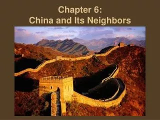
Great Wall of China separate walls built between 770 – 476 BC Emperor Qin combined them into the Great Wall in 214 BC
Silk roads of China Brittney Morris
Xian: Big Wild Goose Pagoda Jiayuguan Pass Mountainous sceneries in Tianshan Along the Silk Road Taklamakan Desert