Download
1 / 69
690 likes | 870 Views
Map, Compass, and GPS Basics. Search and Rescue… When Accuracy Counts Brad Rounds, Registered Maine Guide Wilderness Rescue Team Leader Education Director, MASAR.

E N D
Map, Compass, and GPS Basics Search and Rescue… When Accuracy Counts Brad Rounds, Registered Maine Guide Wilderness Rescue Team Leader Education Director, MASAR
With illustrations fromKjetil Kjernsmo's illustrated guide onHow to use a compass(Used With Permission)Peter H. DanaThe Geographer's Craft Project, Department of Geography, The University of Colorado GPS Worldand the U.S. Geological Survey
When A Life’s In The Balance • Accuracy = Effectiveness • Effectiveness = Maximum Advantage to Victim
Not Even In The Ball-Park • Finding south using a watch • Shadow methods • Moss on Trees • Direction of lean of branches • Sunrise and Sunset • Pixie Dust and Natural Instinct
These skills require practice You will not be proficient or confident otherwise… You are likely to become part of the problem instead of part of the solution !
Simply a representation of the land area of part of the earth on a piece of paper or screen (chart if ocean) Different Projections Different Scales Larger Number = Smaller Features Topographic are the most useful Distances Descriptions Declination Details (color coded symbols) Direction Designations (place names) MAPS
Maps in the Field • Folding to optimize usefulness • Weather Protection Baggie Waterproofing solution Remember, the ink on print-outs of maps is not weather-resistant at all !
Scale • You must know the scale to work a map • 1:12,000 occasionally available, usually as a printout from a mapping program – very rarely increases the features from a 1:24 …just spreads them out more • 1:25,000 metric maps, several years still in circulation • 1:24,000 most common topo portrayal, 7.5 minute quads. About 2.5 inches = mile • 1:62,500, or 15 minute quads consist of the area covered by 4 7.5-minute quads (1 inch = 1 mile) • 1:125,000, or DeLorme Atlas maps
Details • Black = Manmade objects • Blue = Water features • Brown = Elevation • Pink = Heavily populated areas • Green = Woodlands • Purple = Change since last full map made • Red= Major roadways
Directions • Top of the map is true north • There is also grid north • There is also magnetic north Declination (on ocean it’s variation) The agonic line Declination in Maine Declination by rose Declination by compass measure
Designations Different style print for town/city/state Names Different style print for boundary lines and then there’s benchmarks
Contour Lines • Drainages • Ridges • 10-20-50-100 foot increments • Index contours • Concept of closer = steeper Practicing visualizing in the field so you can get a knack of what the portrayal should look like in reality
The Compass • Pocket • Lensatic • Mirror • Optical • Orienteering
Important Features • Fluid or induction damping The infamous “air bubble” • Base-plate creates right angles and a distance measure…may also give GPS/UTM scale(s) • Bezel creates a compass – the bigger the bezel, the easier and more accurate reading • How to tell north on the protractor and north on the compass needle • Deviation problems • Complications of adjustable declination devices
Concept of Direction • You must distinguish between a true direction and a magnetic direction • Direction is a line of travel or sight from point A to point B – called a bearing • Expressed in 360 degrees of a circle in which you are in the center and “north” is at 360 degrees • If you go exactly opposite in direction it is 180 degrees off your bearing and called a back-bearing
Critical Need for Accuracy In One Mile of Travel, if you are off by: 2 degrees (typical difference of grid north in Maine) = 190 feet to the side of destination 3 degrees (typical error factor for a compass reading in 5 degree increments) = 475 feet to the side of destination 18 degrees (typical error failing to correct for declination in some parts of Maine) = 1,710 feet to the side of destination 36 degrees (typical error made correcting for declination east instead of west = 3,420 feet to the side of destination
Parts of the Orienteering Compass • Base-Plate • Direction of Travel Arrow • Compass Housing (bezel) • Magnetic Needle • Orienteering Arrows/lines
Function of the Compass • “Always” points magnetic north • Create an imaginary angle between north and your destination Taking a field bearing Taking a back bearing Going point to point Boxing around a house/boulder, etc. Working around water bodies
Combining Map and Compass Making Oranges and Apples Into Apples and Apples
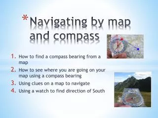
Orienting the Map • Visually • Using the Compass • How and Why to Convert the Map to Magnetic Direction Using borders Using Tick-marks • How not to… using the grid lines extending a line from the “compass rose”
Takinga Map Bearing • Remember, the compass is a protractor, the magnetic needle has NO function here • Remember, use Tick-marks or borders OR magnetic north-south lines • Extending out your lines • Make sure where the “Direction of Travel” arrow is pointed
Why Not Use Grid Lines ? You can, but remember, they are a different projection for GPS purposes For use in Maine, you will need to forget True North, use magnetic north declination number, subtract grid north factor and use the result to compute bearings Why bother ??? Well, most people won’t, but it does enable you to then use the vertical grid lines instead of drawing lines on the map
Routefinding with Map and Compass • Whenever using field bearings think whether what it says makes sense to you • But don’t doubt the compass
Handrails • Offsetting • Backstops and Baselines • Checkpoints • Best Travel Routes are not usually an option in SAR that doesn’t compromise safety it does compromise comfort
Triangulation • By visual map orientation • Much more accurate using the compass Requires two visible points Best between 90 and 120 degrees apart
OK – How Do I Calculate Distance In The Field ? • Pedometers • Pace is the basic unit of measure but it’s too small !!! • Pace becomes chains • 66 feet = a chain • 80 chains = a mile • Chain counters
Global Positioning System This is a Very Brief Overview to Introduce You to The Concepts of GPS
GPS Global Positioning System • Started in 1960 as a USAF Project called NavStar • Declared fully operational in 1995 • The result is we common folk benefit directly from a $12 billion project
3 Components to GPS • 24 satellites in geo-synchronous orbit 12,500 miles up • Government base stations that operate the system • May include “Differential transmission facilities” • Your receiver holds satellite I.D. and locations in memory & synchronizes with the satellites’ atomic clocks
P and CA Codes • CA or coarse acquisition codes are affected by the ionosphere • P or precision codes are restricted to the military • CA codes can be enhanced by DGPS, but this application is limited to proximity to a DGPS transmission facility
Other Limitations • It uses batteries • It does not normally replace the compass some GPS units have electronic compass function • It doesn’t do altitudes very well at all (normally within 100- 500 feet) some GPS units have digital altimeters that are quite accurate • The more you ask it to do, the heavier the battery drain
WAAS • Developed for aviation purposes • Like DGPS it involves 25 ground stations and two extra equatorial satellites • Corrects for ionespheric errors in CA code transmissions • Works only in US • Because satellites are equatorial, areas such as Maine may not fully benefit