Download
1 / 13
130 likes | 259 Views
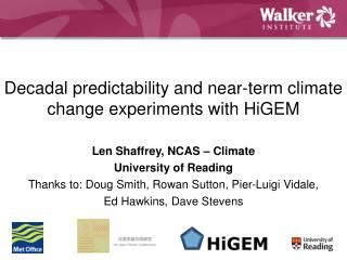
Len Shaffrey, NCAS – Climate University of Reading Thanks to: Doug Smith, Rowan Sutton, Pier-Luigi Vidale, Ed Hawkins, Dave Stevens. Decadal predictability and near-term climate change experiments with HiGEM.

E N D
Len Shaffrey, NCAS – Climate University of Reading Thanks to: Doug Smith, Rowan Sutton, Pier-Luigi Vidale, Ed Hawkins, Dave Stevens Decadal predictability and near-term climate change experiments with HiGEM
HiGEM is a partnership between the UK academic community and the Met Office to develop a 'high' resolution atmosphere ocean coupled climate model. HiGEM is based on the Met Office coupled climate model, HadGEM1, but with increased horizontal resolution. HiGEM Snapshot of the HiGEM Model • In the atmosphere the horizontal resolution is increased to 1.25 degrees longitude by 0.83 degrees latitude (~90km). The parametrisations remain largely the same as in HadGEM1, including the simple interactive aerosol scheme. • In the ocean the horizontal resolution is 1/3 by 1/3 degree globally.
HiGEM • Centennial length control integrations of HiGEM have been completed on two computing platforms, the HPCx in the UK and the Earth Simulator in Japan. • Some marked improvements • Blocking in the Northern Hemisphere • Position of the Gulf Stream • Representation of the MJO • Warm SST biases in the marine stratocumulus regions • Some things don't improve • Indian monsoon • Some Tropical precipitation biases
ENSO in HiGEM and HadGEM1 Observations (HadISST2) El Nino DJF Sea Surface Temperature composites from HadISST2, HadGEM1.2 and HiGEM1.2. Units K The warming of the Tropical Pacific during an El Nino event is well captured in HiGEM. HadGEM1 HiGEM
HiGEM • Just completed porting HiGEM to a third computing platform (HECToR) • On 128 processors the integration speed is 0.75 model years/day, but the model doesn't scale well past this. • The plan is to be involved in the decadal predictability experiment, preferably using anomaly assimilation (some variation of DePreSys, Smith et al 2007) • Computing resources and people are constraints to producing the forecasts but, since anomaly assimilation requires a series of long integrations to produce the initial conditions and HiGEM is slow, the biggest constraint might be time... • ..so we've already started working on the anomaly assimilation runs. • Another possible constraint might be data volume and data handling. • Already using the COSP simulator (offline) • No aquaplanet version planned (at the moment)
El Nino in HiGEM Normalised Nino3 SST Power Spectra for HadISST, HadGEM1.1 and HiGEM1.1 Both the spatial and temporal characteristics of ENSO, and its remote teleconnections, are better simulated in HiGEM relative to HadGEM Why does the ENSO improve in HiGEM?
Tropical Instability Waves • Tropical Instability Waves in the Tropical Pacific Ocean are shear instabilities that grow in the equatorial current-counter current system • They propagate slowly westwards (~0.5ms-1) Instantaneous SSTs in the Tropical Pacific Ocean (Chelton et al. 2001) Instantaneous SST from HiGEM
Future Directions • Understanding the value of resolution • HiGEM being used to inform seasonal forecasting development in the Met Office (PACE - Sarah Keeley) • Idealised climate change experiments underway • Decadal forecasting? How to initialise the ocean? From Smith et al. (2008) • Model development - a high resolution version of HadGEM3? The ORCA2 grid - no North Pole!
Will increasing the resolution of climate models allow us to better represent weather? ERA-40 HiGEM Courtesy of Jen Catto Composite structures of the 50 most extreme wintertime Northern Hemisphere storms in ERA-40 and HiGEM. Colours – windspeed, Black lines – 1000hPa isobars, Red lines – 850hPa to 500hPa temperature thickness
El Nino in HiGEM CMAP El Nino DJF precipitation composites from CMAP, HadGEM1.2 and HiGEM1.2. Units mm/day. HadGEM1.2 HiGEM1.2
El Nino in HiGEM ERA-40 El Nino DJF mslp composites from ERA40, HadGEM1.2 and HiGEM1.2. Units hPa. HadGEM1.2 HiGEM1.2
Tropical Instability Waves • Tropical Instability Waves in the Tropical Pacific Ocean are shear instabilities that grow in the equatorial current-counter current system • They propagate slowly westwards (~0.5ms-1) • Satellite data shows the coupling between the SST fronts associated with the TIWs and the atmosphere Instantaneous SSTs in the Tropical Pacific Ocean (Chelton et al 2001) Instantaneous surface wind stress divergence from QuikSCAT winds
Tropical Instability Waves in HiGEM HiGEM HadGEM Instantaneous Sea Surface Temperatures (contours) and surface windstress divergence (colours) How important is the small-scale coupling between ocean and the atmosphere in Tropical Instability Waves for the climate and its variability?