Download
1 / 20
210 likes | 337 Views
Airborne Electromagnetic Surveys for 3-D Geological Mapping. Jared D. Abraham and James C. Cannia. Project Sponsors. North Platte Natural Resources District South Platte Natural Resources District Twin Platte Natural Resources District Nebraska Environmental Trust

E N D
Airborne Electromagnetic Surveys for 3-D Geological Mapping Jared D. Abraham and James C. Cannia
Project Sponsors • North Platte Natural Resources District • South Platte Natural Resources District • Twin Platte Natural Resources District • Nebraska Environmental Trust • Nebraska Geological Survey
Project Contributors • Jared D. Abraham • James C. Cannia • Bruce D. Smith • Burke J. Minsley • Paul A. Bedrosian • Steven S. Sibray • Lyndsay B. Ball • Michaela R. Johnson • Maria Deszcz-Pan • J. Alton Anderson • Brian H. Imig
Motivation for Enhancing Hydrogeologic Frameworks • Difficult models, failure to converge/calibration issues due to poor geologic control • Poorly estimated bedrock topography despite large amounts of borehole and surficial geologic data • Groundwater quality will be better understood with new interpretations of geology • Understanding of groundwater age-dating information can be improved and used to calibrate model with new interpretation
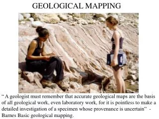
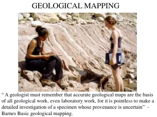
Geology and Lithology A. Iron-stained sediments B. Manganese-stained sediments C. Siltstone clasts ~1.5 feet in diameter Cross bedded, fluvial, coarse grained sediments of the Pliocene Broadwater Formation Photo taken ~1.5 miles north of Big Springs, Nebraska, facing west A. Tertiary Brule fractures B. Unfractured Tertiary Brule Photo taken along summit road between tunnels 1 and 2, Scottsbluff National Monument, facing east.
Airborne Electromagnetic Survey SkyTEM Time Domain EM System Fugro Resolve Frequency Domain EM System
Electrical Properties • High Resistivity – Red (80 to 500 ohm-m) • sand or gravels (aquifer) • Low Resistivity – Blue (5 to 30 ohm-m) • clays and silts (aquitard) Many combinations exist
Impact of 3-D Model • Refined 3-D hydrogeological model • Refined estimate of saturated thickness • Refined estimate of flow paths • Refined estimation of surface and groundwater interaction
Change in Saturated Thickness Previous Saturated Thickness New Saturated Thickness
For the area of the airborne geophysical surveys, an additional ~3.7 million acre-feet of water in storage was identified
CONTACT INFORMATION Jared D. Abraham (303) 236-1318e-mail: jdabraha@usgs.gov USGS Crustal Imaging and Characterization Team (303) 236-1213Denver Federal Center, Bldg. 20, Box 25046, MS 964, Denver, CO 80225-0046 http://crustal.usgs.gov/ James C. Cannia (402) 416-5321e-mail: jcannia@usgs.gov USGS Nebraska Water Science Center (402) 328-41005231 South 19th St., NE 68512-1271 http://ne.water.usgs.govLincoln