Download
1 / 11
110 likes | 326 Views
Please insert a picture (Insert, Picture, from file). Size according to grey field (10 cm x 25.4 cm). Scale picture: highlight, pull corner point Cut picture: highlight, choose the cutting icon from the picture tool bar, click on a side point and cut.

E N D
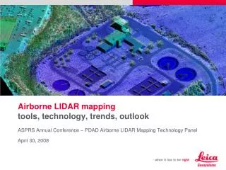
Please insert a picture(Insert, Picture, from file).Size according to grey field(10 cm x 25.4 cm). Scale picture: highlight, pull corner point Cut picture: highlight, choose the cutting icon from the picture tool bar, click on a side point and cut Airborne LIDAR mappingtools, technology, trends, outlook ASPRS Annual Conference – PDAD Airborne LIDAR Mapping Technology Panel April 30, 2008
ALS50-II Airborne LIDAR Scannercontinued innovation, expanded performance • Breakthrough system design allows 150 kHz pulse rate with no loss in accuracy • Multiple Pulse in Air (MPiA) technology • carries 150 kHz performance to 1569 m AGL • 2x pulse rate improvement over conventional systems altitudes above 1400 m AGL • Improved 90 Hz maximum scan rate • Fully integrated FCMS flight navigation with airborne-certified displays • Compact electronics • Simple 3rd-party sensor integration using embedded IPAS10 GNSS/IMU subsystem
ALS Corridor Mapperresponding to emerging markets • Uses key ALS technologies • 1000 m AGL maximum flying height • High accuracy and high point density, even at maximum flying height • Corridor or “large-map-scale” applications • Lower price point
Purpose-designed airborne camera RGB or CIR operation 35, 60 and 100 mm lenses Fast 2.02 second frame interval User-replaceable 1/4000-sec shutter RCD105 Digital Frame Camera introduction39 MP: fast, flexible, plug-and-play with ALS50-II
Significant milestonestechnology put to work Image courtesy of North West Geomatics • MPiA is now a mainstream technology • Huge projects being undertaken w/ MPiA systems (Example – NWG has collected 315,000 km², 835 aircraft hours, 1 point / m², 750,000 km² collection) • Number of new system deliveries/demos for high altitude use @ 4500 m – 6000 m AGL 4500 m AGL, MPiA, 66º FOV, 1.5 m avg. post spcng
RCD105 Digital Frame Camera for ALS50-IIrugged design for precise imagery
LIDAR trendswhere is LIDAR in the “adoption curve”? • Market is still growing • ~249 LIDAR systems sold (total market) since mid 1990s • Rate at which LIDAR systems are entering the market is doubling every 3-4 years • 48 LIDAR systems entered the market in 2007
LIDAR trendswhat are the application market trends? • Increased interest in infrastructure measurements • Railways • Roads • Power lines • Pipelines • National forest inventory • Biomass • Carbon uptake
Point density laser pulse rates doubling every ~2 years Point accuracy customers pushing the limits of technology, but limited by GNSS accuracy Availability of high-accuracy position data increasing with introduction of GPS + GLONASS Increasing use of “fitting” software (e.g., TerraMatch) Regulatory issues import/export getting easier to deal with due to wider IMU availability Use of auxiliary sensors over 50% of LIDAR systems have integrated imaging sensors Medium format Large format Multispectral Thermal Processing speed increasing number of 3rd-party workflow suppliers LIDAR trendswhat are the technology trends?
Outlook and summary • Demand for data is still increasing • LIDAR and medium format camera systems continue to show rapid increases in performance • Point density and point acquisition speed (i.e., pulse rate) continue to dominate in the field of new features the market is demanding • New processing architectures are making inroads, but no obvious replacements for current processing methodologies
Please insert a picture(Insert, Picture, from file).Size according to grey field(10 cm x 25.4 cm). Scale picture: highlight, pull corner point Cut picture: highlight, choose the cutting icon from the picture tool bar, click on a side point and cut Thank you!(come see us in booth 200) Ron Roth ron.roth@leicaus.com