Download
1 / 17
190 likes | 231 Views
Explore seismic sources in Central America, specifically in Managua, Nicaragua, to understand earthquake potentials. Discover geological studies on surficial faults and active faulting investigations. Learn about fault mapping, trench locations, and geological zoning. Enhance knowledge for seismic hazard prevention and risk management in the region.

E N D
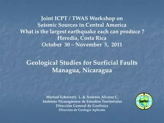
Joint ICPT / TWAS Workshop on Seismic Sources in Central America What is the largest earthquake each can produce ? Heredia, Costa Rica October 30 – November 5, 2011 Geological Studies for Surficial Faults Managua, Nicaragua Marisol Echaverry L. & Antonio Álvarez C. Instituto Nicaragüense de Estudios Territoriales Dirección General de Geofísica Dirección de Geología Aplicada
Geological Setting Managua Area La Femina, 2002
BACKGROUNDS 02.01.72 Los Brasiles 16 Km. W Managua Richter: 5.5 Mercalli: VI 31.03.1931 Falla Estadio Centro Oeste Managua Richter: 5.8 Depth: 5Km 04.01.1968 Colonia Centroamérica Centro Sur de Managua Richter: 4.8 Mercalli: VI
23.12.1972 Tiscapa Fault Managua Lake Richter : 6.2 Depth: 5 Km
Investigation of Active Faulting in Managua, Nicaragua and Vicinity Vice Ministerio de Planificación Urbana, Gobierno de la Republica de Nicaragua. Woodward- Clyde Consultants. November de 1975.
Trench location Before, 80s Morfological surficial expression Exploratory trenches cartography Disruption and displacement key stratas
Managua Area Geological Formations Local Stratigraphy Aligneaments and Faults Age and Correlation Map of Faults, 1975
2002 - THE INETER MAP OF FAULTS • DATA BASE • Analysis and integration of consultant reports. 1981 a 2002. • Copies of 400 reports for library • One hundred of lineal kilometers of trenches • Digitizing maps until 1981 (Brown et al., 1973) • Woodward - Clyde Consultants, 1975 and • Ministerio de la Vivienda y Asentamientos Humanos (MINVAH, 1981) BM / ASDI Proyects, 2001
Objetives and scope Find evidence of faults: active or not Geological zoning of the land Not build on faults Guarantee the human life and prevent damages of properties
Inspection of Site Study for Soil Use Requirement 1975. Geological Method
Supervision of local geological studies for soil use requirements 2003. Método Geofísico
Distribución en el tiempo de estudios geológicos de falla local en Managua y alrededores Periodo 1990 a 2008. Fuente: Ineter, 2008 Estudios geológicos vs Tiempo 1990-2008: 1547 reports: 154.7 lineal Km 2003 – 2008: Geological: 489 Geophysical: 32 2009 – 2011: 180 a 200
CONCLUSIONS Datas about new fault sites, active or not, are available, and others could be aggregates, but limited. No data about Neotectonics and Paleo seismology are being colected. know its seismical activity, above all, the most important faults is necessary, and study that with no information but densely inhabited. Could be practical and useful combine these geological studies with geodetics studies of deformation for prevention of seismic hazard and risk, for Managua fault region and its vicinity